Today I stand at 1,475 feet above sea level. Over the next 2,340 river miles I will go down to 0 feet, sea level.
Along the way I will have many major milestones:
Lakes Bemidji, Cass and Winnibigoshish.
Minneapolis, MN - The first industrial city on the Mississippi. The farthest up the river that barges can travel.
27 locks & dams, all between Minneapolis and St. Louis.
Hannibal, MO - The birthplace of Mark Twain.
St. Louis, MO - The Chain of Rocks. Confluence of Missouri River.
Cairo, IL - Confluence of the Ohio River.
Memphis, TN - The start of the Mississippi Delta.
Vicksburg, MS - The “Key to the South” during the Civil War.
Old River Control Structure - The head of the Atchafalaya River, and the largest distributary of the Mississippi.
New Orleans, LA - Where a good portion of the city sits below sea level and is only protected by levees and floodwalls.
And countless more.
Lake Itasca
But it all starts here, where I stand, at the headwaters of Lake Itasca. Or does it, really? There’s been plenty of debate about where the headwaters of the Mississippi River really is. And in some groups that question is not settled to this day. Determining what constitutes a headwaters is a tricky business, with many factors to weigh against one another.
Some think that the headwaters should be based on distance. What would be the farthest distance a raindrop could possibly travel, and end up in the Gulf of Mexico? Well by that definition, the headwaters would be in Montana, in what we now call the Missouri River. A raindrop that falls at Lake Itasca travels ~2,340 miles to reach the Gulf. A raindrop that lands at Three Forks, MT travels ~3,495 miles before reaching the Gulf.
If we go by volume of water, well then we’d have to go up the Ohio River to find the headwaters. Where the Ohio meets the Mississippi in Cairo, IL, it often carries twice as much water as the Mississippi. Meaning the volume triples at this confluence. Another school of thought argues that the main stem of the river should always be flowing toward its final destination. This has the effect of often placing the headwaters on the center stem of a river, no matter the size of that stem.
Oddly enough, these same questions and debates have played out on a micro level concerning Lake Itasca and other nearby lakes.
Lake Itasca comes from latin, meaning “true source” (veritas caput). Yet even this is contested. A quick look at a map reveals the controversy:
There are a few contested origins of the Mississippi, as Lake Itasca receives drainage from many sources. The most prominent disputes were cases made for Elk Lake and Nicolet Lake. As clearly a raindrop would travel farther to the Gulf if it landed in one of these two lakes. Taking this logic even further, the most distance any raindrop could fall would be if it landed in De Soto Lake, which feeds into Nicolet Lake.
Explorer Giacomo Beltrami (using the third argument from above), claimed that Lake Julia was the headwaters in 1832, because it flowed south into Cass Lake. As opposed to Lake Itasca which flows generally northeast until Cass Lake. Beltrami thought it was incorrect that the headwaters would flow northeast, while the Mississippi generally flowed south toward the Gulf.
In 1832, Henry Schoolcraft declared Lake Itasca as the one true source. His argument was that it flowed the farthest into Cass Lake. There was much contention to this position, as it became clear that Itasca had at least 5 tributaries. Surveyor Jacob Brower in 1888 confirmed Schoolcraft’s assessment, despite the knowledge of these tributaries. His logic for not considering these tributaries was quite arbitrarily that they weren’t “true rivers,” that only a “true river” emerges from Lake Itasca.
To learn more about the headwaters controversy timeline, visit: https://www.rivergeo.org/true-source
All this to say, it doesn’t truly matter what the source is. Does a headwaters have to be a certain size to be valid? What arbitrary size is this? Surface area or volume? Who is the authority on such matters? Lake Itasca is the common agreed upon source, but is not the only option.
As for me, I’m going to catch the River here and paddle downstream, that’s my destination!
Day 1: Lake Itasca → Coffee Pot Landing
URM 1342 → URM 1326
Distance today: 16 miles
River Time: 8.5 hrs
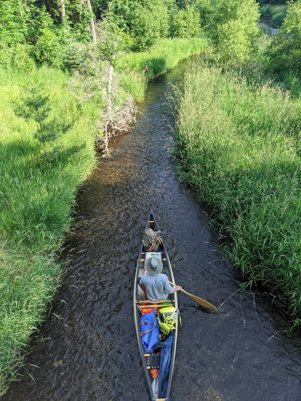
Today was launch day. Solange dropped me off at Lake Itasca, and decided to join me for the first little bit. We decided to put in at a boat ramp on Lake Itasca, to see a bit of the actual headwaters lake as well. Very quickly we found ourselves at the headwaters, and made a quick portage to where the Mississippi River commences!
Solange stayed on until we exited Lake Itasca State Park. It was extremely shallow and we had to drag the canoe multiple times even in this first .5 miles. It was beautifully shaded in a tall coniferous forest! Red and white pines swaying in the wind were our first views of the Mississippi.
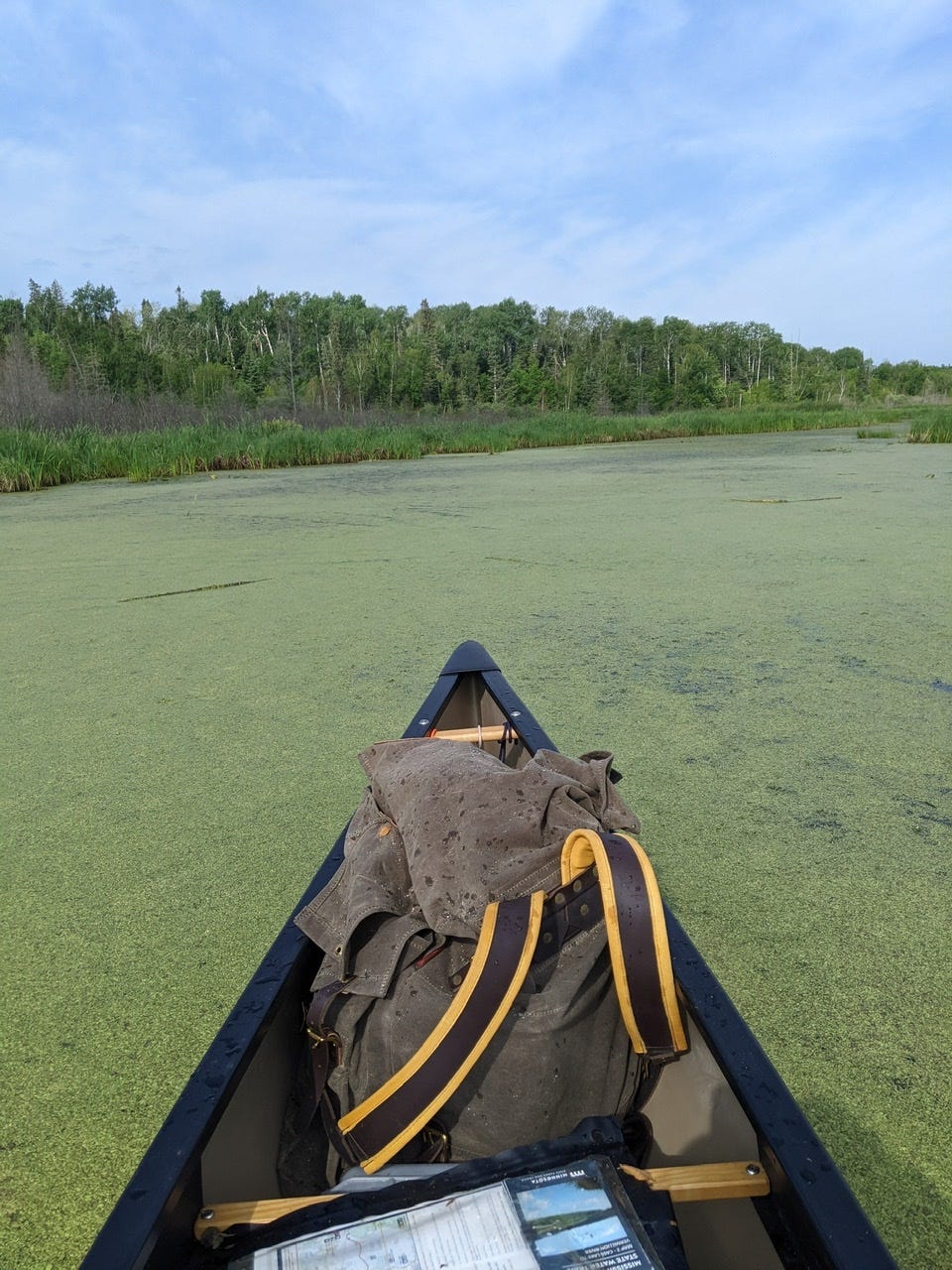
As soon as Solange left to retrieve her vehicle, the scenery changed dramatically. The bottom grew deeper, and I left the forest behind as I found myself in a bog of wild rice, cattails, and muck. With the Mississippi only a tiny trickle weaving its way back and forth through the vast swamp.
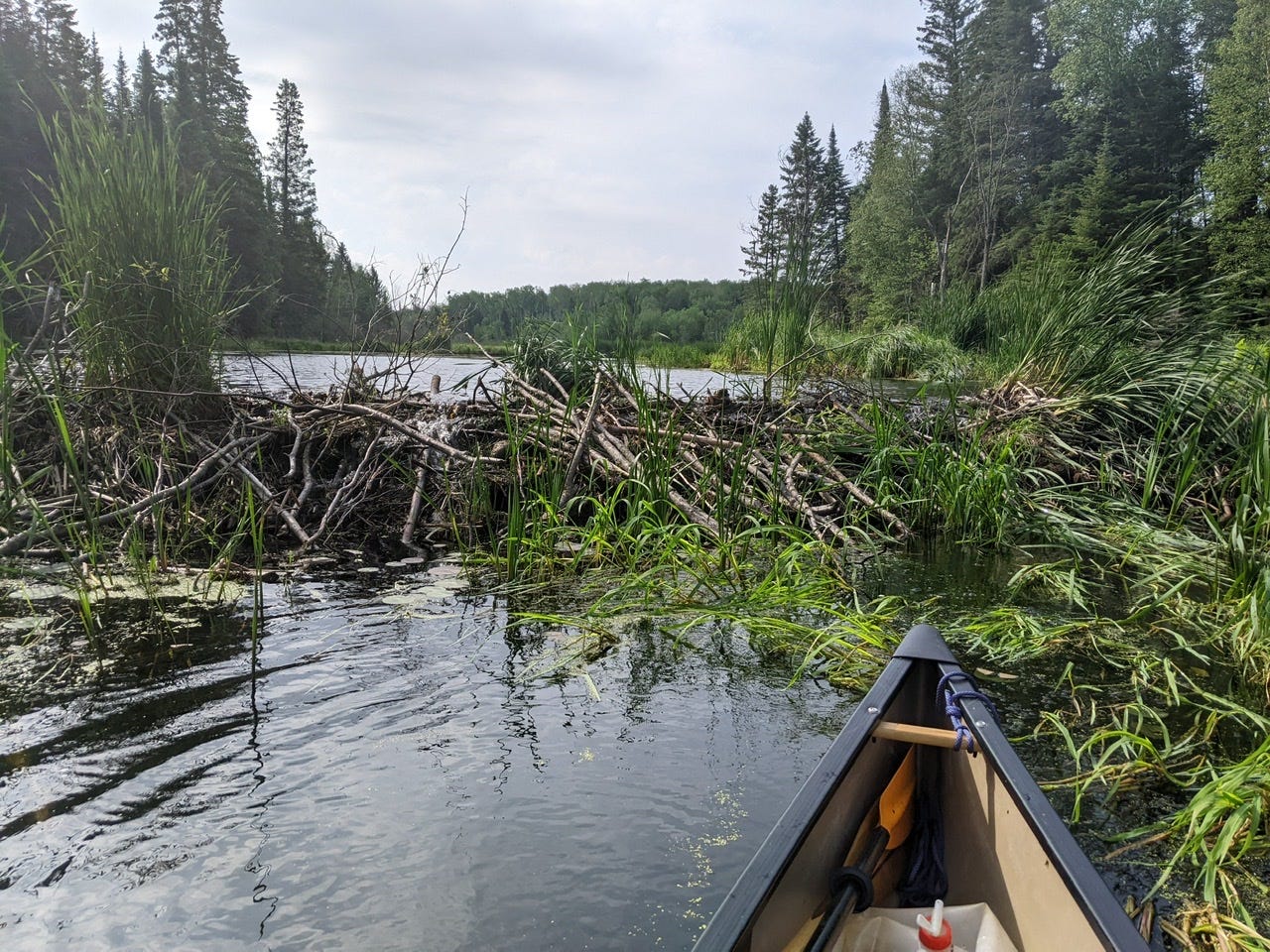
This was the most challenging portion of the day. There were numerous instances where algae and other plants had completely overgrown the channel; it was like paddling through green mucus for these stretches. There were also elaborate beaver dams across the entire width, which required hauling the canoe by hand.
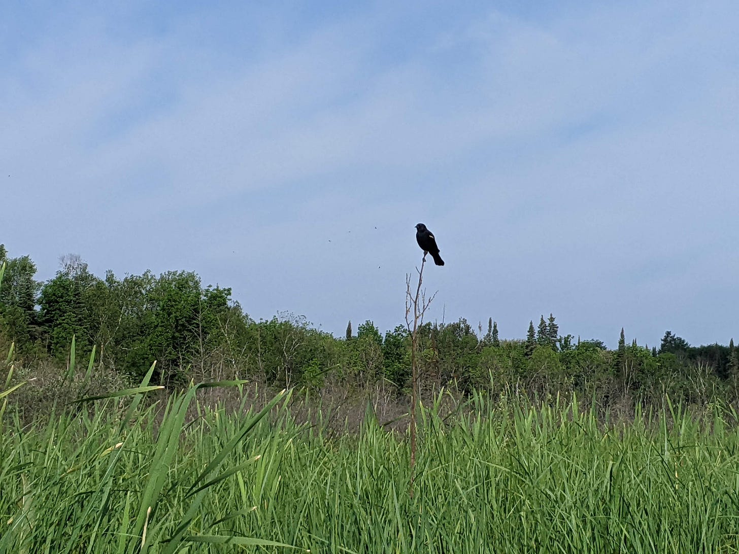
Already I was surrounded by abundant wildlife of the uppermost Mississippi River. The mosquitos of the forest yielded to thousands of dragonflies and damselflies. My neighbors were great blue herons, red-winged blackbirds, ducks, geese, eagles, beavers, and otters.
The toughest moment was not two miles into the journey. A massive peat bog chunk had lodged itself firmly in the middle of the channel, spanning the entire width. There was no purchase for paddling, despite all my straining. The peat moss did not yield to any horizontal force. I was forced to disembark, and haul the canoe through many yards of bog. Maliciously, peat bog chunks were happy to yield to my vertical pressure, and I promptly sunk up to my chest in a sea of yuck.
Having passed this, the rest of the swamp section was a delight. Easy meanders and plentiful wildlife were my company until I approached Vekin’s dam. Boulders started to pop up as I made my approach. After the portage, was the highlight of the day: 4 miles of Vekin’s rapids! Weaving through boulders cropping out with no chance to catch my breath before the next set was already upon me — what a thrill! This is one of the few rapids sections on the Mississippi, so I soaked it up!
One more slog through the bog, and I had arrived at my campsite for the night! Coffee Pot Landing. I decided to take a video of this last bog section and it is below. I figured it could be cool to make a short video for every day that I paddle, to show what the river and scenery looks like every day, and how it will change over the course of the entire river and 90 days. Plus, I figure if I’m lucky, Layne Logue will make me a montage video of all the days once I get to the Gulf!
Coffee Pot Landing brought friends and good food. River Angel Janet Rith-Najarian in the Bemidji area very kindly provided a delicious and nutritious picnic dinner. A couple of other regional Angels, Ron and Judy Vroom joined as well! Plus an old friend from Lac du Bois adult programs showed up. In addition, 2 of my best friends Solange and Ikse were there by surprise, being off-duty from Les Voyageurs and still in the area. It was a wonderful celebration of my trip and just generally being in good company!
I’ve now done 16 miles of the Mississippi River! This amounts to .6% of the Mississippi River. A humbling amount, but I know that I will continue to chip away at that number with each day. Every paddle stroke downstream is progress.
If I paddle 16 miles every day with no rest days, it will take me 146 days to reach the Gulf of Mexico. But I plan to reach the Gulf in approximately 90. I will have to pick up the pace!
River Log Day 1
1342 - Gulsvig Landing: Easily the most challenging portion. Shallow waters, numerous beaver dams, and thick sections of peat bog.
Gulsvig Landing: Immediately after Gulsvig, there are some extremely tight turns. Canoes over 17 feet will have a very difficulty time navigating. I spent 10 minutes making K-turn on a single bend. Soon after, it opens up and is a pleasure to paddle until Vekin’s.
1336.8: Wanagan Campsite. Very clearly marked from water. Very overgrown. 1 Adirondack shelter
1334: Vekin’s Dam + Portage. .5 miles before the portage rocks will start appearing. Portage is not signed on upstream side, but the rapids is very clearly not canoeable. Not a good portage for portage wheels. Very steep and rocky.
1334-1331: Vekin’s rapids. Really fun set of rapids with some breaks in between. Gradually rising in intensity until abruptly ending just after the CR2 bridge.
1326.2 - Coffee Pot Landing/Camp: 1 mile downstream of power line crossing. Not marked, but Adirondack shelters visible from river. If you hit a bridge after the power line, you’ve gone too far. Well-kept site. Decent access. Foot bridge with good swimming.


Holy mackerel, what a beginning! A most interesting read, although I kept wondering how long you had to paddle before you got a shower! Should be exciting to keep up with you even from our armchairs. Tu as du courage, Jean-Canot!
And so it begins...