


Day 18 - Soggy Paddling to Blanchard Dam
And a 6-mile wind tunnel

Day 18: Crow Wing State Park → Blanchard Dam
Date: July 26th, 2022
URM 991 → URM 957
Distance today: 34 Miles
River Time: 11 hrs
New day, new map. I started off at Crow Wing, which is on this map: https://files.dnr.state.mn.us/maps/canoe_routes/mississippi6.pdf
But by the end of the day I was on to this one: https://files.dnr.state.mn.us/maps/canoe_routes/mississippi7.pdf
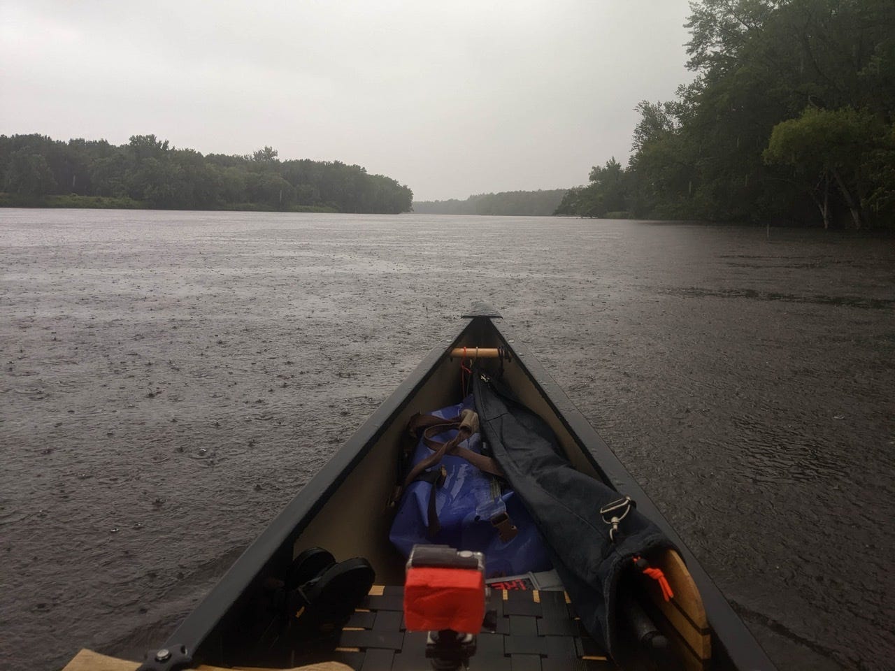
Phew. Today was a tough day, and today was a wet day. It drizzled beginning at about 9 a.m., and only got harder by midday. The rain let up in the afternoon for a few hours, but now it’s raining again as I write this around supper time.
Today the first big milestone was to make it to the Little Falls portage. It was 26 miles away so I got an early start. Leaving Crow Wing State Park was tough, and I drifted peacefully away from my wonderful zero day spot. Before I left, I offered some tobacco to the River and to the winds — asking for mercy and for safe passage today.
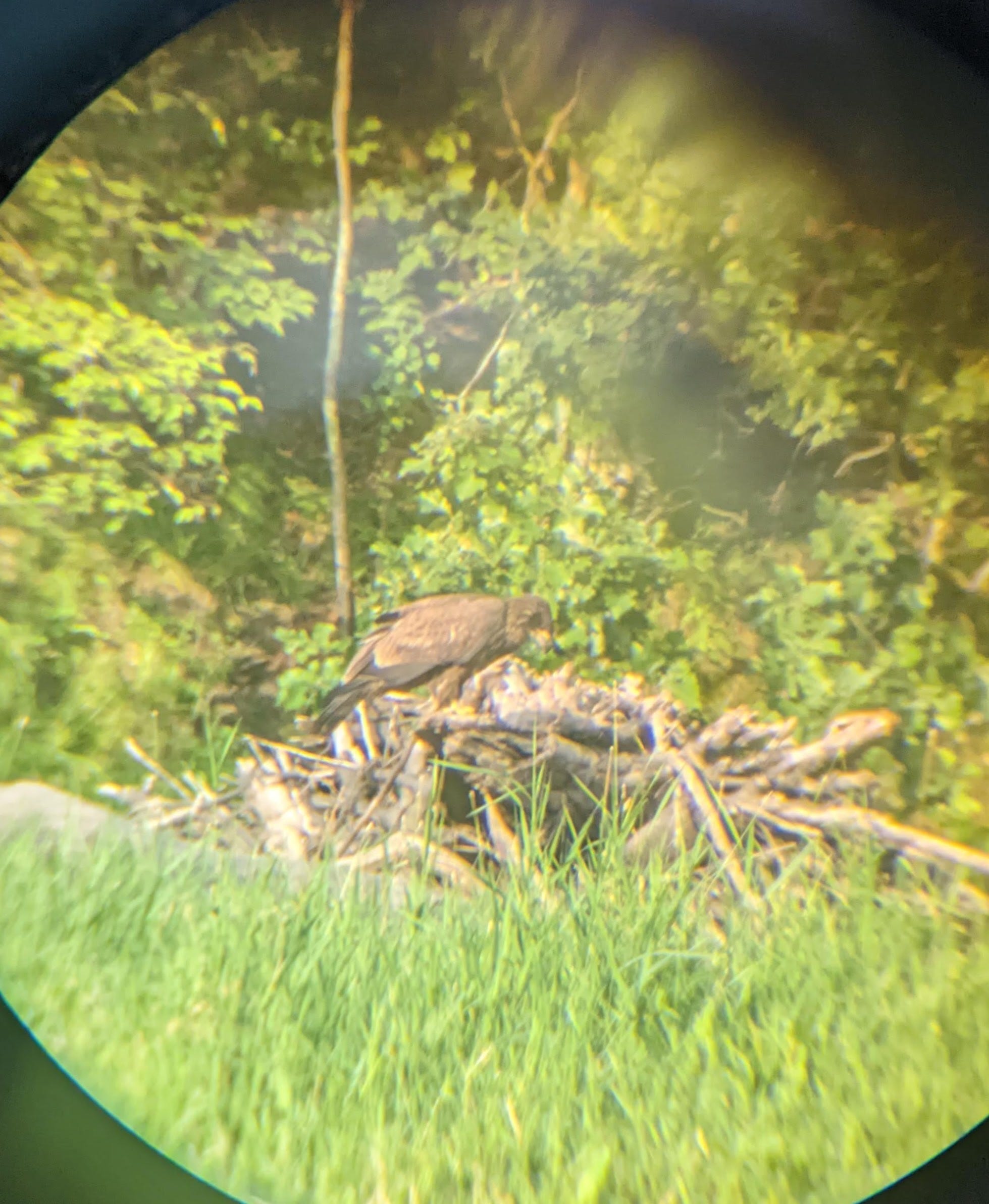
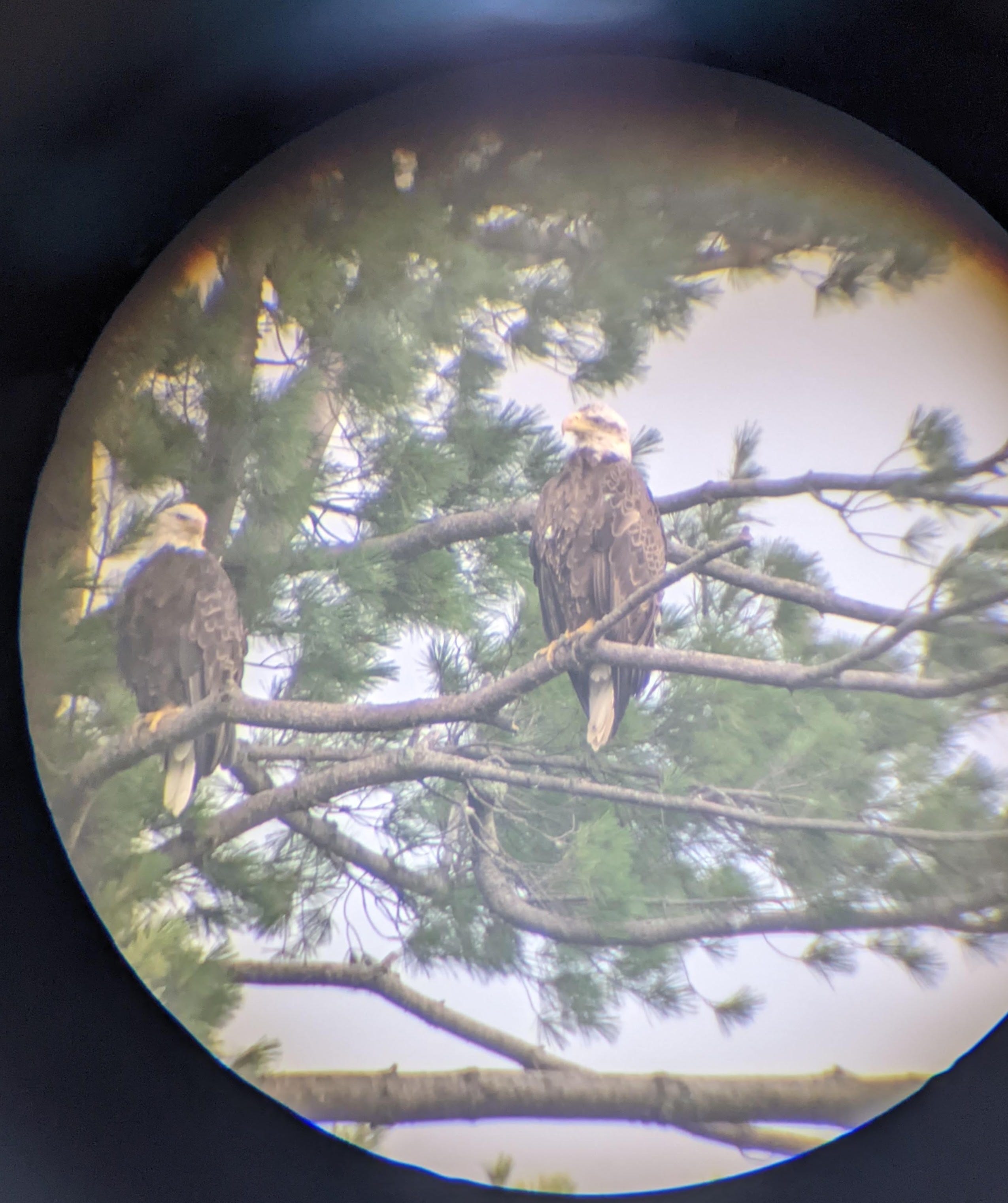
In the early morning hours I saw tons of wildlife, including about 3-4 groups of river otters! These little guys are so fun to watch, and they are often very curious of me. I also saw only my second golden eagle (I believe) of the trip, feasting on a recent kill:
Once the rain came, the only animals still out with me on the River were the herons, and the occasional bald eagle. In the drizzle and headwind I made my way toward Little Falls. As is typical with dams, the current started to dry up as I approached the pool created upstream of the dam. The flow lasted a little longer than usual this time, probably until about ~4 miles out.
This portage was a bit more annoying than previous ones, as there were no boat ramps. This didn’t play nicely with my portage wheels, but I simply just had to remove everything then attach the portage wheels on land. Ditto for the re-entry.
Normally after dams, I get a burst of good current for a while after. Not so this time, due to the Blanchard Dam only 8 miles farther downstream.
The Blanchard Dam backs up water to create Zebulon Pike Lake. A ~7 mile long lake, that is really just a swollen Mississippi. The channel is close to 1 mile wide at points in here. This was the toughest part of my day — the last 6-7 miles were much tougher than the 26 I had just done, no contest. Even though the rain had let up a bit, the lake created a wind tunnel that funneled the wind from the south and pummeled me directly in the face. For the last 6 miles of Zebulon Pike Lake I was battling hard, and doing all I could not to lose ground! Ouch.
The more the River widens, the more the wind will become the dominant factor.
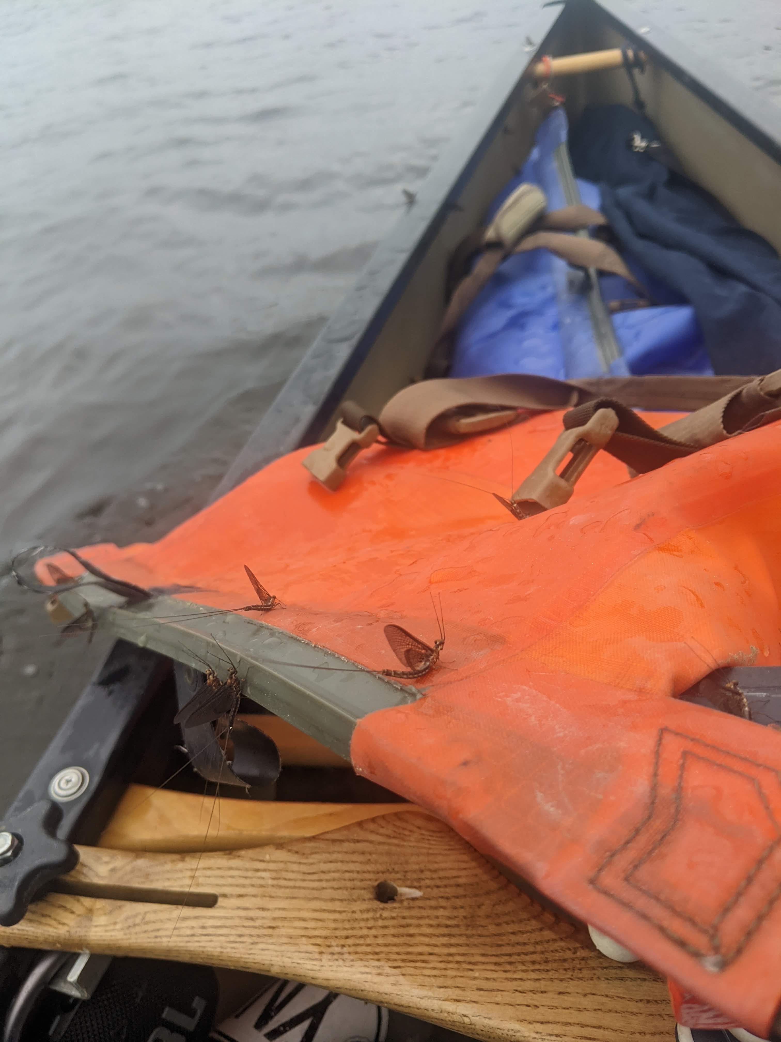
To make matters worse, or more buggy at least, there had been a recent hatch of mayflies in the region, and the lake was just thick with them. I had to hug the shore tightly due to the wind, which meant that every time I passed a willow tree I would spook thousands of them and they’d all come billowing out. There were sometimes I couldn’t see because I was just swarmed.
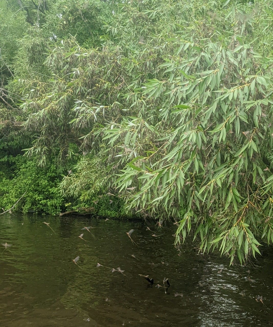
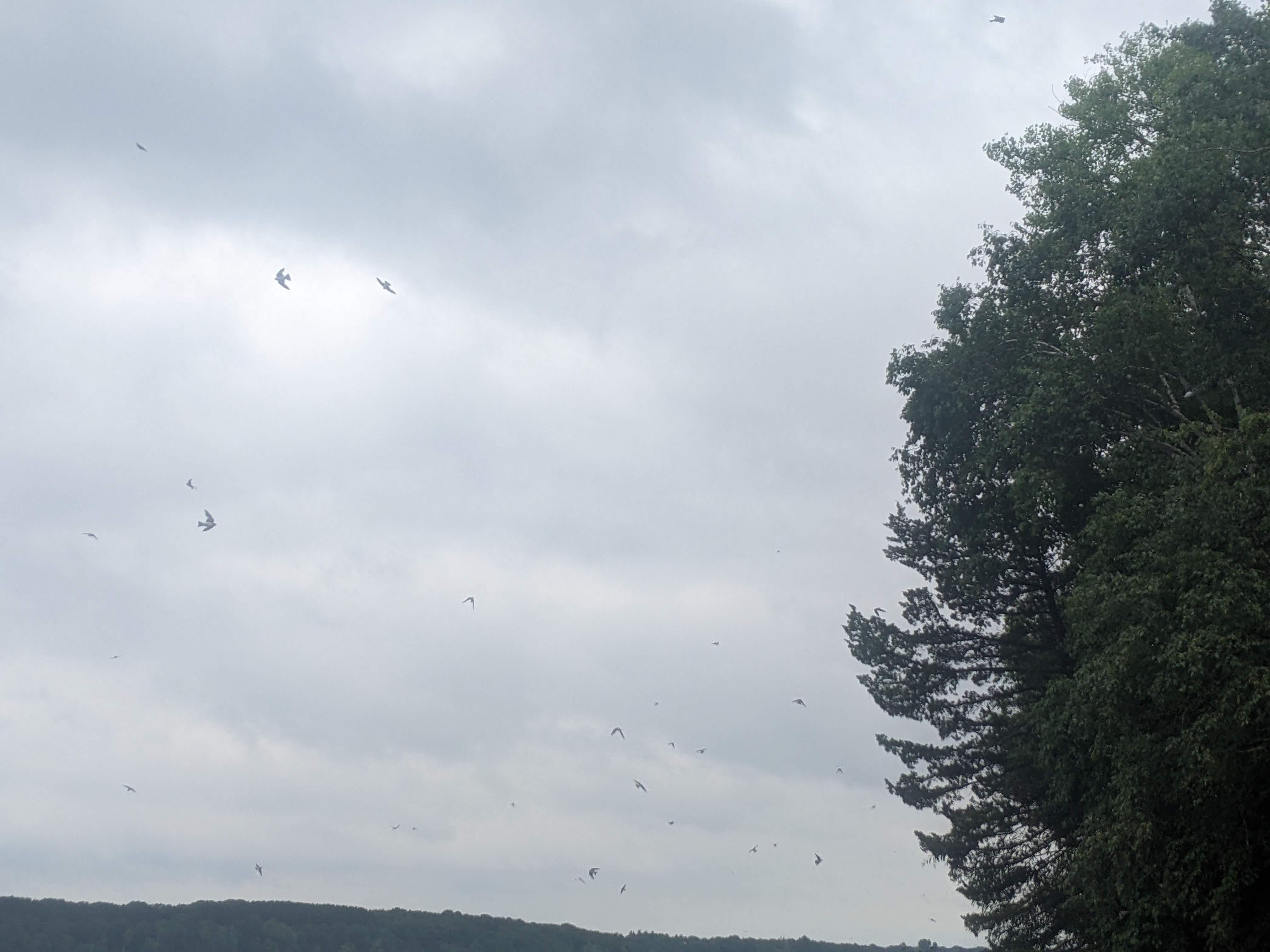
The swallows on the other hand, were loving the feast it afforded them, and the fish too, for that matter. I saw hundreds of swallows nabbing from the all-you-can-eat buffet of mayflies multiple time. And saw many fish surface to get a snack.
I finally made it to Blanchard Dam, which is about 6 miles farther than my schedule from yesterday. I decided to move on once I arrived at Pike Landing for 2 reasons:
I was exhausted, but it was raining when I arrived, so I wouldn’t have been able to make camp anyway
I didn’t like the look of that 34 mile, 3 portage day in my future, so I figure if I can do a little extra here and there, that day can be broken up!
Blanchard Dam is notorious in the paddle community as the toughest portage in the Upper Mississippi. Not the longest, but the toughest. Tonight I made camp at the very beginning of the portage; tomorrow morning I will tackle it first thing in the morning!
More Photos
River Log Day 18
979 - Pipe Island: Some very shoal sections and boulders start to pop up just before the island
979 →976 Middle and Lower Pipe Islands: Can be very shallow anywhere in this section. A few halfway decent sandbars would make for decent primitive camps in a pinch. There is one “quasi-official” site on one of the lowest small islands. ~976.5
972.7 Fletcher Creek landing and camp: Camp is .1 miles downstream from landing. Accessible by hiking trail. No direct water access. 1 table and 1 latrine.
966.5 - Pool created by Little Falls Dam: Very shallow RBD.
963.3 - Pike Creek: Bridge still indicated canoe campsite, but reports are that it’s reservation only. Can camp at landing in a pinch.
How wonderful to see river otters!