


Day 27 - Hello Wisconsin!
Plus the final Water Sommelier results for the trip

Day 27: Lock and Dam #2 → Diamond Bluff, WI
Date: August 4th, 2022
URM 815 → URM 800
Distance today: 15 Miles
River Time: 6 hrs
Countdown to St. Louis: 620 miles
Today the trains woke me up early. I was in no rush, so I took my time breaking camp and enjoying the morning. I had a short day today, 15 miles to River Angel Jim’s house.
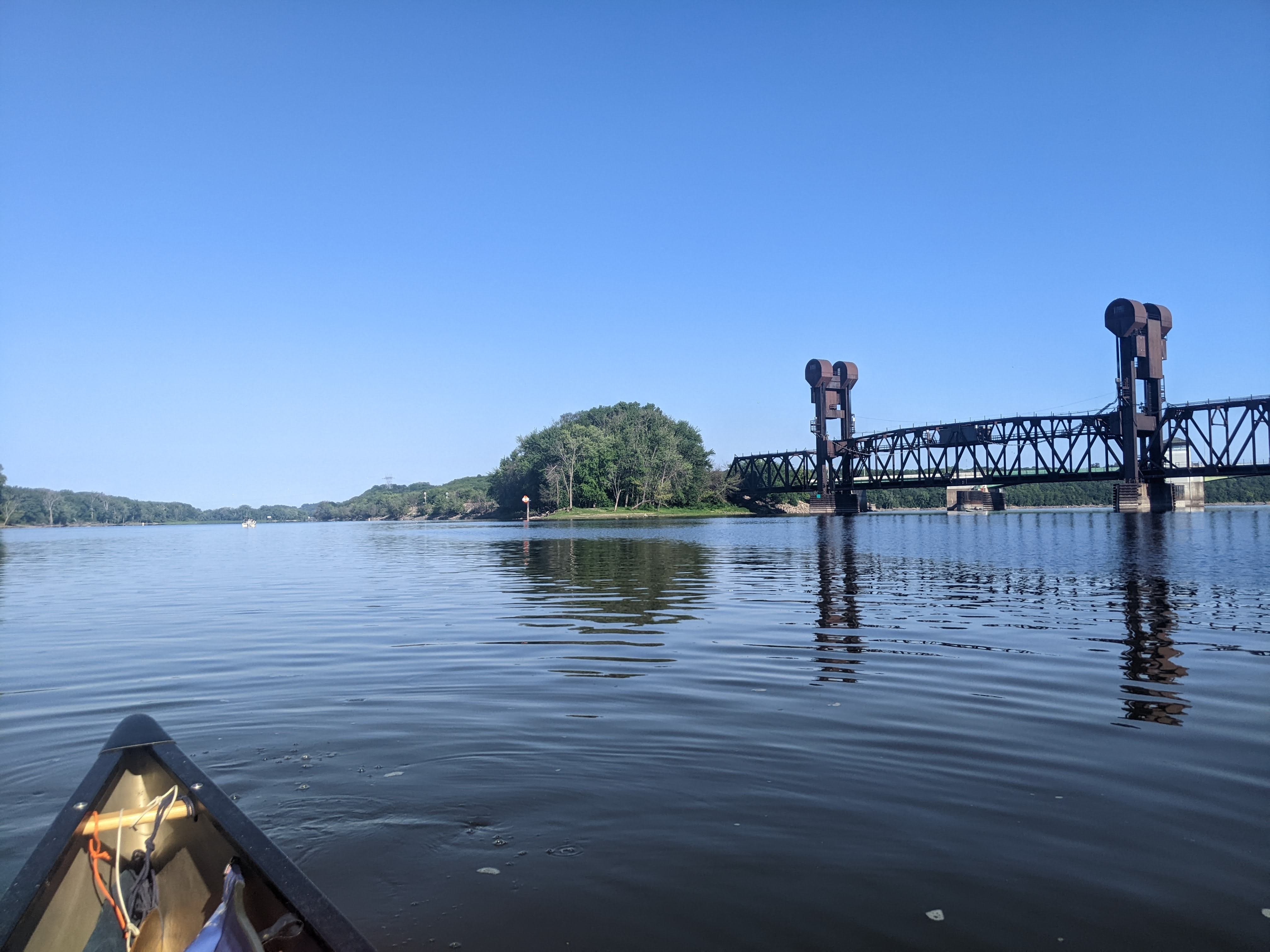
St. Croix River Confluence (Hello Wisconsin!)
Quite early in my morning paddle, I arrived at the mouth of the St. Croix River. This river forms the border between Minnesota and Wisconsin until this point. From here, the Mississippi River will continue the task.
Twenty-seven days and 531 miles of my trip were exclusively in Minnesota. And now for a very long time the Mississippi River will always be the border between two states. The Mississippi River borders 11 states, but is only ever entirely within the borders of 2 of them: Minnesota and Louisiana.
It was a nice little token of the progress I’ve made, and I took my time in appreciating the moment.
The other thing about the St. Croix is that it has very clean and very clear water, in sharp contrast to the Mississippi River’s muddy brown sludge. So apparent is the difference that one can plainly see the disparate rivers meeting one another:
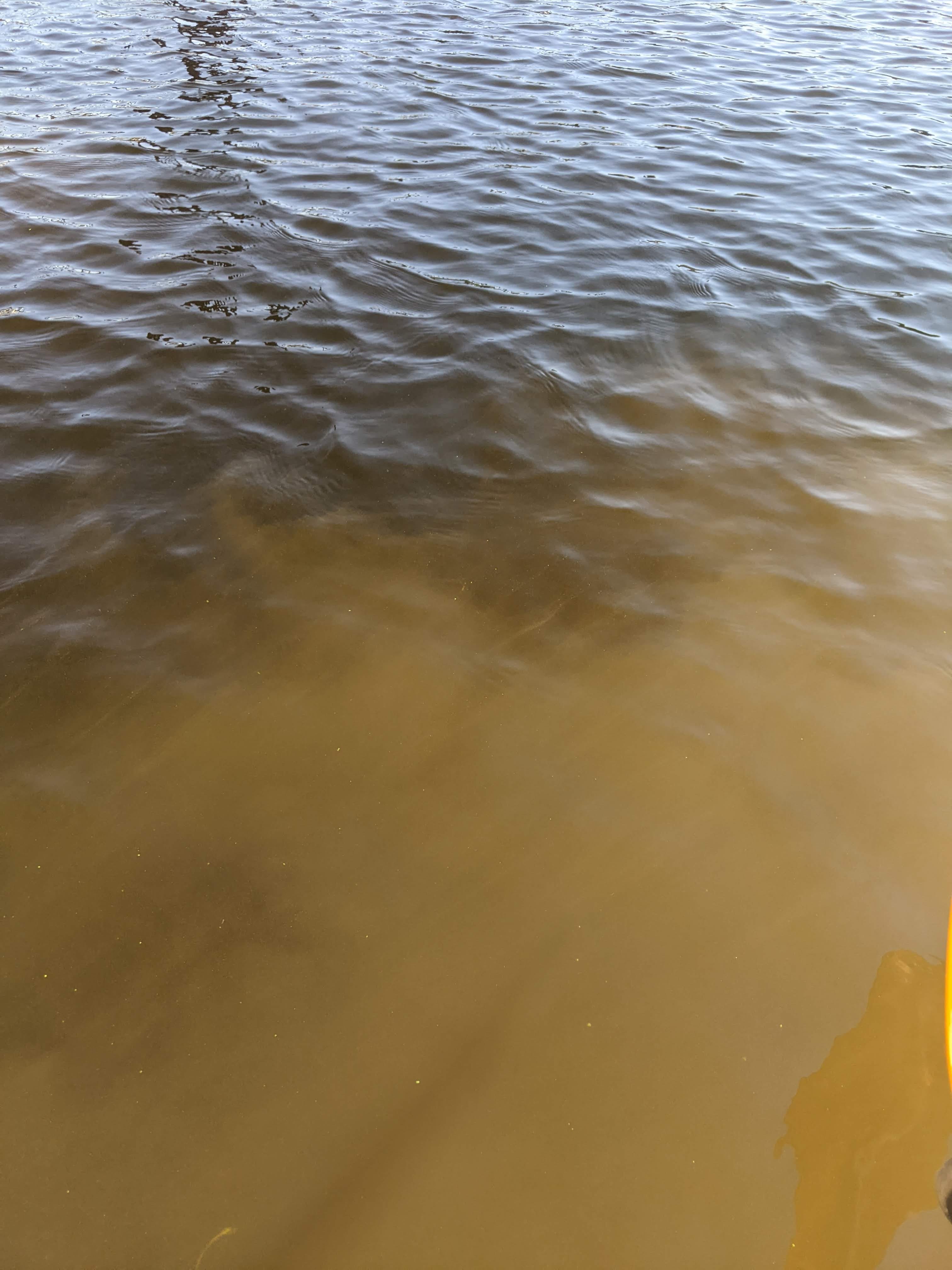
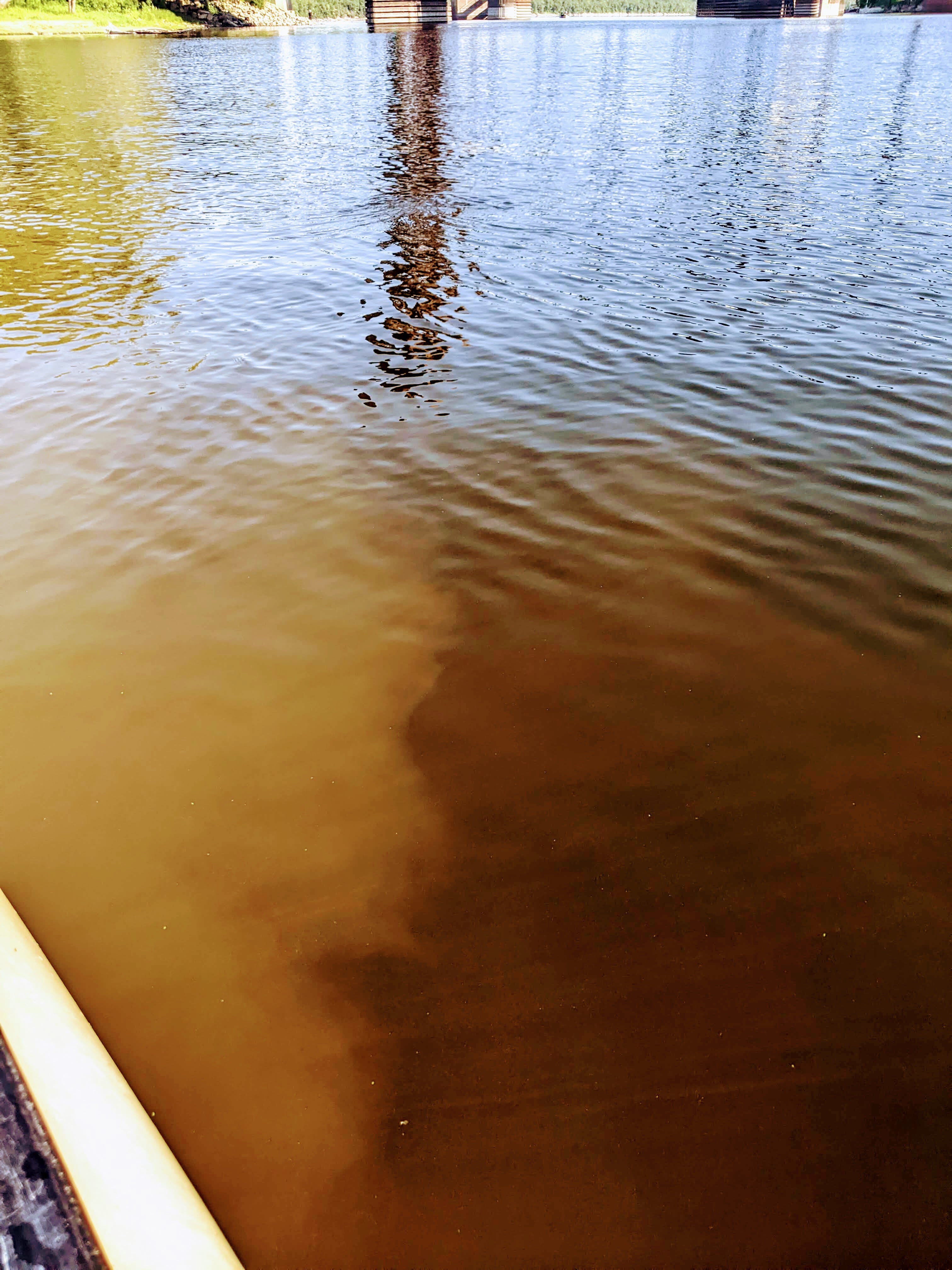
The melding and merging of these waters can sometimes take 1-2 miles before they are fully incorporated, depending on the flow of both rivers. Today, the dividing line lasted about .4 miles.
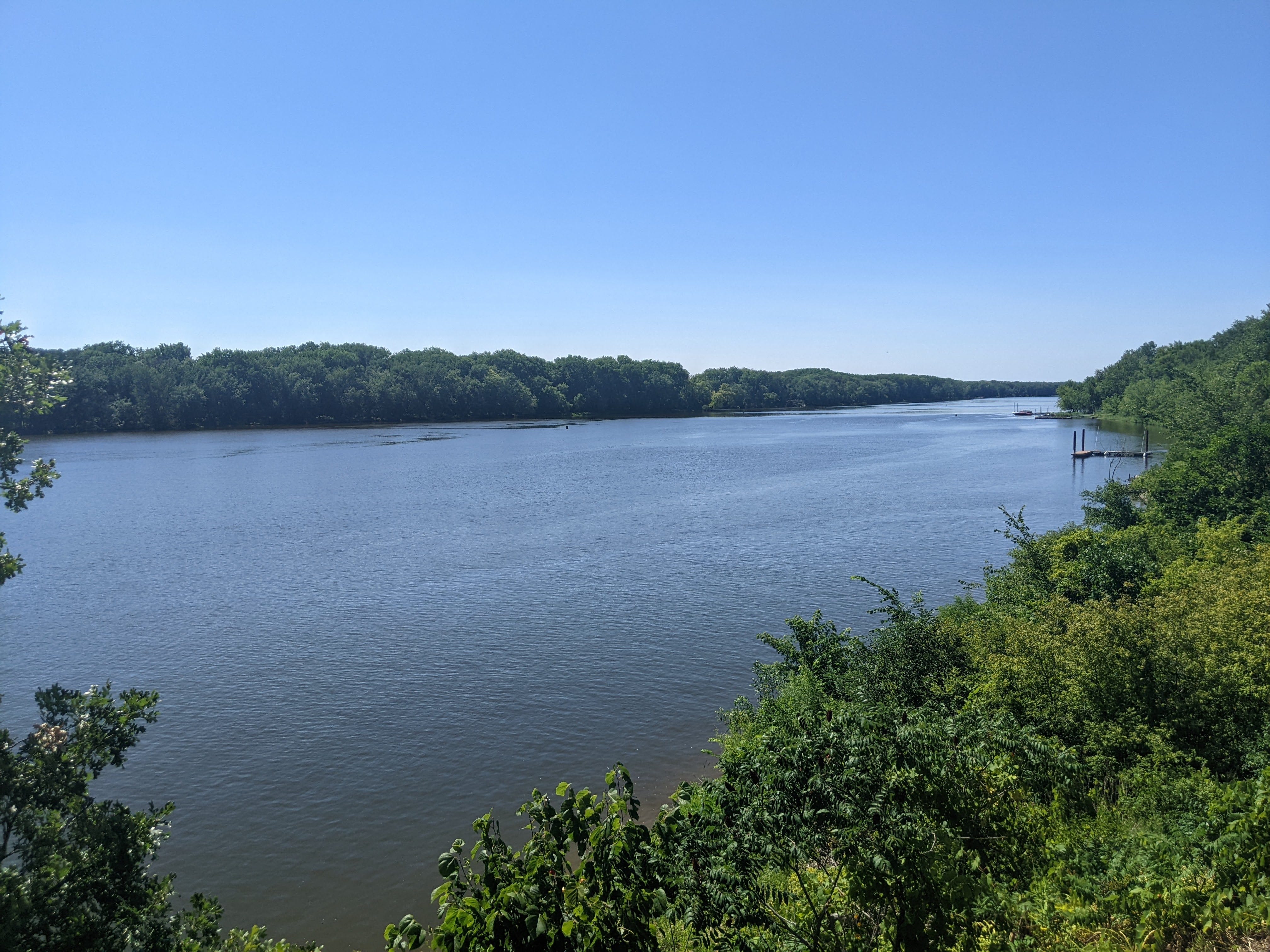
I spent the next few hours of the day paddling lazily on the long lake that is Pool 3. Even directly after Dam #2, there was no flow. Oh well. There were nice sandbars and islands along the way, so I stopped for a few swims as well. I am loving that nice sandbars are becoming more and more prominent! They are wonderful spots for swim breaks, lunches, and camping, too.
I took a nice long lunch break in the shade, and then soon after I had arrived in Diamond Bluff, WI. I am staying here tonight with River Angel Jim, upon a high and scenic bluff with a great view of the Mississippi. Thank you for the hospitality, Jim! You River Angels never cease to amaze me.
I am going to bed early tonight, then doing a voyageur start tomorrow morning. Tomorrow I tackle Lake Pepin, which is 22 miles long. My plan is to split this into 2 days. Tomorrow I will paddle 8 miles to arrive on the lake, then between 5 and 15 miles of the lake, depending on the wind. Then Saturday I will paddle the remainder and hopefully into Wabasha, MN. So I will leave it at that for today.
Final Water Sommelier Tabulations
With the St. Croix River behind me, this marks the last time I plan to sample any water in a long time, so without further ado, here are the final results from all my water testing on this trip:
Uppermost Headwaters: Tastes strongly of plants. A bit stagnant. Many floaties.
Coffee Pot Landing: Nice. Slight iron taste and slight plant taste. Clean aftertaste.
Iron bridge: Strong plant/bog taste. Not great, but not bad either.
Lake Bemidji: Open water, fresh and quite clear. A background note of fish. Very cold. The best so far.
Channel between Bemidji and Cass: Exceptionally clear water. Clean on the palette, but has slight plant aftertaste. Close second place.
Cass Lake: Very clear water, but very forward fish taste. Likely due to all the dead crawfish I was seeing! Lots of floaties.
Lake Winnibigoshish: Almost as good as Bemidji but had more of a fish-forward taste.
Winnie → Grand Rapids: Decent. Background notes of plant-matter, but not overpowering. Well-balanced. Lots of floaties.
Grand Rapids → Palisade: Pretty good. Slight iron taste. Earthy notes. Few floaties.
Aitkin area: Similar to above. Less iron, more earth.
1013 → Above Potlatch Dam: Clear color. Stronger notes of plants taste. Slight iron undertones.
Brainerd: Stronger Iron taste, earthy as well. Les reddish, more brown color.
Above Crow River: Good water. Few floaties. Mainly just earthy taste. No iron or fish.
St. Croix River: Clear green water. Very clean finish reminiscent of granite, tastes like a babbling brook with only a slight fish taste. Medium amount of floaties.
More Photos
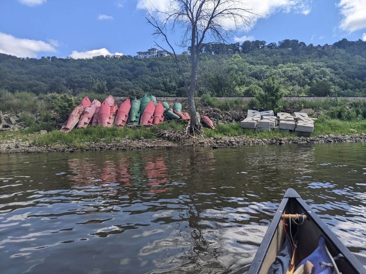
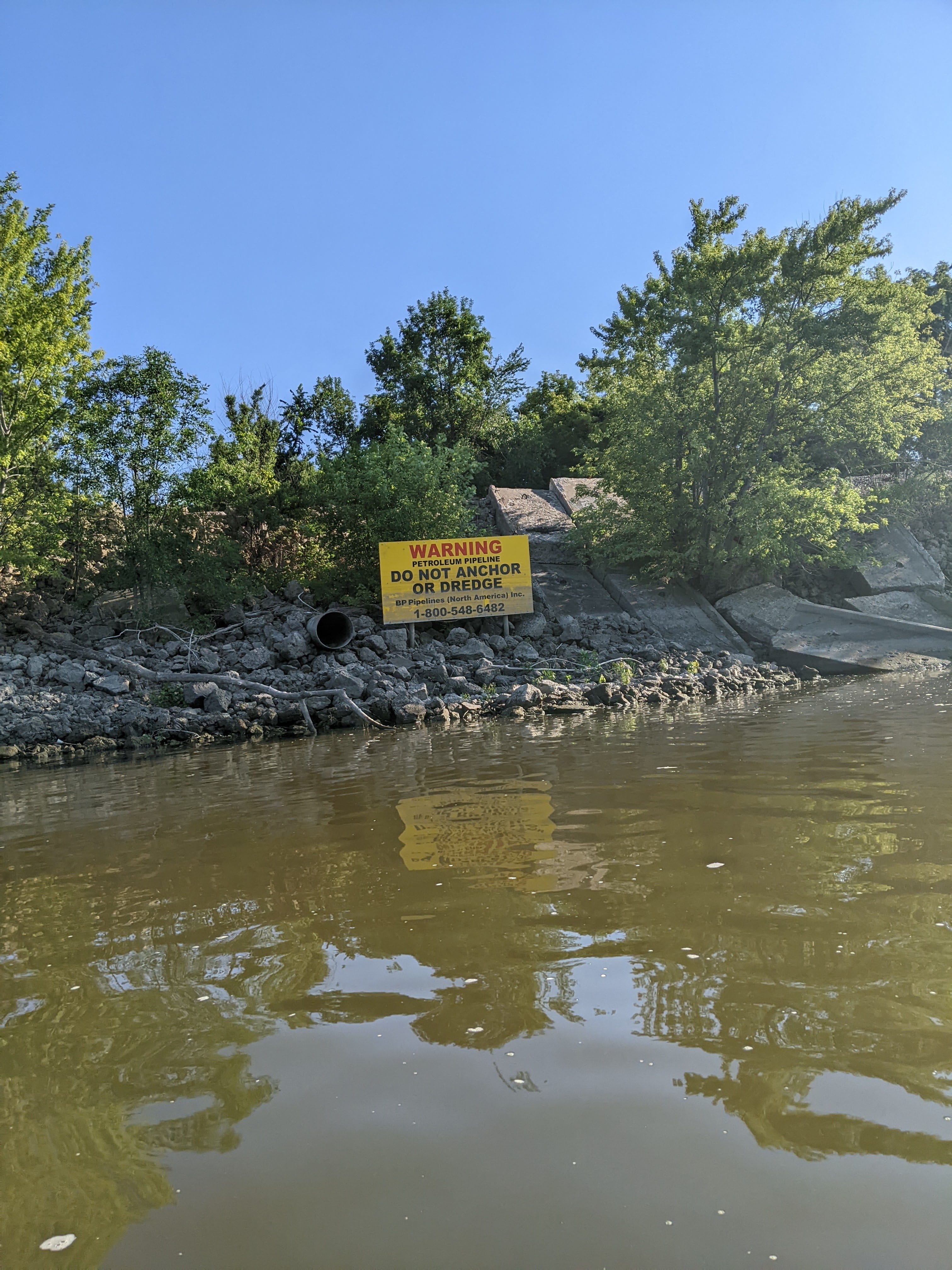
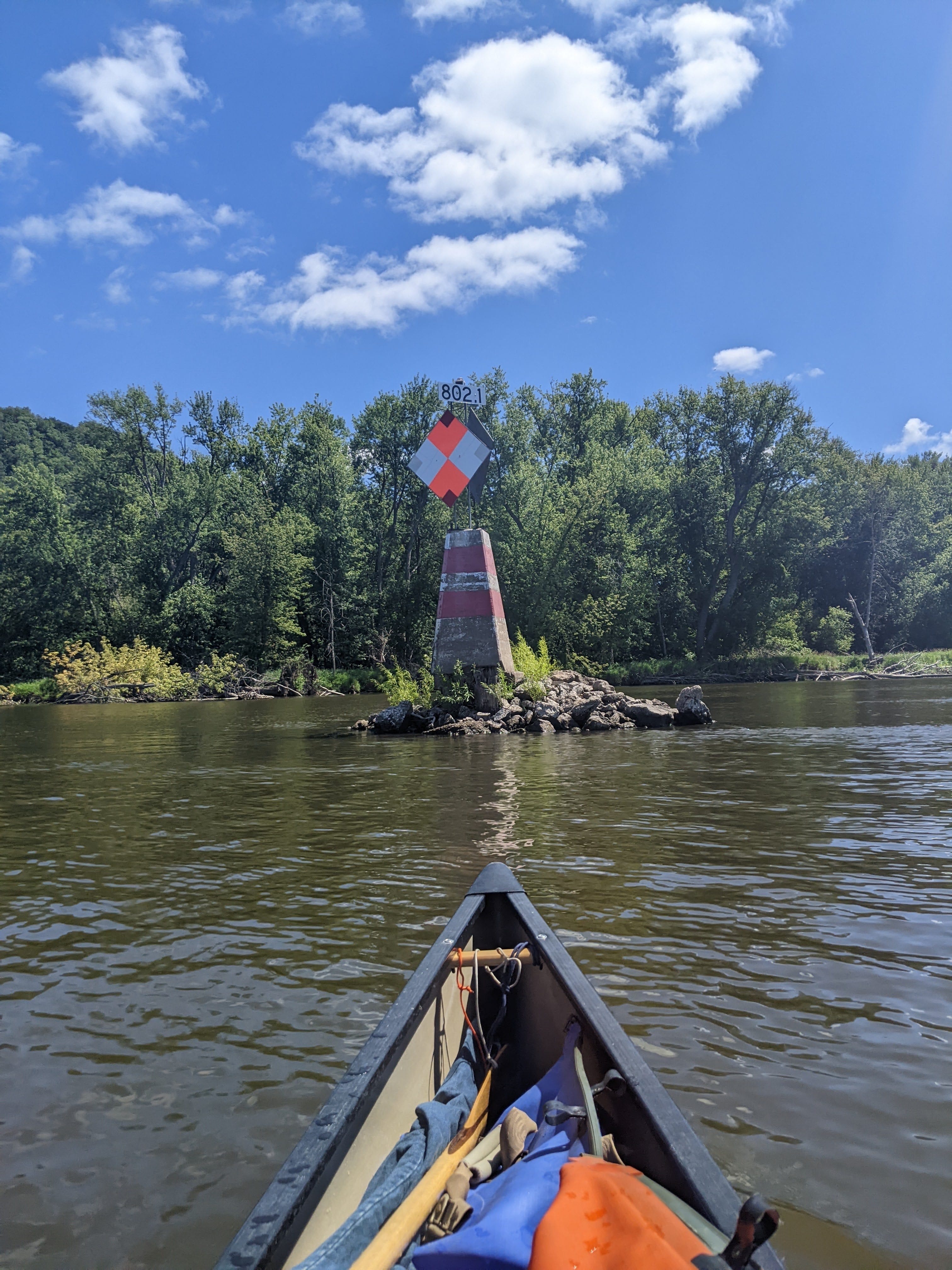
River Log Day 27
812 - Good camping RBD. Just before confluence of St. Croix.
811 - St. Croix River: Very busy boat traffic near marina on weekends.
810 - Unnamed Island: Very good primitive camping on small island LBD. Near railroad tracks.
807.5 - “String Island”: Good campsites on long narrow island RBD
802 - Coulter Island: Many nice sandy landings, precious few good tent spots
Nice to know the St Croix is clear and clean. It is protected from overdevelopment under the federal Wild and Scenic Rivers Act, passed in 1968 and championed by Minnesota’s own Walter Mondale.
https://www.nps.gov/articles/rivers-act.htm