

Day 5 - Loons in the Mist
Eerie and Magical Creatures

Day 5: Island Point Camp → Star Island
URM 1276 → URM ~1262
Distance today: 14 Miles
River Time: 3.5 hrs
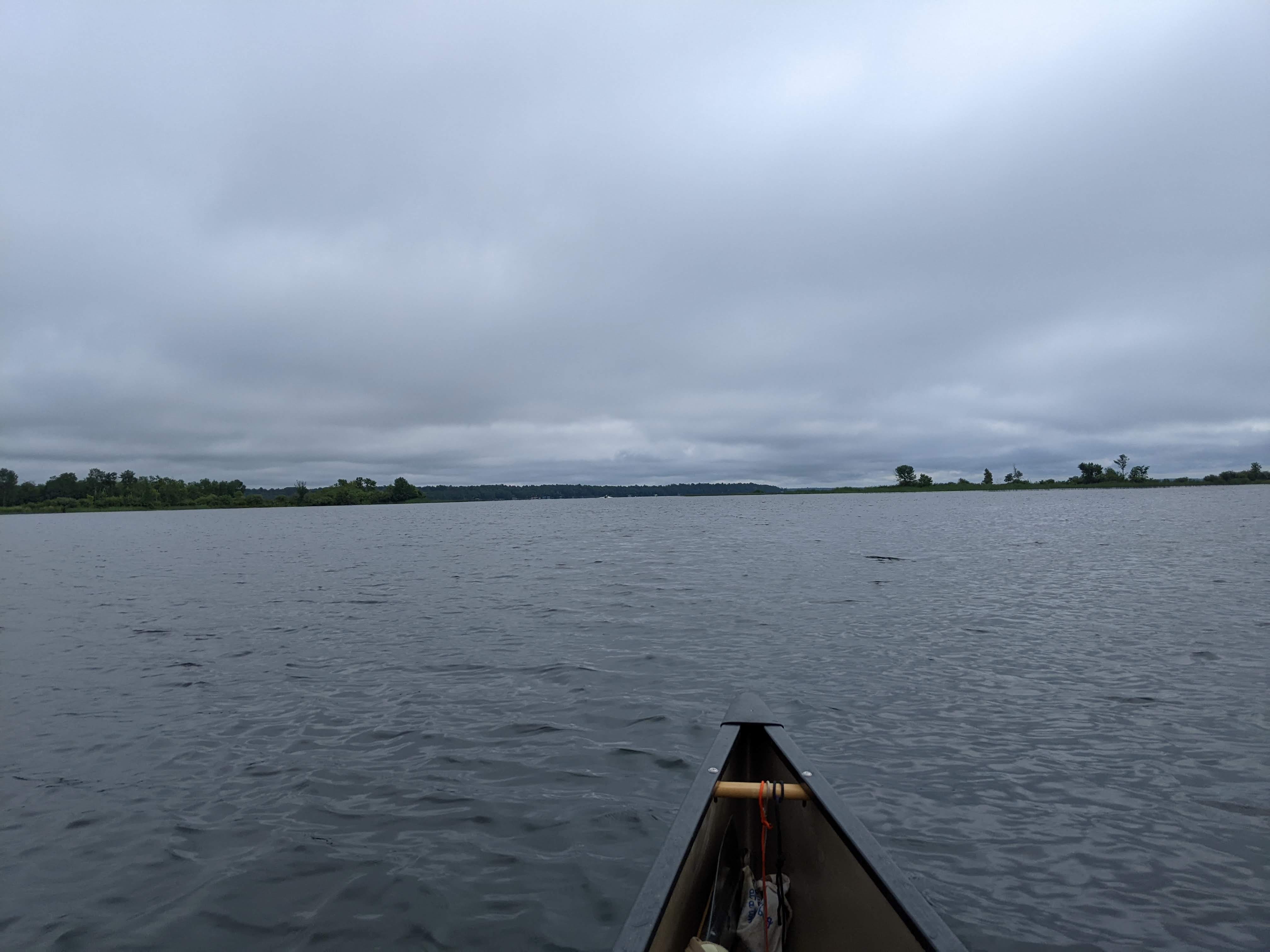
I awoke to a thick fog blanketing Island Point. I couldn’t see the river from the bluffs. As I packed up the fog mostly lifted, but there were still wisps of it when I got on the water.
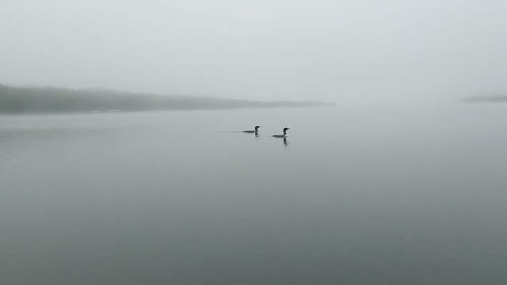
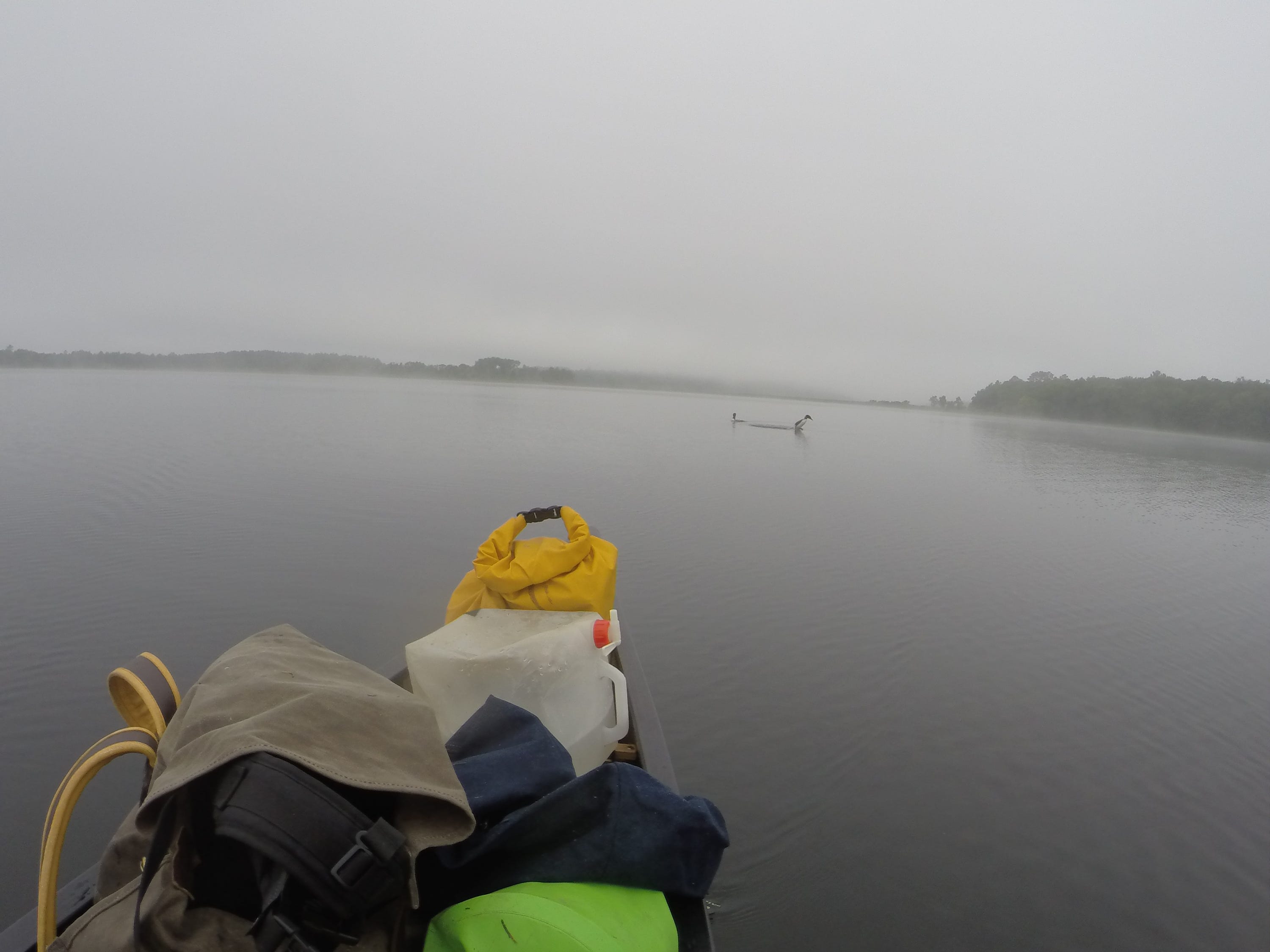
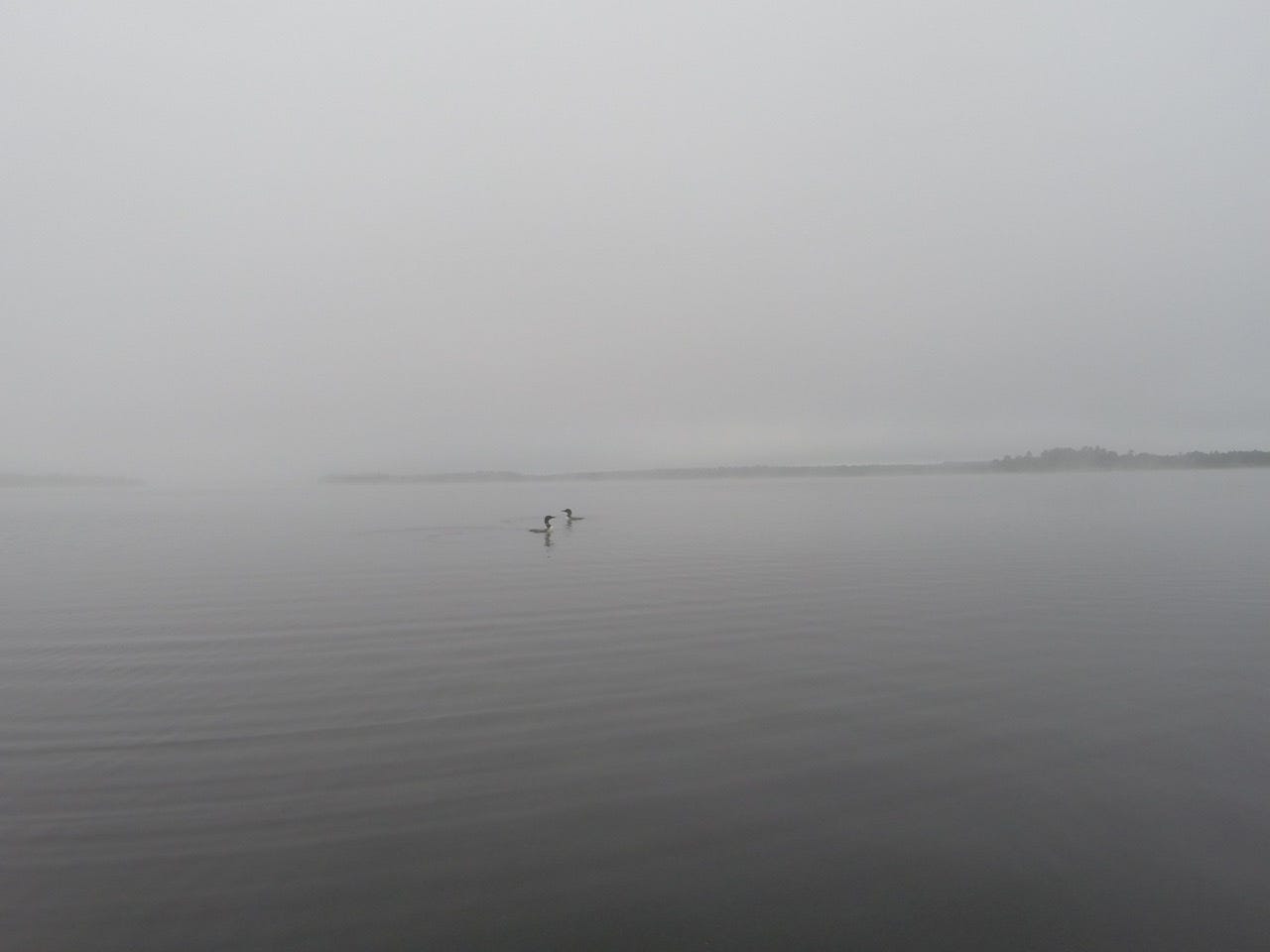
The highlight of my morning were the 2 loons that were highly curious of me. I encountered them on Wolf Lake, where the fog was thick again. It was a magical, eerie moment as they made their shrill melodic calls. They were about 30-50 feet away from my boat, and drifting along with me, clearly aware of me and investigating. Every once in a while they would dive under and swim right towards me, I would see them underneath the water get within 5 feet of the boat. Then they would swim away and resurface 30 feet away again, calling loudly to each other and to me. They were playfully squabbling at me! This process they repeated about 4 times, and the whole interaction was about 15 minutes time. It was a surreal moment. There was no other boat or human on the lake, just me and the loons and the mist.
After this remarkable encounter, I couldn’t stop thinking about it, but carried on paddling. I made it past Lake Andrusia and into the notorious Cass Lake.
Cass Lake has an island in it called Star Island, due to its long reaching peninsulas. This can cause the wind to do odd things as it shears by the long outcroppings, and funnels in and out of the bays. Today I had decent luck on Cass. In Allen’s Bay I had a bit of headwind, but once I made it past the neck, and into the protected cove of Star Island’s north shore, I was set. In fact, I made it to camp at around 11am! A great time to make it into camp in my opinion.
Since on Star Island I’ve been having memories flooding back to me of a trip I did on the Turtle River in 2015, which was simultaneously one of the best and worst trips I’ve ever done, in part due to the winds of Cass Lake. The Turtle River comes into Cass Lake via Kitchi Lake in the north. I could have gone on further today, but I had to stay for the nostalgia, and of course opted to camp at the exact same spot as in 2015. I’m savoring every moment of the headwaters section of the Mississippi because I know that before I realize it they will be behind me. Also, my schedule re: Winnie is not rushed, more on that below. I am camped on the northeast branch of Star Island tonight, at a campsite called “Birches”.
Star Island Lore
Star Island is named as such for its bizarre shape, reaching in all directions, but there’s something else unique about it as well. Star Island has a lake on it, Lake Windigo. Which makes it a lake, on an island, in a lake. I’ve heard the claims that this is the only place this arises in North America! Unfortunately this is not true. While it is quite rare, it exists in a few more places, including Isle Royale on Lake Superior.
However, Lake Windigo is spring-fed, and not connected to Cass Lake’s water, despite its proximity. It IS the only lake on and island in a lake that is not connected to the larger lake. It is also the only lake, on an island, on a lake, which is on a river. Phew.
The name Windigo comes from the Algonquin legends of the Windigo monster/spirit who is a cannibal.
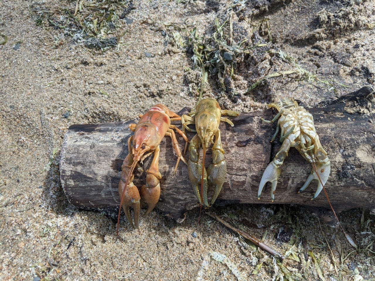
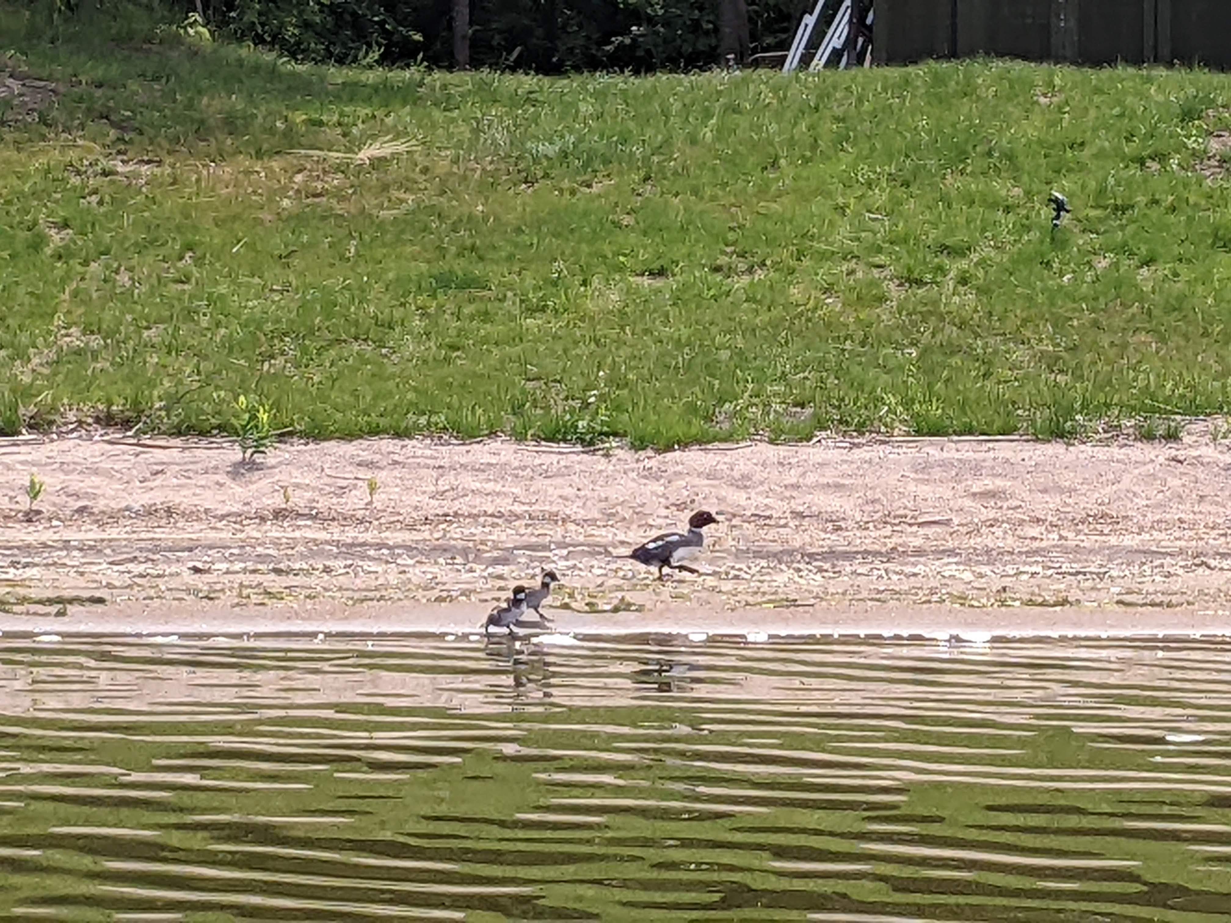
More Photos
A note on the upcoming days
The next big challenge that lies ahead for me is Lake Winnibigoshish, or Winnie. This is an extremely fickle lake, and dreaded by many paddlers. Because of its large surface area, even a 2-3mph wind on land can mean whitecaps on this lake. There have been many source to sea paddlers who have opted to just get a ride around the lake and avoid it completely. Others insist it is a rite of assuage. Out of respect for the big lake, I am planning and molding my next few days around it. Currently, it’s looking like Friday is the best day to cross Winnie in the coming days, so I will opt for that. I am not going to mess around with Winnibigoshish. Which means that today I was in no rush to get to very far. Great news for me since I love Star Island! Tomorrow will be another short day to end up at the cusp of Lake Winnie, and then Friday I will attempt my crossing!
River Log Day 5
1273 - CR 25: Could camp here in a pinch.
1267 - Allen’s Bay. Immediately after entering Allen’s Bay, there is an emergency campsite on your left. Useful if Cass Lake is rough
1262 - NE Cass aka Birches Camp: A bit difficult to find. Find the line of docks on the north shore of Cass and head east. Just past the last dock is the site, buried in the trees. A bit primitive. 2 fire pits, 0 tables, 0 shelters, 1 latrine. Really nice view of Cass, and phenomenal swimming beach!
~1262 - South Cass Camp: Well established site with amenities. Big campsite.
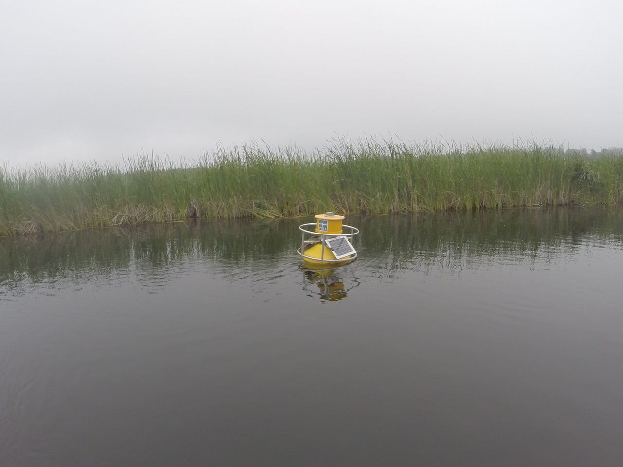
JC-it's Jeremy, we met in Trempealeau, WI at Lock #6, I'm finally working my way thru the day to day postings and thoroughly enjoying it. Then I saw your photo of the YSI buoy and your question about what is this thing...I recognized the name since I'm a hydrogeologist / environmental consultant and we use YSI products for other applications. Bottom line is this is some remote deployment of a sensor, can collect data on elevation of water, collect water quality samples from specific depth horizons..etc..and the deployers can get the data in real time via telemetry. Here is some info for what I believe is the model EMM68 Buoy :
A quickly deployable water monitoring platform with remote telemetry.
Just two people needed to lift this buoy into place reducing deployment and maintenance costs. The entire system can be installed without divers, allowing for complete serviceability from a small boat or watercraft. A buoy that is secure and difficult to steal or vandalize.
Collect data from any YSI 6-series or EXO sonde via two data delivery systems.
Receive remote data via two data delivery systems:
• Basic data delivery sends a raw data file to your computer
• Web-based option posts data directly to a public or private web site.
Among the advantages of remote data delivery are:
• Save you unnecessary trips into the field, reducing operating costs
• Makes you aware of changing conditions as they occur, improving response time
• Match your calibration and maintenance schedules to actual sensor performance, reducing consumables
Collect data in waters that may have been previously out of reach. The EMM68 buoy is an economical alternative to an installed permanent fixture on bridge pilings and piers.
Applications Include:
Dredge Monitoring
Baseline studies
Dye-tracing studies
Emergency response
Fisheries
Industrial sites
Non-point source/TMDL
Point source/discharge
Stormwater & CSO
Source Water
University/research
This product is a complete solution from our Integrated Systems & Services group. Let our application engineers help you with the heavy lifting on your next project. Contact YSI's Integrated Systems & Services team to discuss your specific monitoring application. We offer a variety of buoy platforms which can be tailored to fit your needs.
https://www.ysi.com/emm68
I'm enjoying your story of your trip down the "River". Hope to meet you when you get to the lower River. I'm inland at lower river mm 839 and can meet with any supplies if needed. Mike