

Day 76 - Dodging Barges

Day 76: Clarksdale, MS → Old White River Mouth
Date: September 22nd, 2022
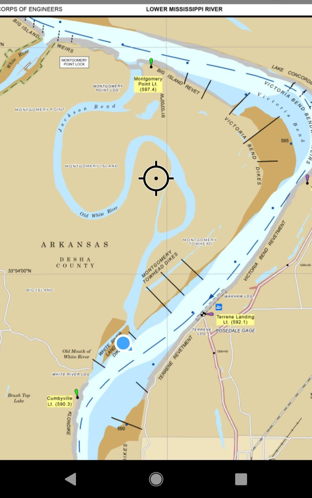
LRM 638 → LRM 591
Distance today: 47 miles
River Time: 11 hours
Countdown to Baton Rouge, LA: 362 miles
Local Gauge: 1.4 Helena Gauge
It was tough this morning, leaving Clarksdale and the community I have there. I saw so many good people over the last few days, so it’s tough to go back into solitary mode. That being said, the River is a fun place to be, so I can’t complain much.
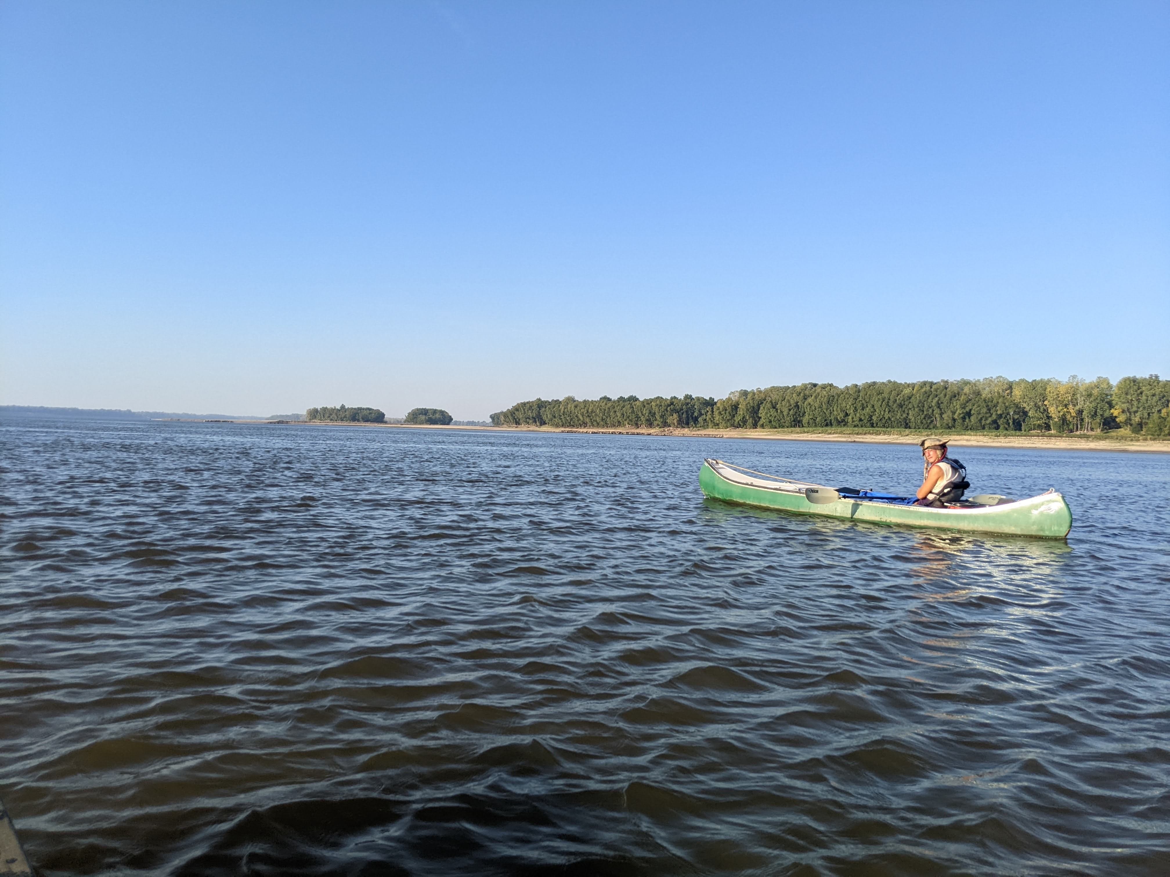
I got underway early in the morning at the same place I took out three days prior: the backchannel of Island No. 63. I was joined for the morning by another through-paddler, Peter the Pirate. He began in Lake Itasca on June 20th, and we’re overlapping now!
A Low River
The River is low today. It was low when I arrived at Clarksdale, and it’s even lower now, by about 2 feet. The Helena Gauge reads 1.4 today. It’s not a record-breaking low, but more like a 5-10 year low. It can get as low as -5 or so. The gauges along the River measure in feet, but zero does not mean the river bottom. On each gauge, “zero” means something different, but no matter — to a paddler, the daily change in feet is more important than the exact depth.
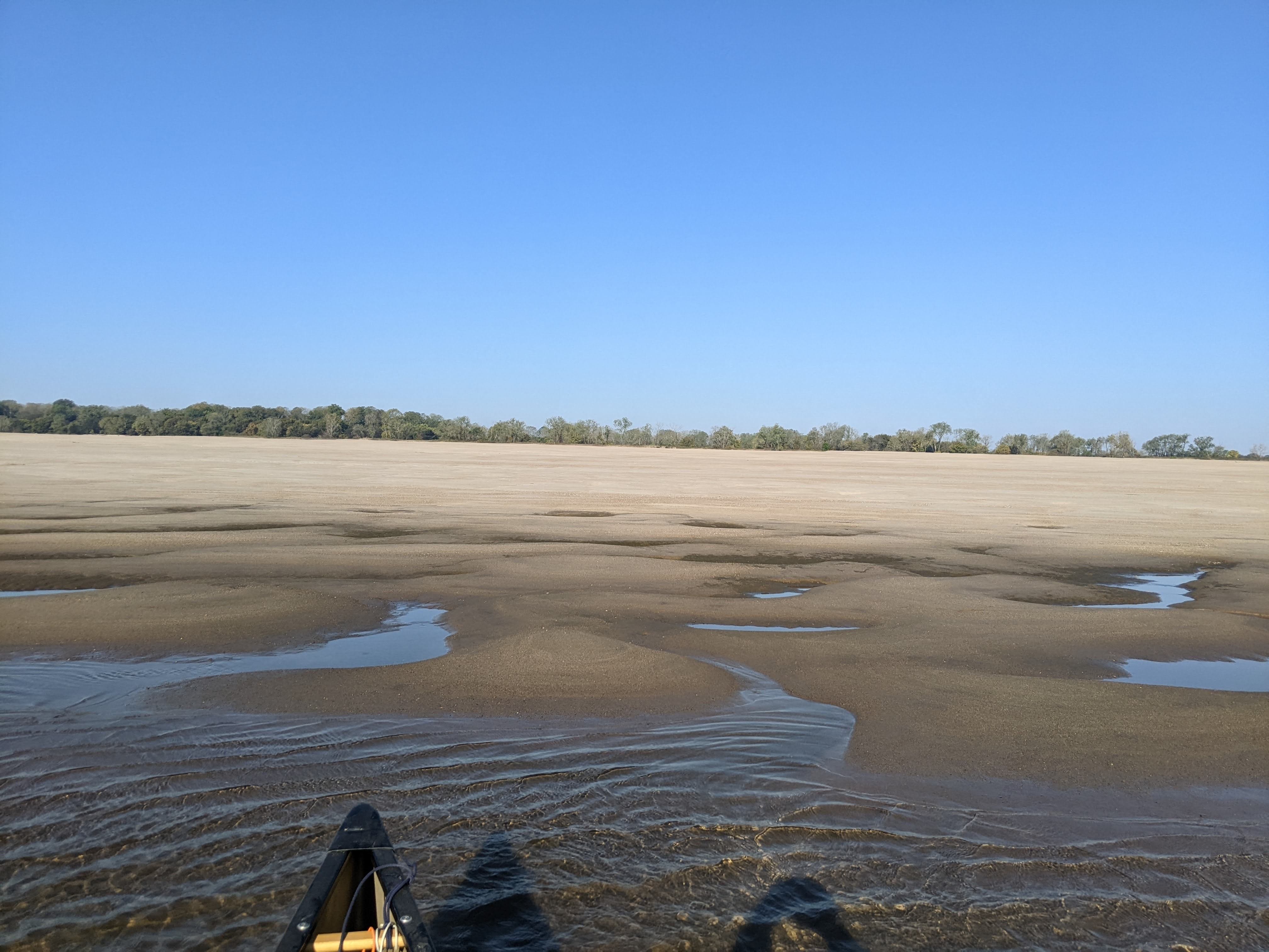
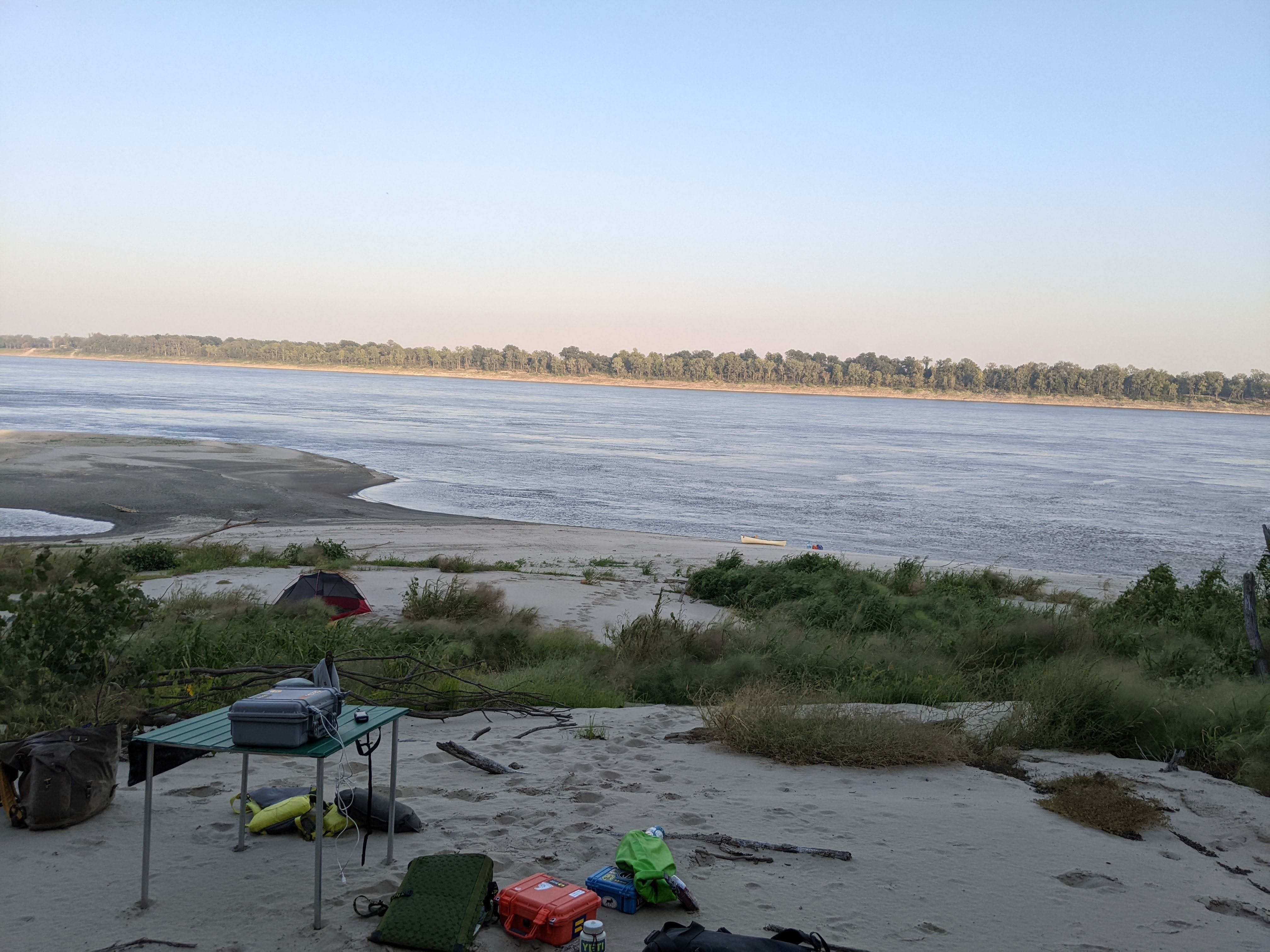
The low River means there are vast expanses or sand. In many places, around bends especially, there is much more sand than water (in terms of surface area) within the river banks. Most trees I see are a quarter or half-mile walk away, making shade scarce. Finding a good campsite with shade in walking distance is a challenge.
The low level of the River means it has less flow, but honestly I haven’t noticed a huge decrease, which has been nice!
Dodging Barges
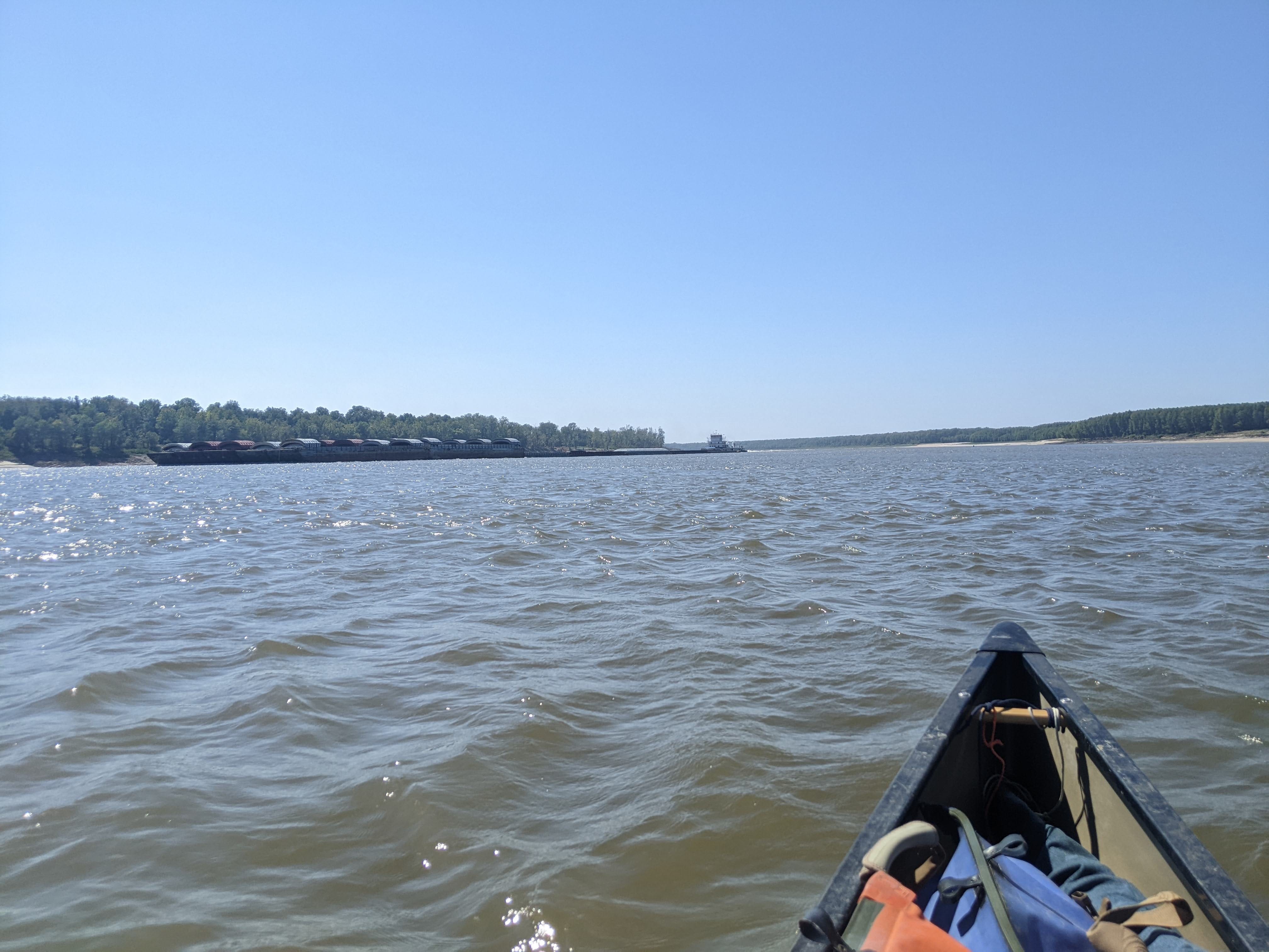
Peter and I paddled together for the morning and had the River to ourselves for a good 3-4 hours — not a single other vessel to be seen! It was really nice to not have to worry about tows, and to be smack dab in the middle of the channel!
Around 10 a.m. that all changed with a string of northbound barges one after another. The wind also picked up, making it tougher to keep my boat where I wanted it to go. The toughest moments were when the wind was pushing me directly in front of a barge, and I had to fight with all my strength to stay out of its path.
Normally when this happens I would cross immediately astern of that barge to relieve the pressure, but that option was unavailable with the barges coming so tightly together. I really had to plan my crossings carefully to avoid the barges, and all while contending with strong winds.
Around one bend I saw what I believe to be a coyote drinking water! Nice spot for the middle of the day!

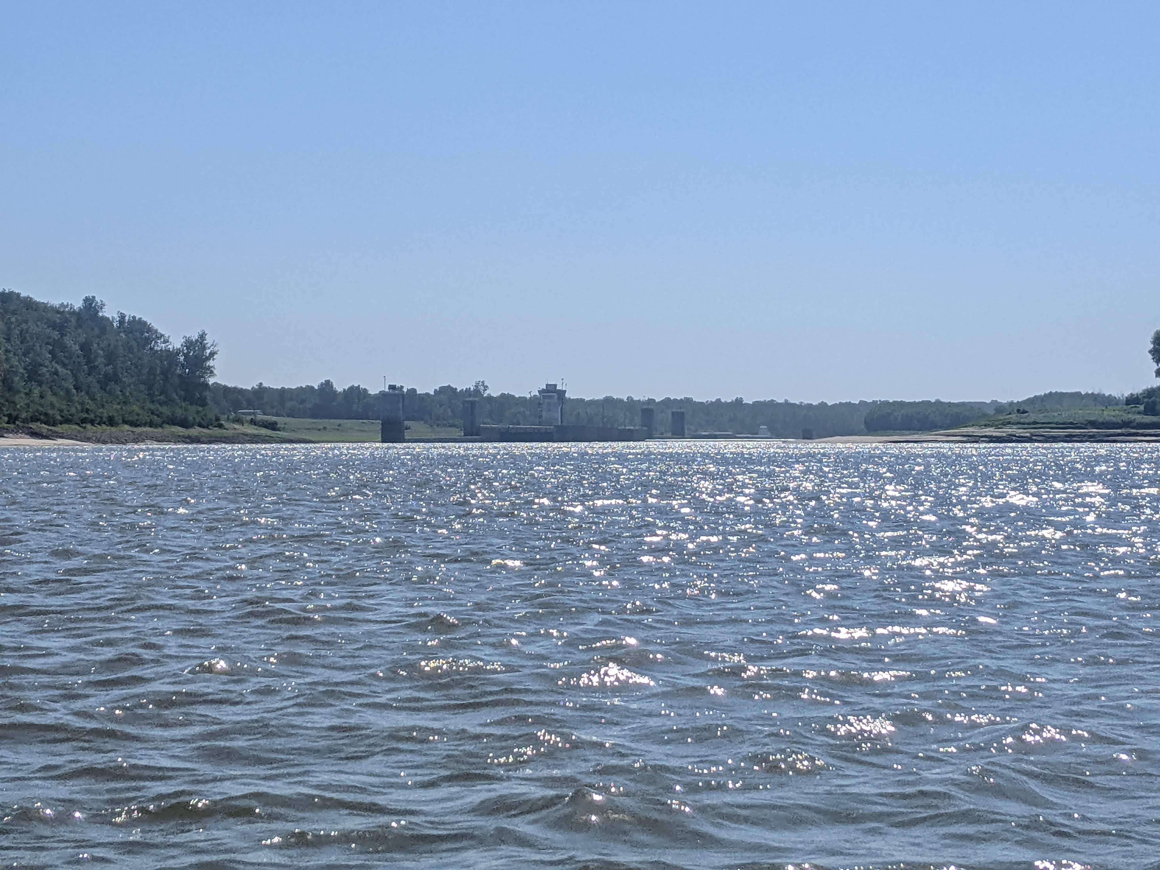
Old White River
After some long hours paddling, I arrived at the old mouth of the White River. This previous channel used to go three bends farther. The current White River lets out about 8 miles upstream from here.
Here is where I call home tonight.
The Future
I have this idea of getting to Baton Rouge on a Sunday. The port of Baton Rouge is notoriously busy and can be dangerous for paddlers, but is less so on Sundays. My goal is to arrive there on Sunday, October 2nd.
Achieving this would mean paddling an average of 37.1 miles per day, with zero rest days.
Or paddling an average of 40.9 miles per day with one rest day.
With weather on my side and no big disruptions, this should be possible. Not necessarily a walk in the park — those are long days — but certainly doable.
River Log:
630.0 - Angie & Allie Islands: RBD, good low-water camping. Short steep walk to afternoon shade.
614 .5 - Island 69: RBD, a few really good options for low-water camping. Sandy willow forests a short walk from the water.
Another interesting blog entry. I am enjoying them a lot.
I notice Peter the Pirate seems to have much less gear than you do. Did you ask him about that, and if so, how did he reply?