

Days 2 & 3 - Wetlands Galore
Days 2 & 3 - Wetlands Galore
The river is growing before my eyes

Day 2: Coffee Pot Landing → Iron Bridge Camp
URM 1326 → URM 1301
Distance today: 25 Miles
River Time: 10.5 hrs
I woke up with the sun and the birds today. Sunrise is still quite early these days, and first light comes around 4:15am. I packed up my tent and gear, took down the bear bag and loaded the canoe. I was all ready and on the water by 6:15am. Only because coffee was already brewed from the day before. I wanted to get out early to beat the heat of the day, it can be stifling and humid among those reeds!
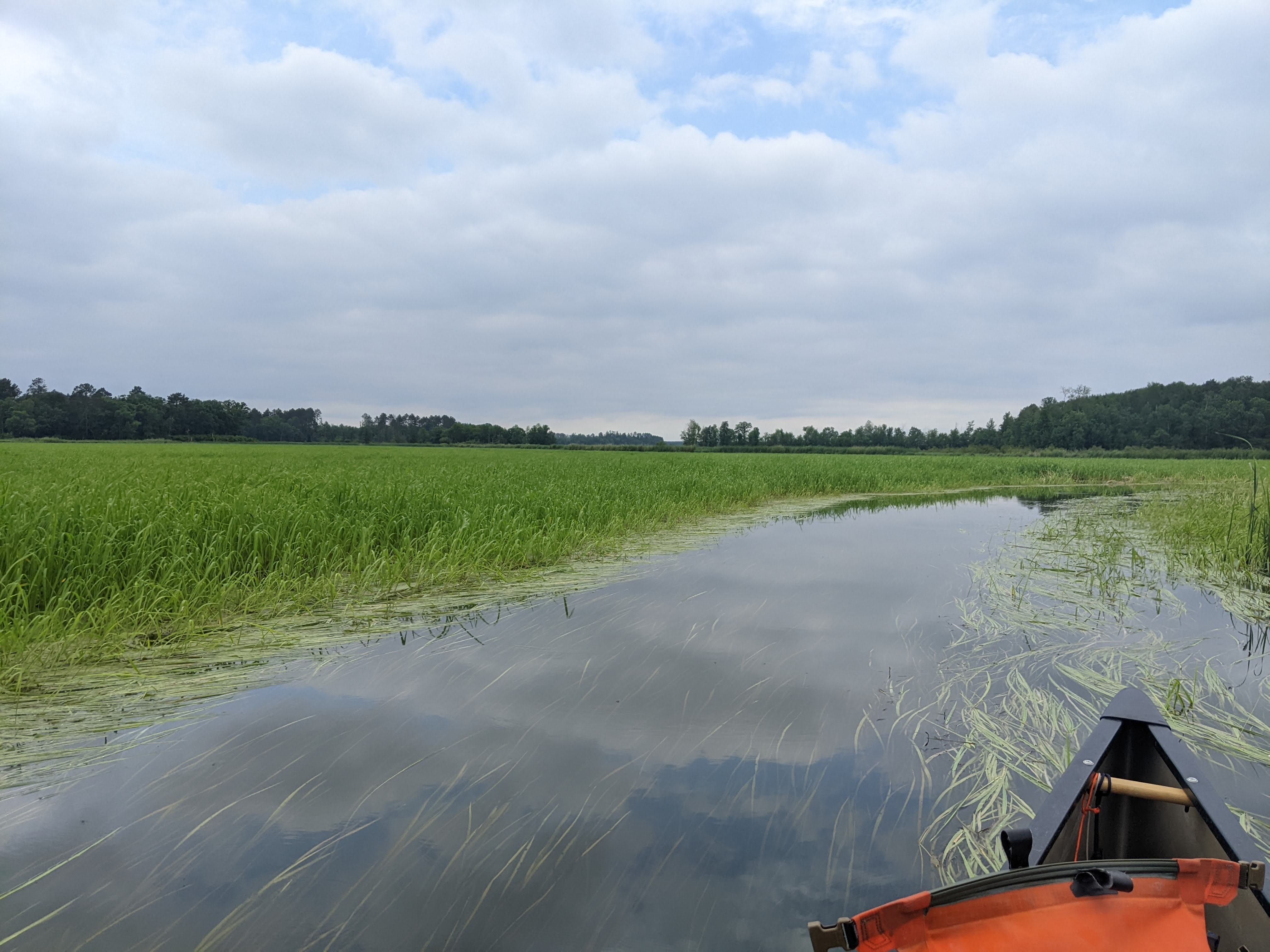
My first section was more of the same, the swampy wetlands of the Northwoods. It was cool and a bit buggy with the sun still rising into the sky. Within the first hour of paddling I saw a pair or river otters playing, and further down a beaver scoffing loudly at me before dipping underwater to his den.
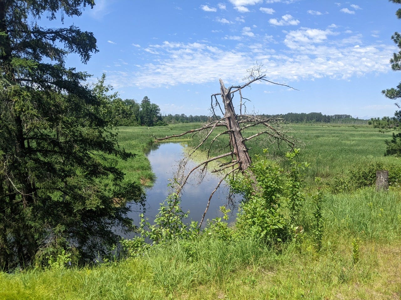
Most of this section is just various types of aquatic plants, with no real solid ground for miles. Absolutely not a good place to capsize your canoe. But the animals that do live here thrive in this environment.
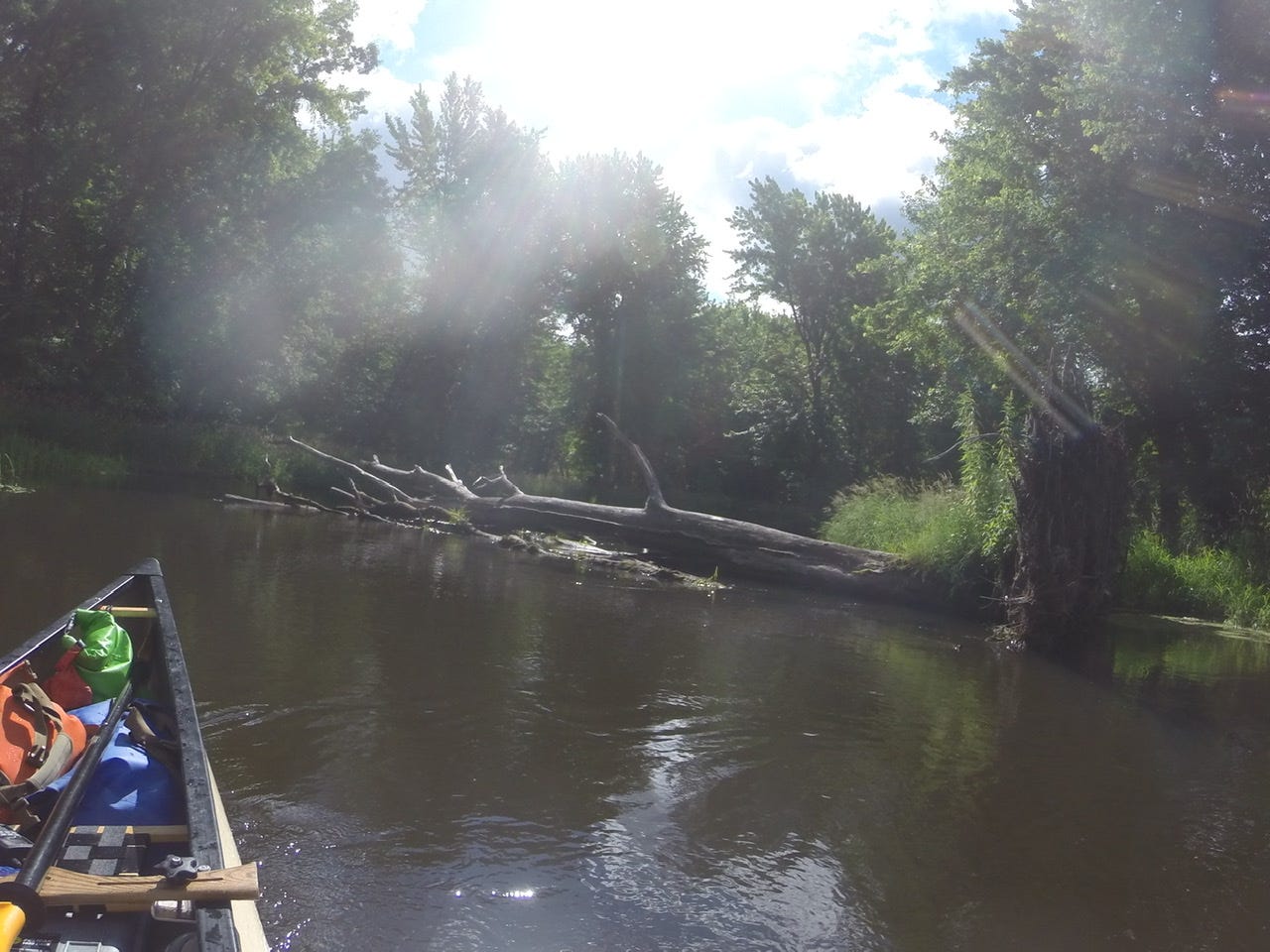
I passed through the very unimpressive Stumphges Rapids, barely registered. I kept waiting for them to appear, then realized I’d passed the bridge that marked the end. It was a brief respite in the red pine and birch forest before getting spit back out into more wetlands. Below is a video of the first few turns of Stumphges Rapids
[Note: I apologize for the quality of the audio on these first videos! I had no idea my waterproof case was so noise-reducing. I will have to figure out something to make it better from here on out!]
A bit into this wetlands, I started to notice ominous clouds. Lacking cell service, I reached for my weather radio, and learned a line of thunderstorms was inbound in about 30 minutes. A quick check of the map let me know that the next bridge was about a 40 minute paddle away. I decided to paddle hard to the bridge, to avoid being caught alone in a giant field. I almost made it before the rain started, but made it to the CR 5 bridge mid-storm and was able to wait it out there. Luckily, it was a classic summer storm: brewed up really quick and intensely, but also passed quickly. I continued on my way.
I made it to Fox Trap Camp around noon. This was a consideration of a spot to spend the night, so I got some lunch and had a think. After lunch, I decided to keep going, because the day was nice and overcast— perfect weather to paddle in! Any time I can paddle and not have to worry about sunburn is a win for me!
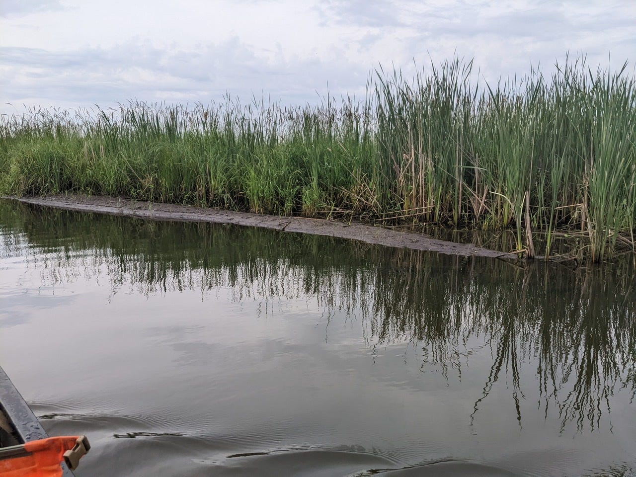
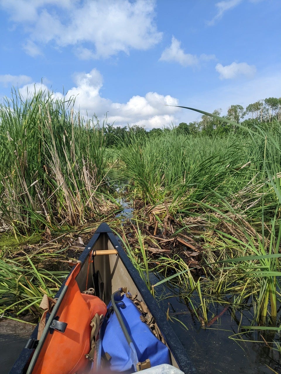
The last section was 8 miles of wetlands, where often the main channel would split into 2 or 3 channels in front of you. It was tricky to know which path to choose sometimes, and I made the wrong decision a handful of times and had to either backtrack or bushwhack. But I made the correct decision a lot too, and on the whole the section was manageable. I made it to Iron Bridge in decent time.
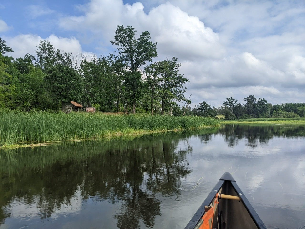
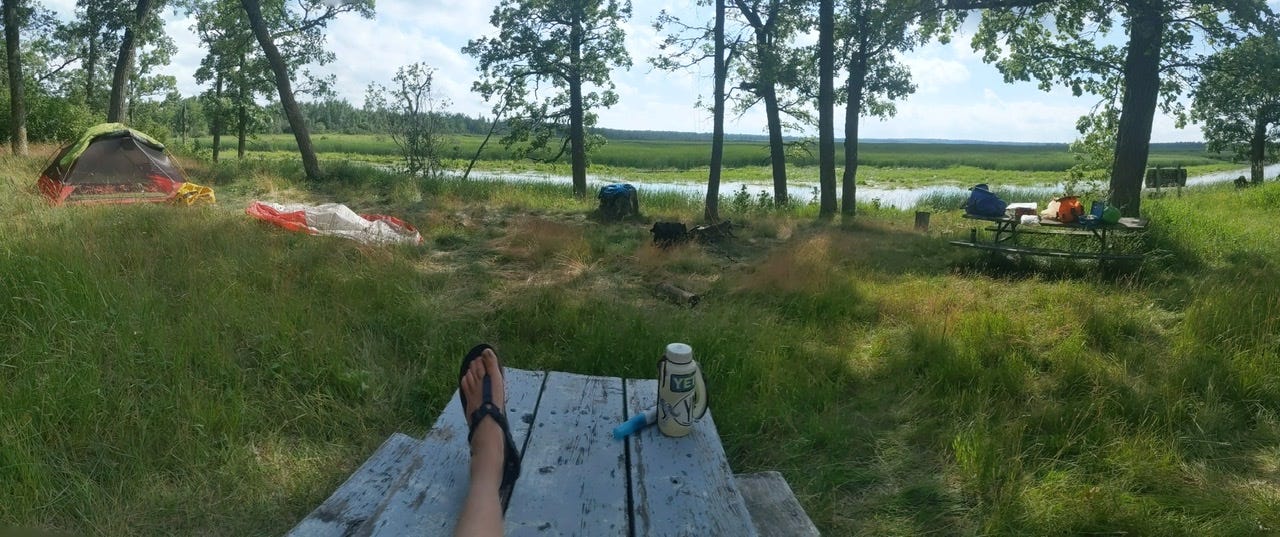
I have paddled this section of the Mississippi in 2015 with Les Voyageurs, and the memories kept flooding back to me as I paddled today. I had strong memories of Iron Bridge being one of the best sites in the region, and my memory was correct! A shady, expansive sight, with a little elevation, and with a view of the 8-mile bog I just slogged through! Tonight I will kick back, relax, and enjoy the view.
Day 3: Iron Bridge Camp → Silver Maple Camp
URM 1301 → URM 1290
Distance today: 11 Miles
River Time: 4 hrs
Today I awoke to some light drizzle, and to the sounds of trumpeter swans and sand hill cranes(I think) whooping and bellowing. Today was destined to be a short day. I was only aiming to do 11 miles, to Silver Maple, and upon learning of the afternoon thunderstorms, this only solidified my plans. I packed up my soggy tent and other gear and hit the water!
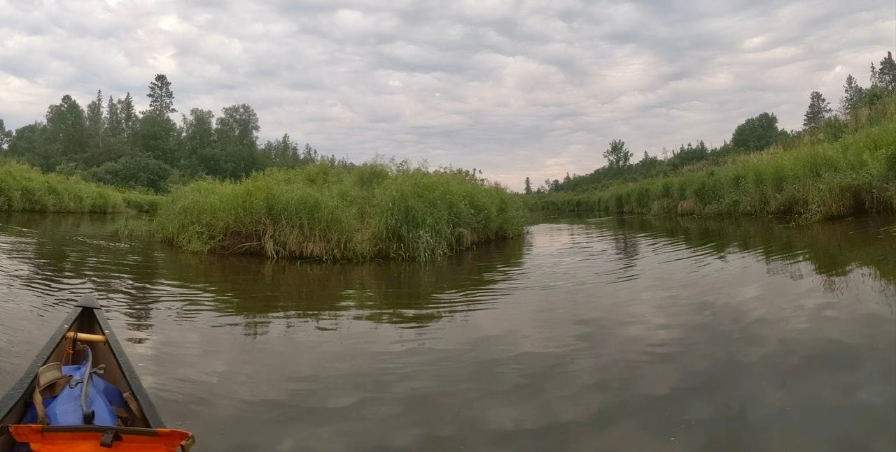
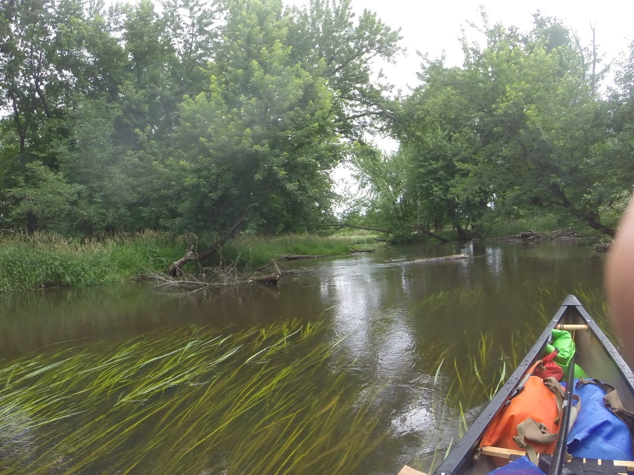
I had more wetlands right off the bat, but at least the channel is generally wider now, without extremely tight turns. I can easily turn my canoe around without issue. It was an overcast day with off-and-on light rain, which was fine by me— nice and cool paddling weather! The highlight of the day was all the water fowl! I would round a bend and come upon an entire family of geese and goslings, or ducks and ducklings! They would often shuffle into the reeds and out of site, but some of the more bold ones would stay out and eye me as I passed by. Other times we’ll play tag: when they see me and startle, they’ll flap and swim around the next river bend to escape, inevitably when I come around the corner they repeat this maneuver. This continues until they realize I’m not a threat. Sometimes the mother fowl will separate from her younglings, and play distressed and injured, luring me to follow her. I of course do so that the ordeal can be over with sooner and I can stop stressing them out! I’m just trying to go downstream momma! I also saw what I believe to be black terns, which is a new species for me. Watching them swoop around and fish was a thrill! They are very agile. Saw some sandhill cranes, and many great blues, who would wait until I was passing right by them— seemingly wondering if I truly was a threat— before taking flight laboriously and complaining noisily.

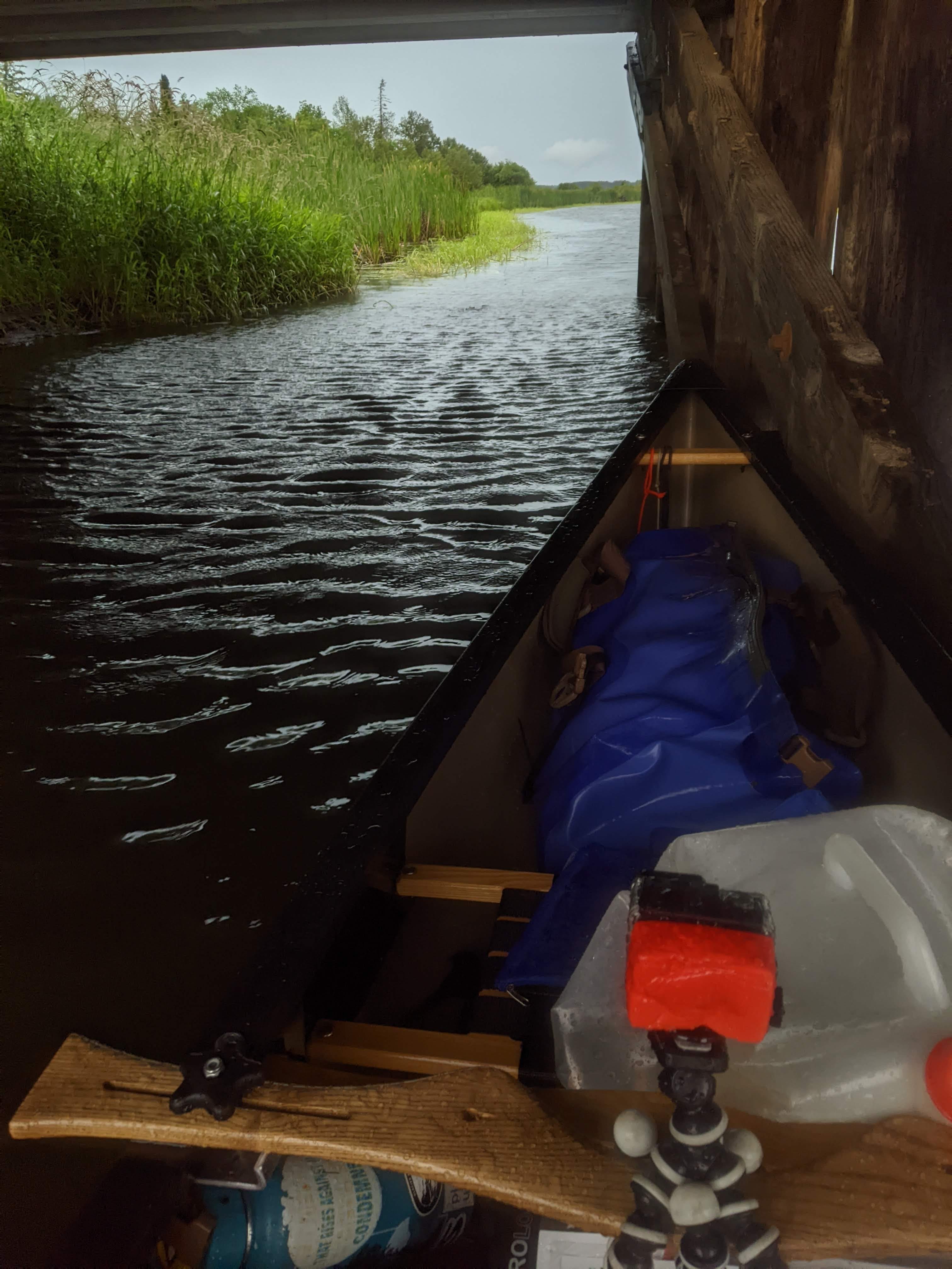
Eventually I entered into the section labeled “Numerous Log Jams” on the map. They weren’t kidding as there were branches and full trees littering the river from the last 10 years and beyond I suppose. Some of them were fallen over 95% of the river and required me to squeeze through a very small opening. Others spanned the entire width, but luckily most had tight spaces where I could do the log jam limbo. More than once I got a face full of bark. Twice I had to get out of my canoe, balancing gingerly on some limbs, and haul my canoe over a limb sitting just underneath the water, then jumping back in on the other side. I really enjoyed this section, each called tree was a puzzle to be unlocked.
I was cruising along in this section, when I realized I had passed my campsite! I must have been too concentrated on dodging the trees. So I got some extra credit paddling in today, going upstream! I made it to Silver Maple Camp, and just in the nick of time, for as soon as I set up my shelter it began to dump on me. I jumped in and waited out the storm.
This site is the first spot where I’ve had good cell coverage! So I have a chance to post these blog posts. Tomorrow I will cross the first lake on the Mississippi River: Lake Bemidji.
PS. To follow along with my journey and all the landmarks referenced, see here: https://files.dnr.state.mn.us/maps/canoe_routes/mississippi1.pdf
River Log Day 2
Weather Radios are nice to have in this section, as cell service is non-existent. I highly recommend these to anyone paddling the Mississippi. Even better is to get one that can also talk to towboats which comes in handy later. Bailer/sponges are nice too because in many spots it’s impossible to leave the canoe to dump it.
1324.4 - Brownie Camp: Visible sign from water. Extremely weedy entrance. Would not recommend.
1321 - Stumphges Rapids: Very minor. Once you pass the wooden bridge, they are over.
1311 - Bear Den Landing: Camping is fine here in a pinch. No signage visible from water, but boardwalk is visible through reeds.
1310 - Fox Trap Camp: Only high spot in the area. Good scenic river views. 1 Adirondack shelter, picnic table and latrine. Landing is upstream from the site. Do not go around the bend hoping for a better access.
1307 - Pine Point Landing/Camp: Must take a side channel to access, very subtle from main channel, and weedy. Pay close attention to maps when approaching to know which side channel is correct.
1308-1301 - Gnarly Wetlands: Easy to loose main channel in this area. Stand up carefully in canoe to gain a bit of perspective. Don’t be afraid to go full prostrate in your canoe to pull yourself through narrow sections of peat bog.
1301 - Iron Bridge Camp: Nice site shaded with oaks. Good view of wetlands you just traversed. 1 Adirondack shelter, 2 picnic tables, 1 latrine. Decent landing, mucky swimming.
River Log Day 3
1290 - Silver Maple: LBD camp. On a tight right hand bend of the river. No signage, but staircase visible once around the bend and downstream, look over your shoulder every once in a while! There is a deep shelf at the landing spot, so go straight from the canoe to solid ground. 1 picnic table, 0 Adirondack shelters, 1 Latrine. Nice high ridge, but only bummer is that it’s near a road.
Whoo-whoop! Brother... awesome... looks like you're having fun... Great. The Minnesota marshlands have always reminded me of the the marshlands at the end of the river... like all journeys, certain circular aspects bring things around, and the finish reflects the start! Onwards... and many blessings!