


Days 54 & 55 - Milestones
To St. Louis and Beyond!

Day 54: Alton, IL → Hoppies Marina
Date: August 31st, 2022
URM 202 → URM 159
Distance today: 43 miles
River Time: 10 hours
Countdown to St. Louis: -21 miles
Countdown to Ohio River: 159 miles
Today was a big day. The last lockage of the trip. The confluence of the Missouri River. The Chain of Rocks, which was the last portage of the trip. And paddling through the Port of St. Louis. Here’s the breakdown.
Mel Price Lock and Dam (Lock #26)
I woke up early from Sonny’s houseboat. The Alton Marina has a direct view of the Mel Price Lock & Dam — it is only about 1 mile upstream. I loaded up my bags hurriedly until I saw a towboat passing and heading straight for the lock. Oh well. Luckily I hadn’t left the dock, so it was a nice place to wait with a cup of coffee.
The tow disappeared from sight, and I radioed the lock about 20 minutes later. The coast was clear! I hopped in the canoe and I was off. Sharing the lock with me were 3 yachts! This was a modern, upgraded, 1,200-foot lock, so the chamber was huge.
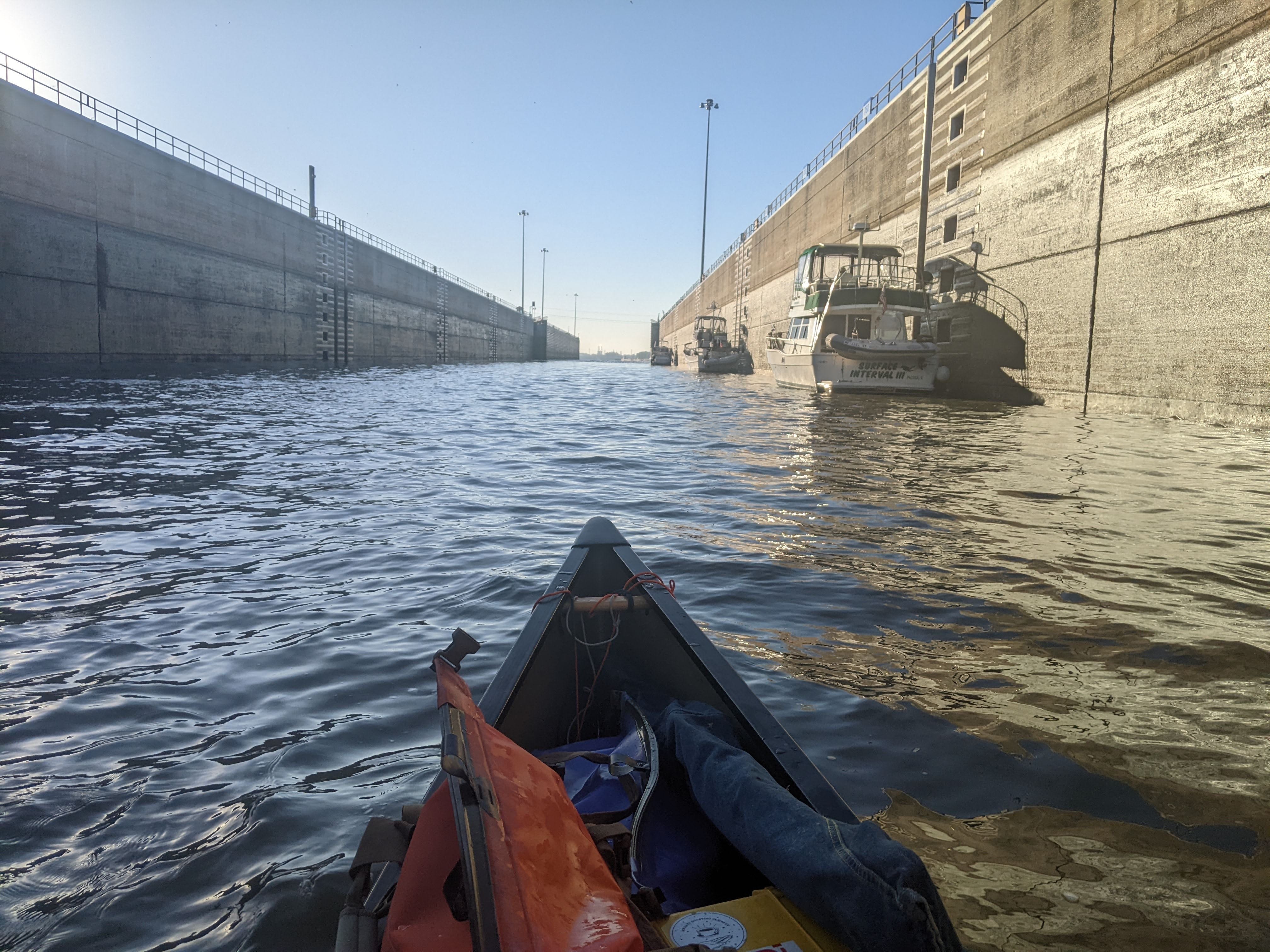
It felt good paddling out of the lock knowing that I would not be delayed by a busy lock for the rest of this trip. All 26 locks and dams that I will take on this trip are behind me now!
Confluence of the Missouri River
I was let out of the Mel Price Lock and expecting the current to be picking up. Not yet. The current was the same as in the pools. Both banks of the River were lined with industry.
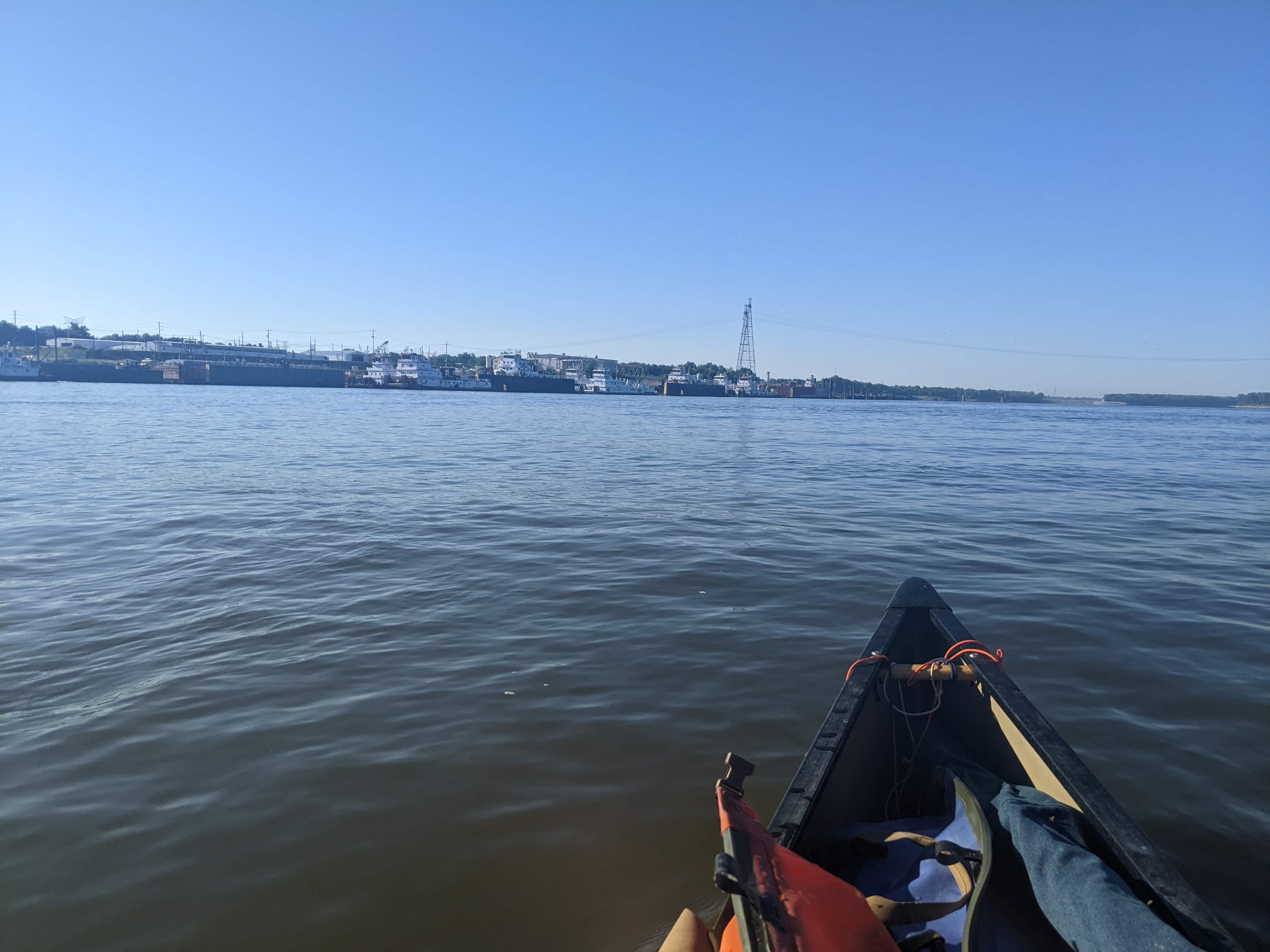
I rounded one bend, and was looking at the confluence of the Missouri River. I stopped and floated in awe of two major rivers colliding and joining forces.
The Chain of Rocks
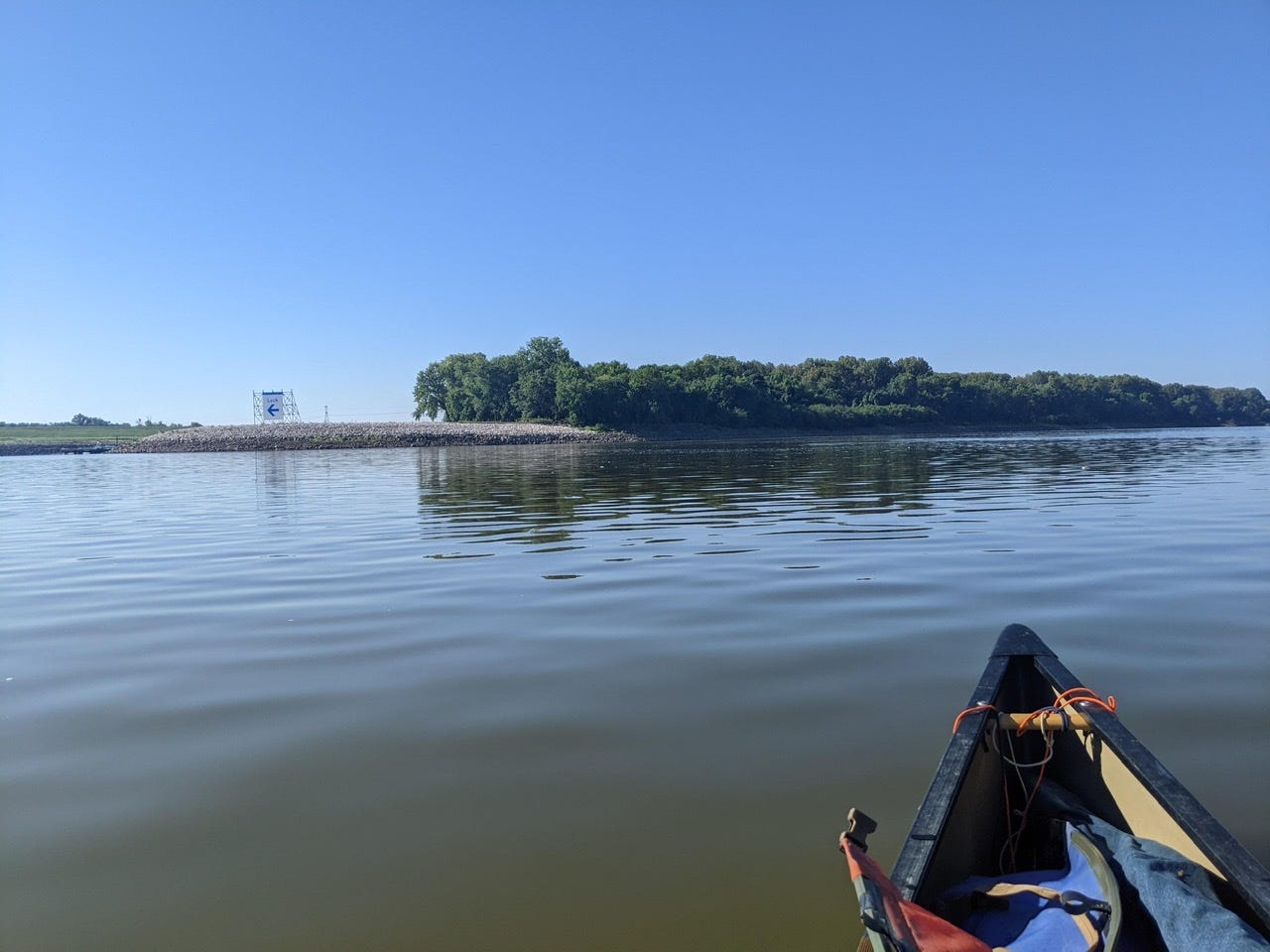
Immediately after the confluence, I had a choice to make. Option one was taking the canal to Lock #27, and option two was taking the main channel and facing the Chain of Rocks. I opted for the latter, as I’d heard it’s quite a sight, and the portage isn’t that bad. The Chain of Rocks is a runnable rapids, but certainly not at this water level. Way too many exposed rocks and turbulence!

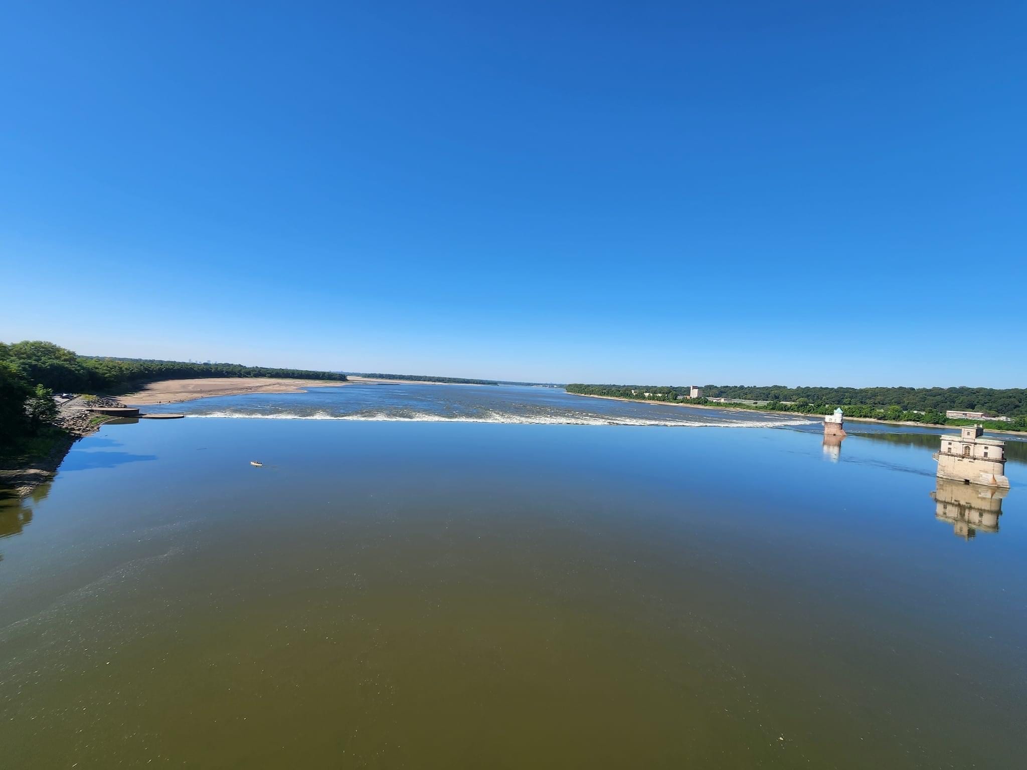
The Chain of Rocks, as far as I understand, was a natural rapids. However, it has since been bolstered by humans for the purposes of having a low-water dam, as it is now. So there are many more and bigger rocks than there were originally. It certainly holds a lot of water back.
It’s difficult to explain, but I could not see the Chain of Rocks as I approached it. As an optical illusion, it looked just like glass. I heard it first, and only when I stood up in my canoe could I see it. What’s crazy is that once on the downstream side, I was in awe of how massive it was: the large drop was more than 10 feet, and the amount of turbulence was massive. It was a bit spooky that it was so indescribable from upriver!
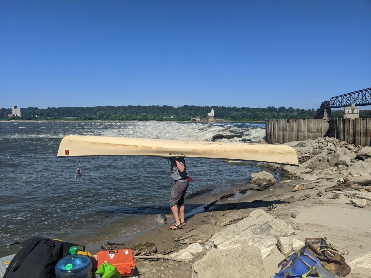
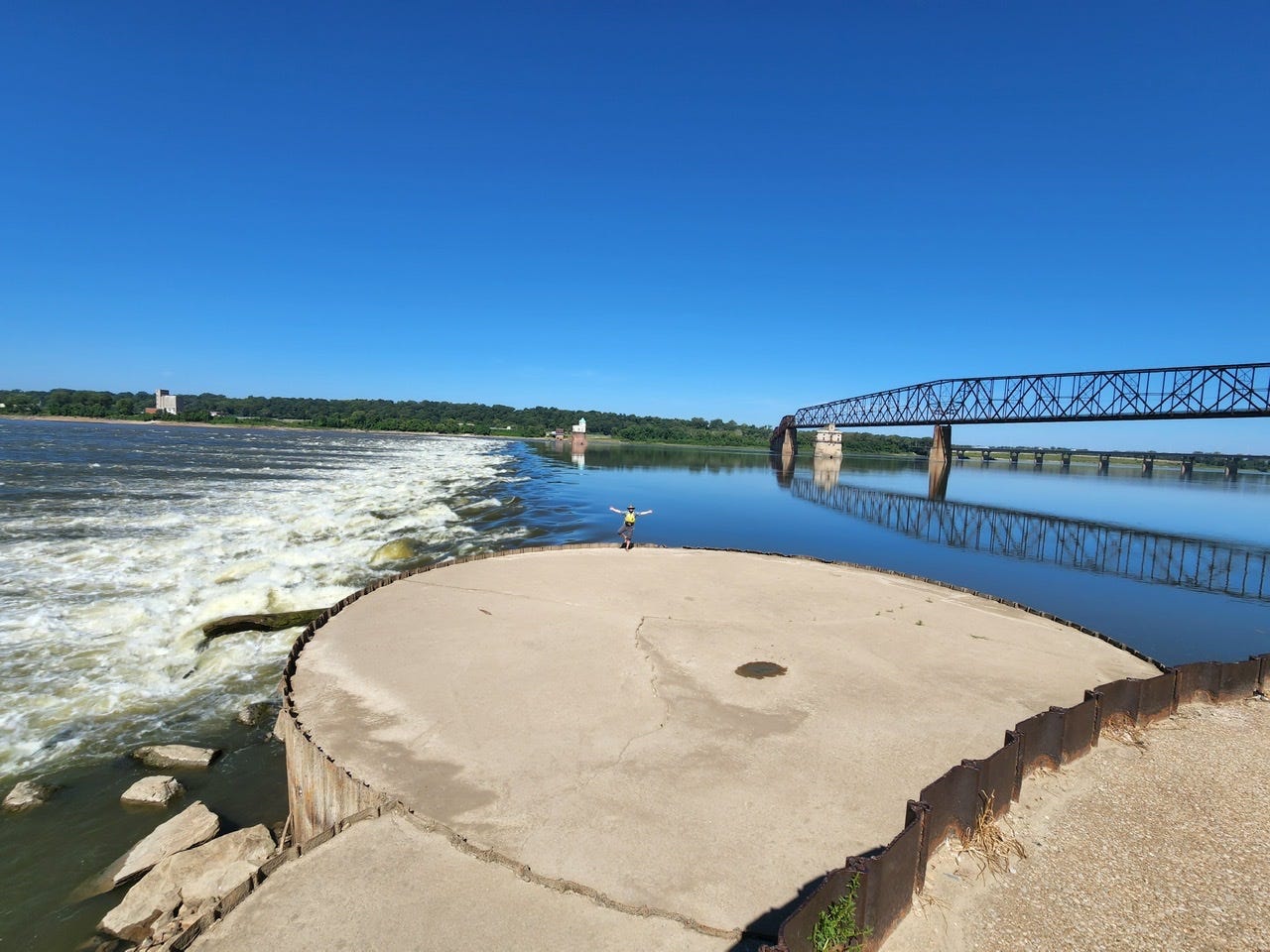
I arrived and set off to do the very, very last portage of this trip (hopefully anyway!) I unloaded, then hoisted the canoe on my back one last time (I left the portage wheels in St. Paul, knowing this was the only upcoming portage). Afterward, I stayed and hung out at the Chain of Rocks and just marveled at it for a little while. It’s an impressive feature of the River. Local river rat John Reed came and took a few photos of me.
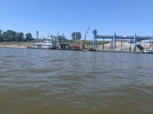
The North and South Ports of St. Louis
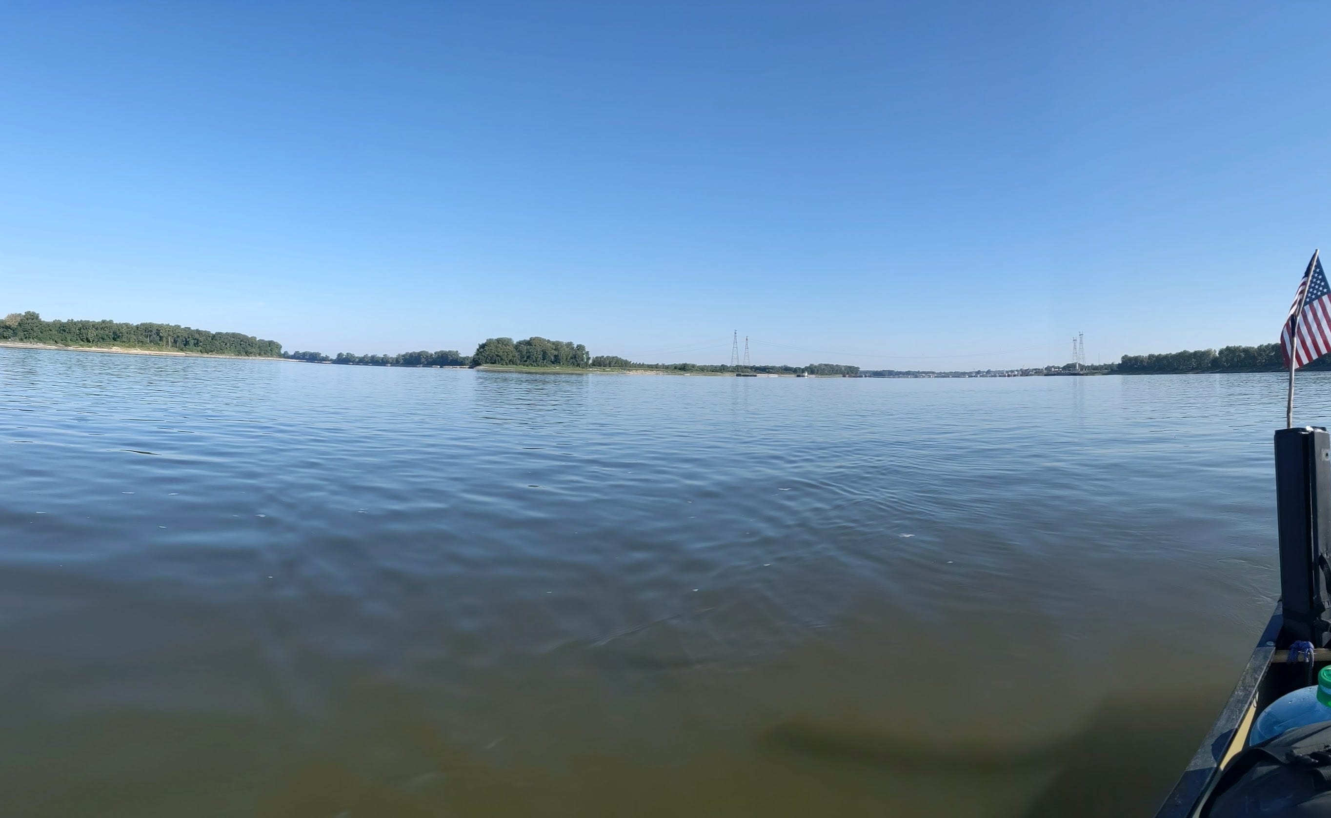
I couldn’t stay too long, however, as it was almost lunch time and I had the entire port of St. Louis to get through. I departed the Chain of Rocks and to my delight I finally had current on my side! It was a glorious feeling to finally be in the free-flowing portion of the Mighty Mississippi!
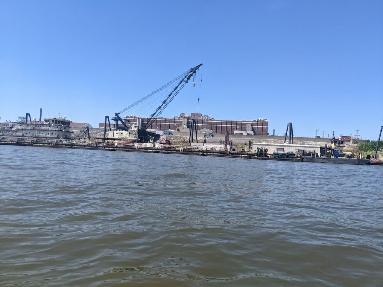
As soon as the canal rejoined me, I had entered the North Port of St. Louis. There was a constant humming as smaller tows moved barge containers, filling, emptying, and swapping constantly. There was a lot of movement, and a lot of waves stirred up by the tows’ wakes, but nothing too bad. I was vocal on my radio to make sure they were aware of my presence, and I had no problems.
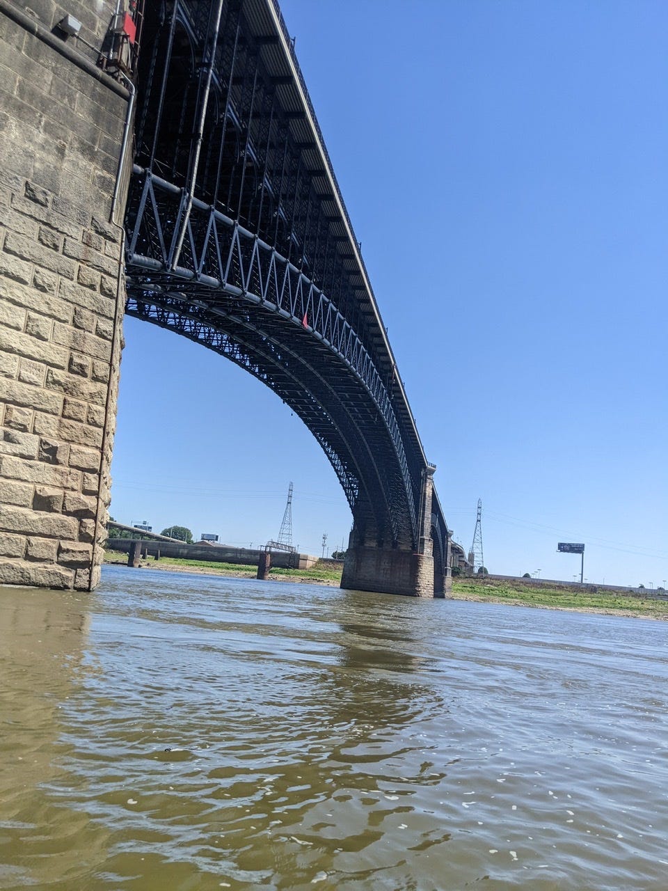
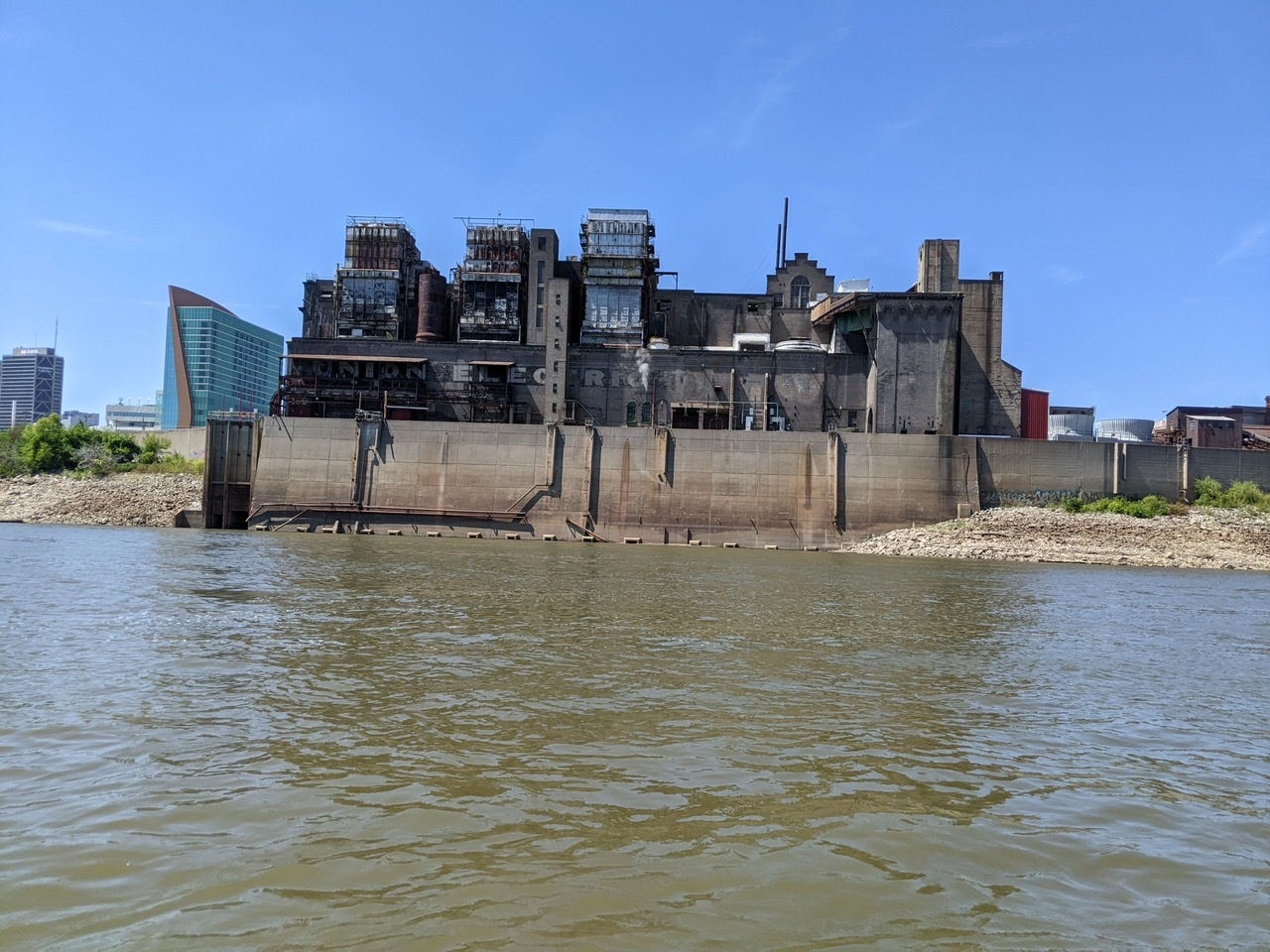
Soon enough I had arrived at the Eads Bridge, and the St. Louis Arch just behind it. The Eads Bridge is the oldest bridge still standing on the Mississippi, and is named after an incredible engineer, James Buchanan Eads. He also popularized the use of wingdams on the Mississippi. This Civil War-era bridge was completed in 1874, and at the time was the southernmost bridge on the Mississippi. It’s a testament to Eads’ brilliance that it still stands today, almost 150 years later.
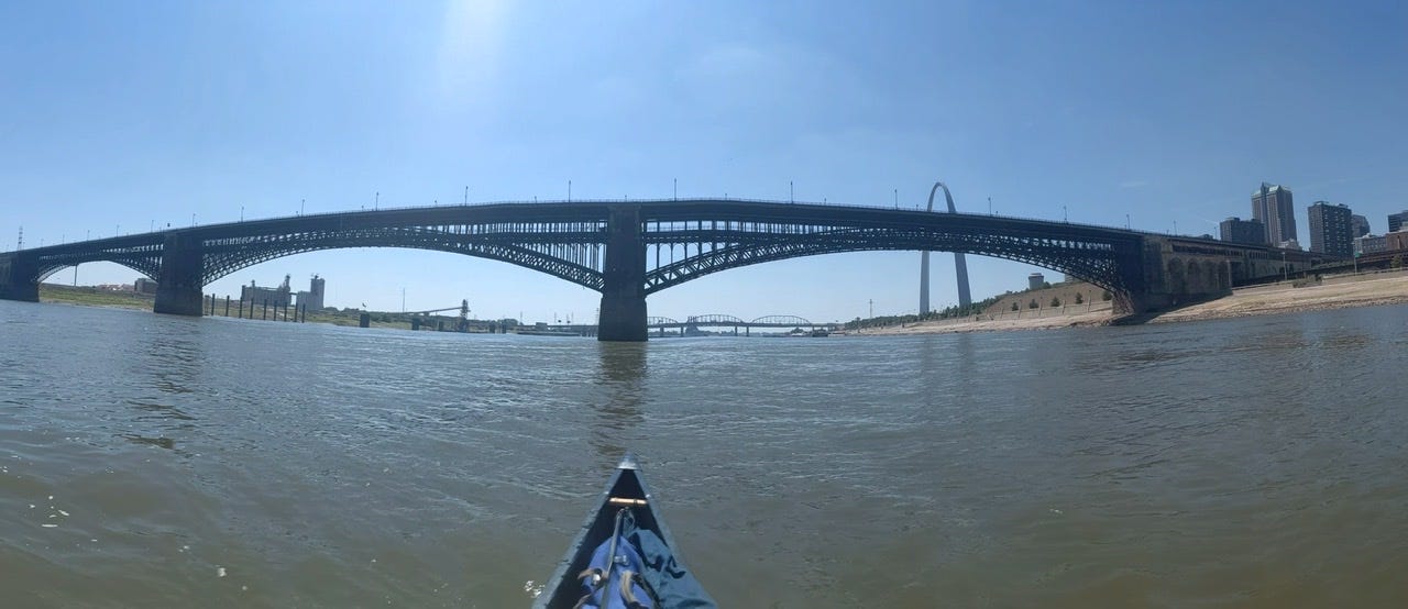

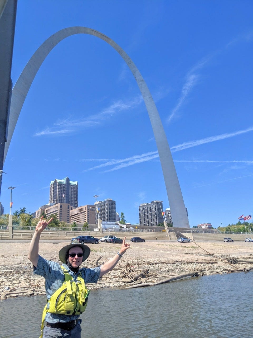
I stopped for a quick lunch in the shade of a tour boat, The Tom Sawyer. It happened to be right near the St. Louis Arch, so I of course did the tourist thing and snapped a photo.
After this, I hopped back in and, once past the Arch, I was in the South Port of St. Louis. Like a light switch, the traffic increased considerably. The commotion on the banks increased, loud bangs were heard from all sides, and there was a constant stream of radio traffic, each boat letting their location and intentions be known. The tows scurrying in front and behind me left their waves to collide in bizarre patterns which tried to push my canoe off of its line.
I stayed vigilant, with my head on a swivel, and slowly, carefully made my way through the port. I announced myself on the radio whenever I needed to, and tow captains got an idea of where I was and shared the information amongst themselves.
I didn’t take too many photos, because I was concentrating, but here are some from my time through the Ports of St. Louis:
Day 55: Hoppies Marina → Fort Chartres Island
Date: September 1st, 2022
URM 159 → URM 134
Distance today: 24 miles
River Time: 5 hours
Countdown to Ohio River: 134 miles
I’ve started a new countdown today, to the Ohio River confluence! It’s the next major marker and I like to have something to look forward to. Now more than ever there is not much civilization on shore — no houses, towns, services, nothing. It’s all behind the levees now.
Cell service is very poor here. I’m not sure if it will continue to be, but if it is, I may not be able to update for a while. Frankly, it was a pain to upload this post with the limited service! The next big town where I’ll have decent service is probably Cape Girardeau, MO.
Today I had a shorter day, and I decided to paddle only in the morning. Still, with this brand new current on my side, that was 24 miles!
Finding Campsites on a New River
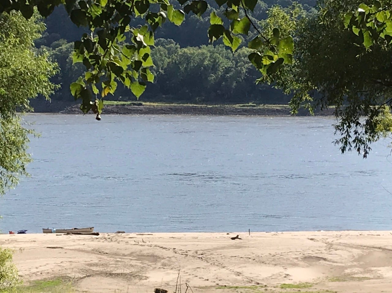
The character of the land has changed drastically now that the River is free-flowing. The River is at an extremely low water level, so there are miles and miles of exposed sand. This makes finding a campsite easy: pick any sandbar.
It also makes finding a good campsite tough, because the big sand is like the Sahara Desert — expansive and no shade. Ideal campsites have nice soft sand, and a forest that is close enough to shore for an easy walk to a shady tent spot.
I’m camped in a poison ivy bramble at the end of a long sandbar walk, but at least there is good shade!
River Log Days 54-55
I will no longer be taking diligent notes on the character of the River, and highlights of what I’m seeing. Now that I have passed St. Louis, Rivergator covers the remainder of the River.
I will still probably note if I see something truly remarkable.
You are probably the best crasiest canoe rider I have known! Thanks for this amazing trip and we follow your adventures with my students who pin where you are.... Learning all the US states by the way!!!! Congratulations for your determination, from far away we are with you!
Many milestones achieved indeed! Last of the locks, St. Louis, and a new river countdown. Your maneuvering at the Chain of Rocks was impressive! Looking forward to future updates.