


Day 16 - Crow Wing River Confluence

Day 16: Dudeck’s → Crow Wing State Park
Date: July 24th, 2022
URM 1013 → URM 991
Distance today: 22 Miles
River Time: 7 hrs
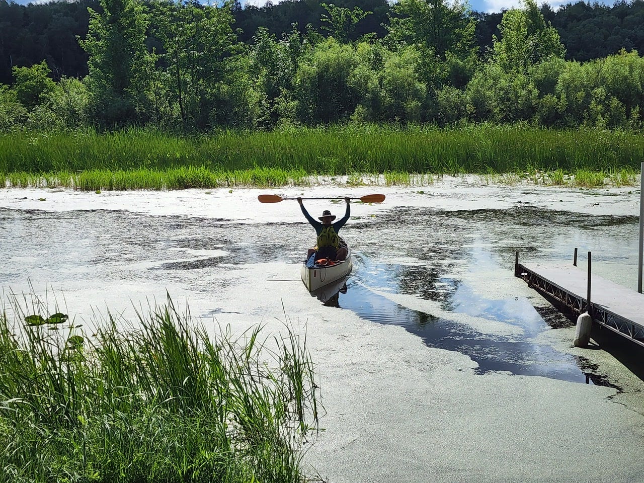
I woke up today feeling quite good considering the marathon day yesterday. I went to bed full, and got to sleep in which are two glorious difference-makers! Since I have a comparatively small 22 mile day ahead of me, I allow myself to sleep in to recover a bit more. Only 22 miles today?? I scoff at 22 miles these days! Hah!
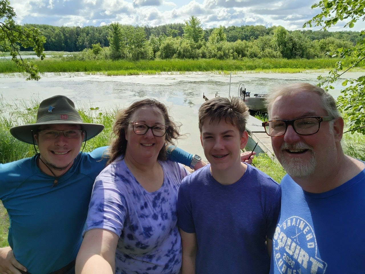
I spent the morning rearranging my gear, getting my food resupply packed away, and sipping on coffee chatting with the lovely Dudecks! They are some really cool folks! Victoria and I got talking about food systems and Michael Pollan and Joel Saltin, and John and I talked about building cedar-strip canoes. So clearly, a great morning! I slowly packed my stuff away and was ready for departure at a leisurely 10am. It was a blast to stay here. Dudecks thanks for the hospitality and flexibility in welcoming me a day earlier than planned!
The day was breezy but nothing too bad. It kept switching directions on me and I believe that was due to all the islands I was passing today. Today also contained a sole portage of the Potlatch Dam in Brainerd. Before arriving at the dam, as usual the River got bloated due to all the backed up water, and widened to a series of long lakes. On one of these lakes, I became enthralled with a gorgeous cedar-strip canoe that I saw on a dock. The owners saw me admiring and came out to chat, turns out it’s a homemade canoe built by a family member, and there are only 5 or so like it. It’s small interactions like these which make the trip so special and unique! (And my friends the canoe owners, if you’re reading this, please do post photos and the story! I’d love to see them!)
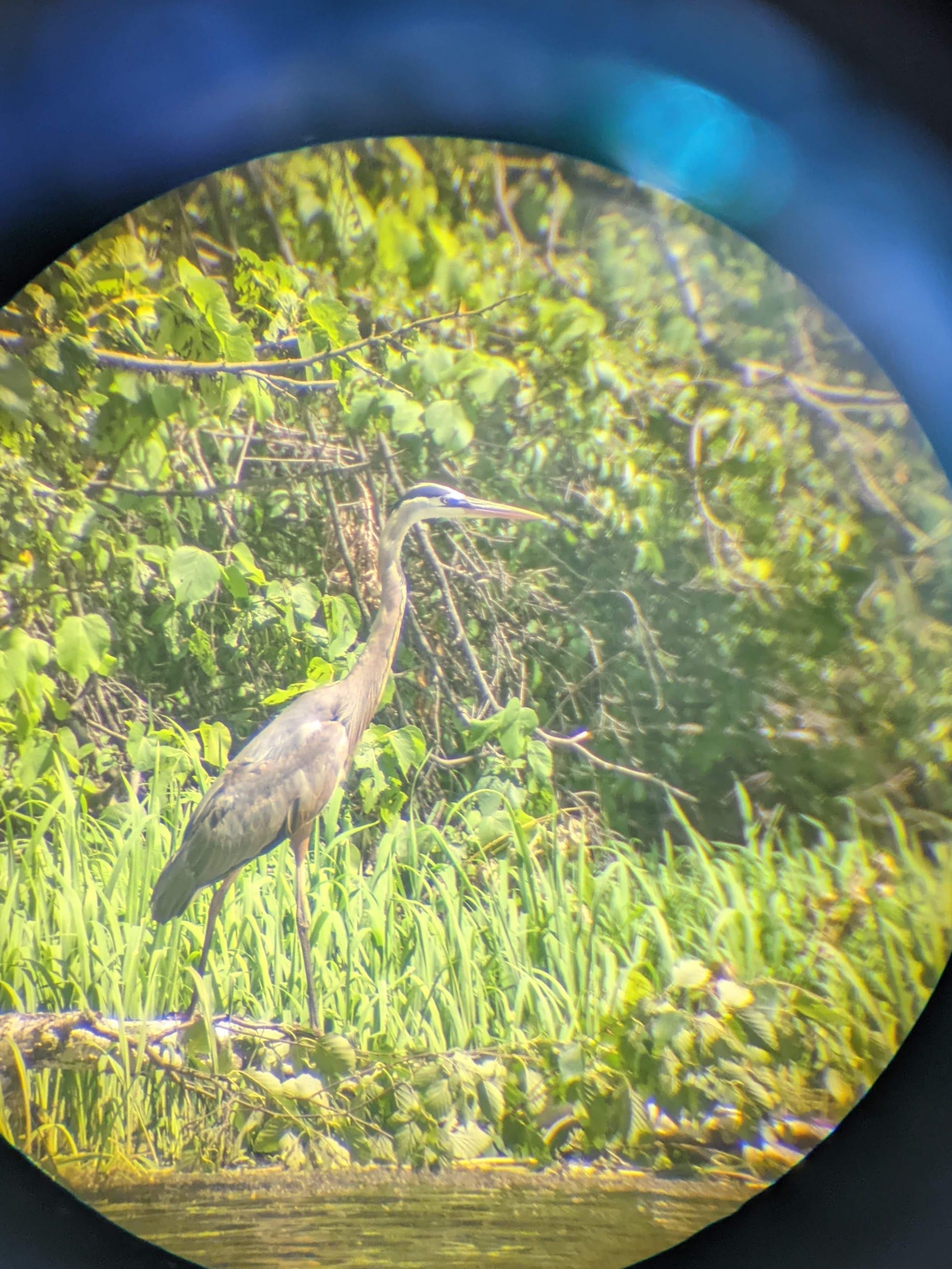
Also on this lake, I captured one of my very best bird photos to date! A Great Blue Heron in the act of hunting:
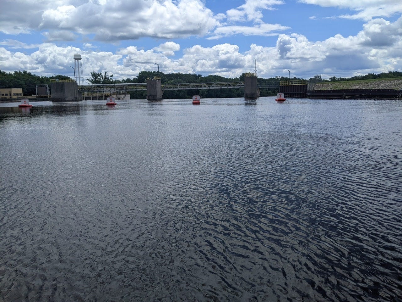
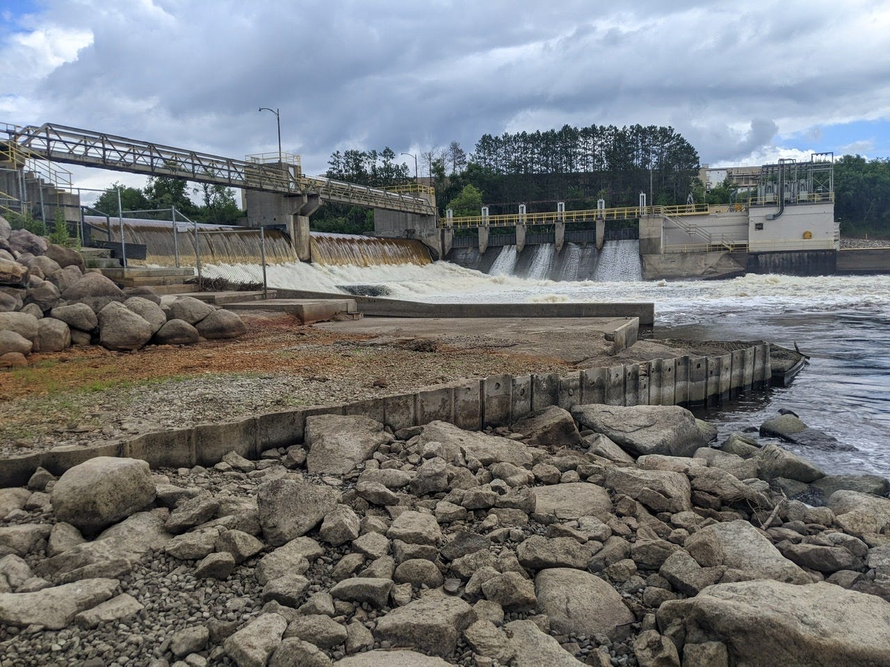
Very soon after this, I had arrived at the Potlatch Dam. This was a nice and easy portage, no real flair to it. Unfortunately my next few portages will be anything but that…
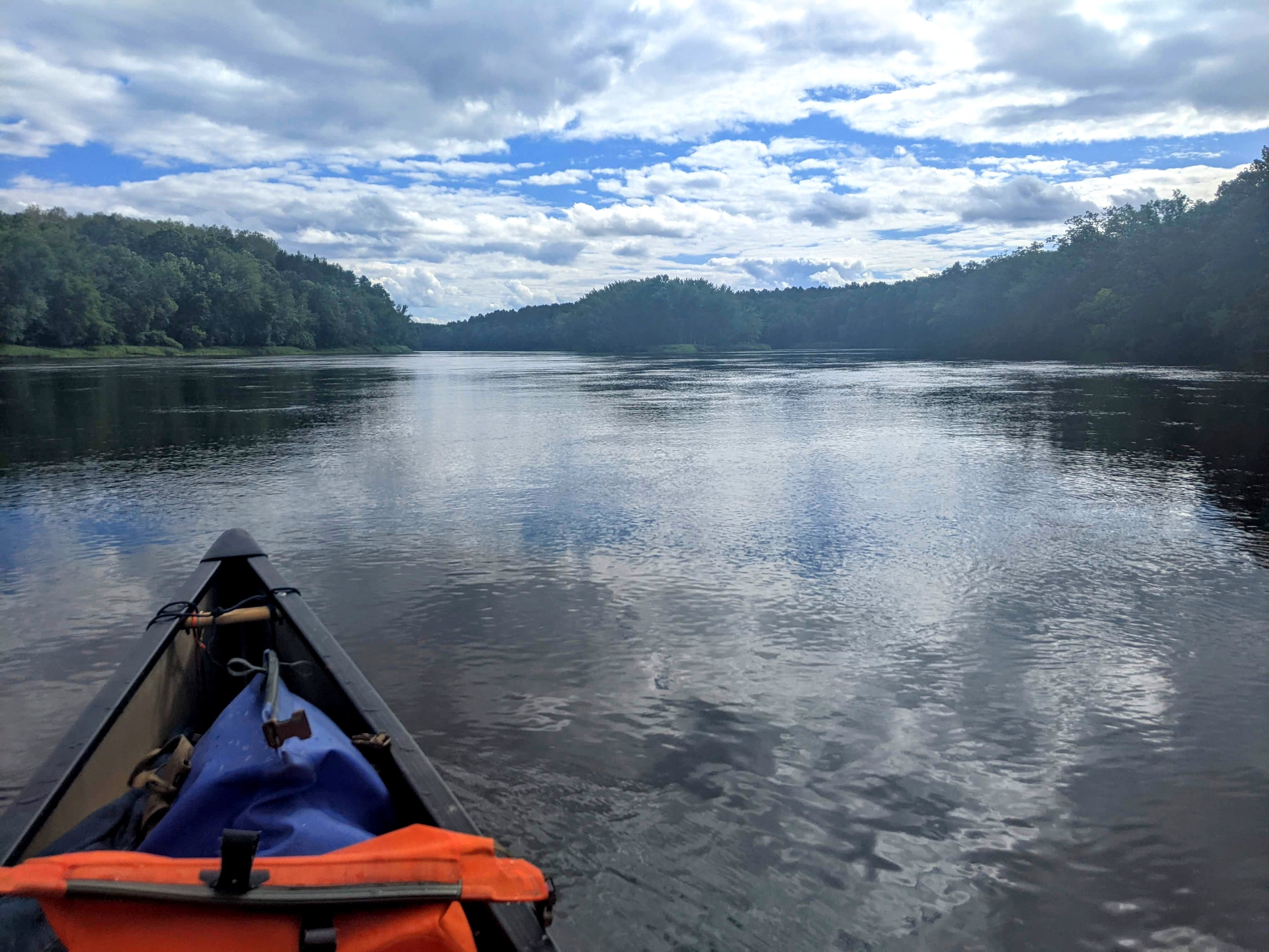
Having passed this dam, the channel fluctuated a lot. It would gape wide, then constrict down to a narrow channel. In these wide sections, it looks like the River in Minneapolis, with tons of sizable islands cropping up, and sluggish but steady in flow. When it constricts, the flow speeds up and I can really feel it, it’s very noticeable.
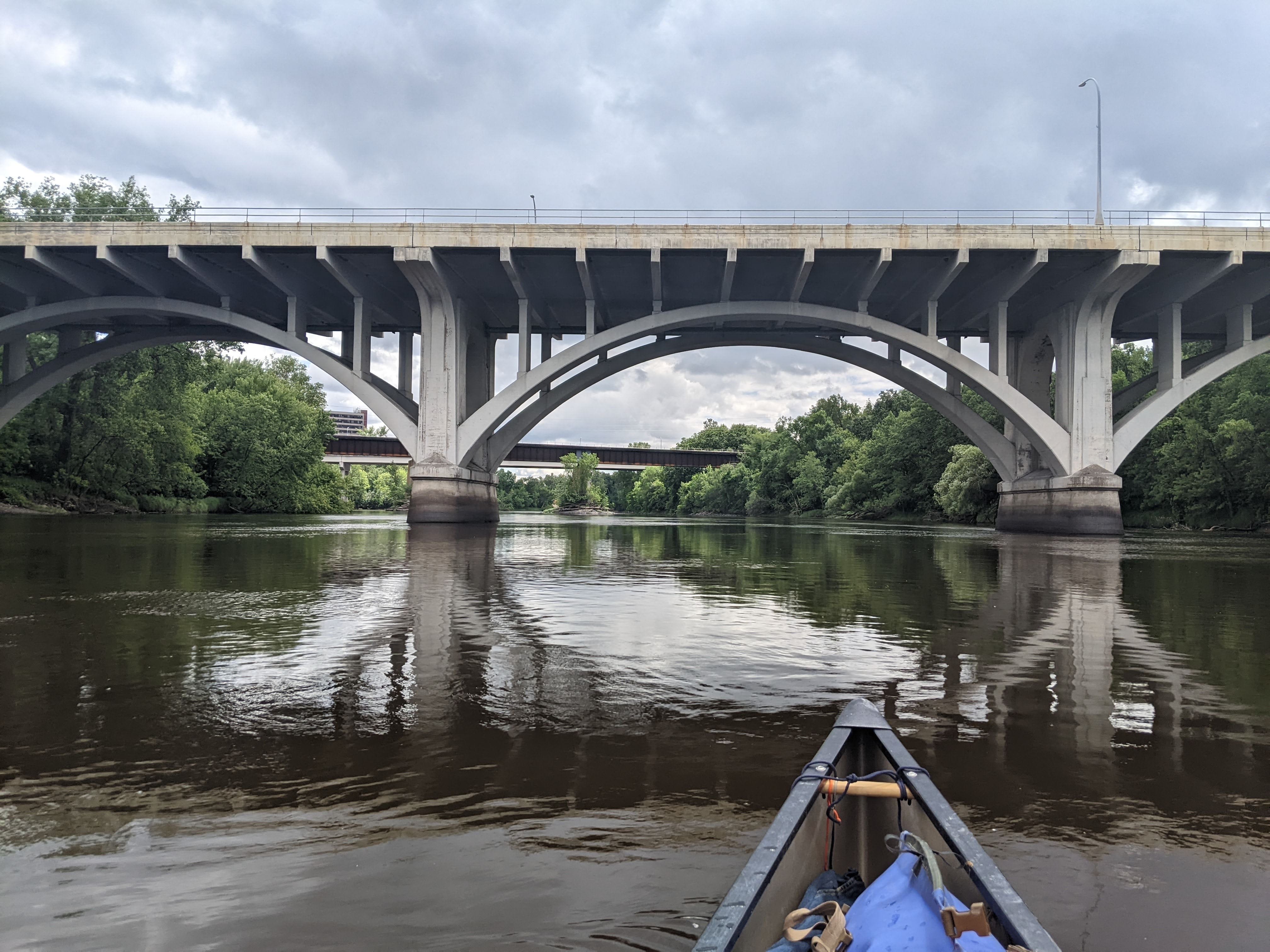
Once I was past the dam, I found myself passing through Brainerd itself. I recognized many of the bridges I was passing under from my many treks up north, and I even crossed the Paul Bunyan Bike Trail! This trail holds a special significance for me and a lot of nostalgia, as I bicycled the entire trail both ways in the summer of 2015, to get to my summer camp job and back. What a grand time! It was cool to see it from a different perspective, and to reflect on how much how much I’ve changed and grown since 2015. 2015 me would have been stoked to know that I’m paddling the entire Mississippi in 2022!
Triple Digits!
I am down to triple digits! I’m camped at Upper River Mile (URM) 991. I was passing through Brainerd when it happened, and didn’t even realize that it happened until about 5 miles later. Still, it’s a significant achievement! As you can see from all my posts, the RIver Miles count down. But to what? 991 miles to go until the Gulf of Mexico? Unfortunately not. The Mississippi River is split into the Upper Mississippi and Lower Mississippi for navigation purposes. That countdown means I have 991 miles to go until I reach Cairo, IL, at which point I will start over again on the Lower Mississippi River Miles, of which there are about 1000 to the Gulf. So take the mileages I’m posting now, add 1000, and that’s how far I am from the Gulf. It’s a long River indeed.
But still, small victories! I have under 1000 miles to go until I reach Cairo, IL, and that is nothing to sneeze at!
Crow Wing State Park
After Brainerd, I came to Crow Wing State Park, my destination for the day. The Crow Wing River River is the first major tributary of the Mississippi, adding a considerable amount of volume to the Mississippi’s already large size.
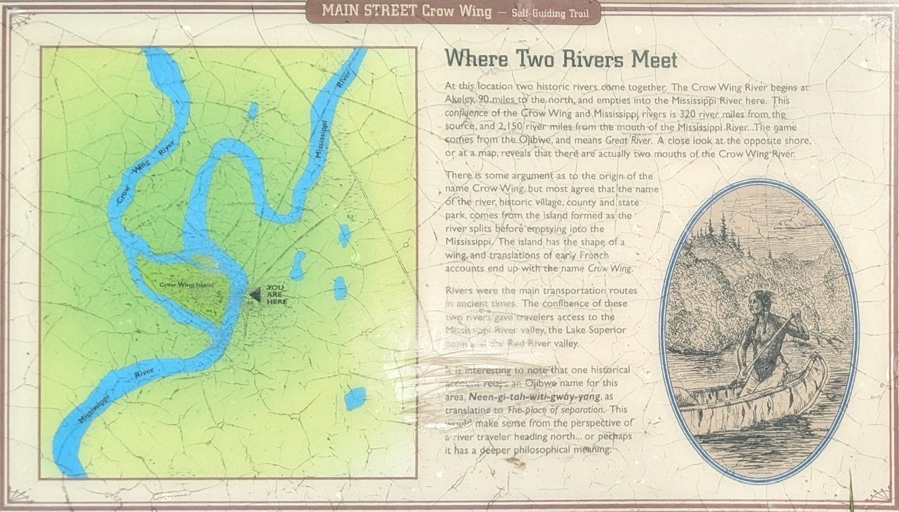
I am not sure on volumes, but just visually from the above, those are two large rivers converging. The next major confluence is the Minnesota River near St. Paul.
Water Quality
Unfortunately, with the Crow Wing River comes undrinkable water. It is a very polluted river1, so this is where I will cease my duties as a water sommelier, and simply pack all the water I need. I purified one last liter of water just upstream of the confluence, so I will have those final results in a future post.
The Future
Since I did a double day yesterday, I now am one day ahead of schedule, and I have a “free” zero day in my back pocket. I’m thinking I will use that tomorrow (Monday) and take a much needed break in Crow Wing State Park tomorrow!
River Long Day 16
1013 → 1004: The river enters the artificial lake created by the Potlatch Dam. Currents will slow down generally, but there are a few places where the channel constricts and there is flow, like French Rapids. But generally slower flow until the dam.
1004 Potlatch Dam: Very nicely maintained portage trail, with a dock at the take-out point. Restrooms on portage trail. And a ‘useable log’ to document how many canoeists use the portage trail. If you use the portage trail, fill out the usage form! The more people who document their use the better chance the portage trial has of surviving!
997-995: in some narrow, constricted sections, current is fast and rocks may be poking out depending on water level. Brainerd gauge was 7.40 when I did this section and there were rocks poking out.
995 - Overlook Park: Well labeled from water. Bravo Baxter! Nicely maintained site with a few campsites to choose from
991 - Some incognito sites available here, at the “Crow Wing Canoe Landing”. Not present on any map I know of. Best sites to camp in this area.
https://m.startribune.com/how-minnesotas-little-polluted-crow-river-clouds-the-mississippi/600192566/
Noice! Enjoy your rest day.
Great reading your post! We enjoyed hosting you!