


Day 51: Gosline Island → Tinsel Towhead
Date: August 28th, 2022
URM 281 → URM 263
Distance today: 18 miles
River Time: 6 hours
Countdown to St. Louis: 83 miles
Today when I left my sheltered sandbar at 6 a.m. and got back on the main channel, the wind was already howling. I had seen the forecast and knew there would be strong winds all day, but I wanted to see what I could do. I set off with no delusions of a big day.
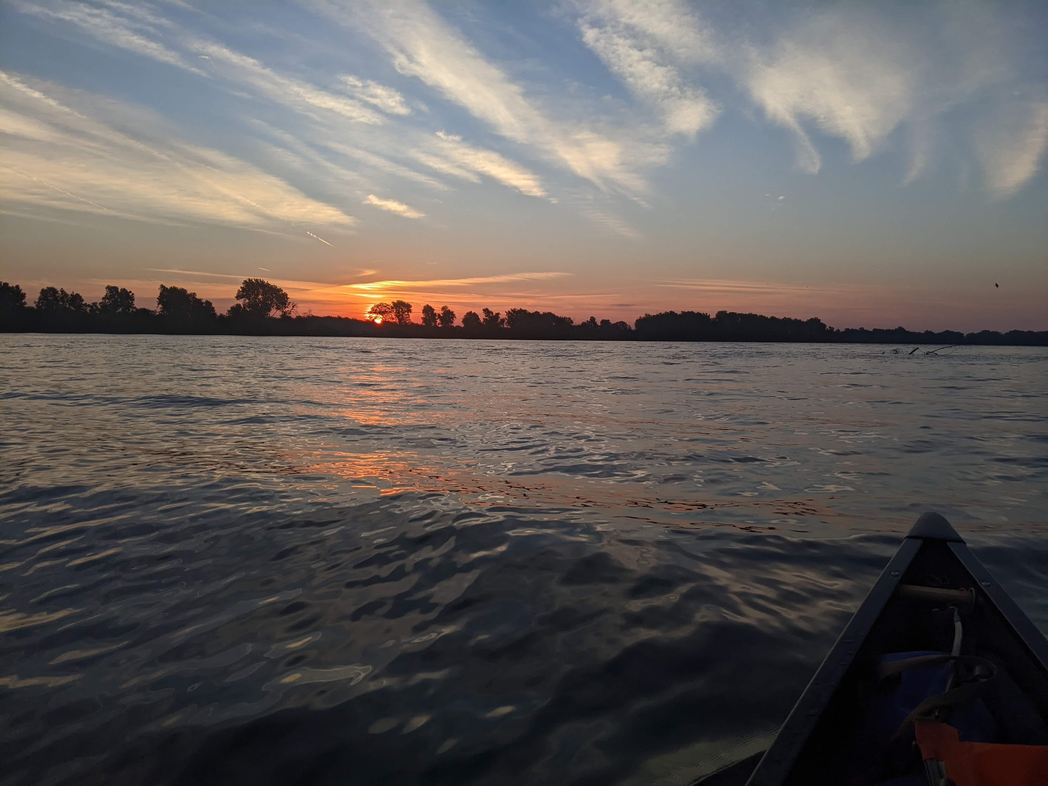
In fact, as soon as I had paddled for an hour against the direct headwind, I’d made up my mind that I would make this a nero day (a near zero day). I told myself I’d make the 7 miles to Lock #24, and then any campsite after that was fair game.
Well, the slog to Lock #24 was real. Hugging the right bank as I descended was all I could do, but nonetheless the winds kept battering. I think a lot about how with canoeing you are truly at the whims of the weather, more so than, say, backpacking. It’s one of the things I am hyper-aware of and check multiple times per day. It’s a very different daily awareness than any backpacking I’ve done.
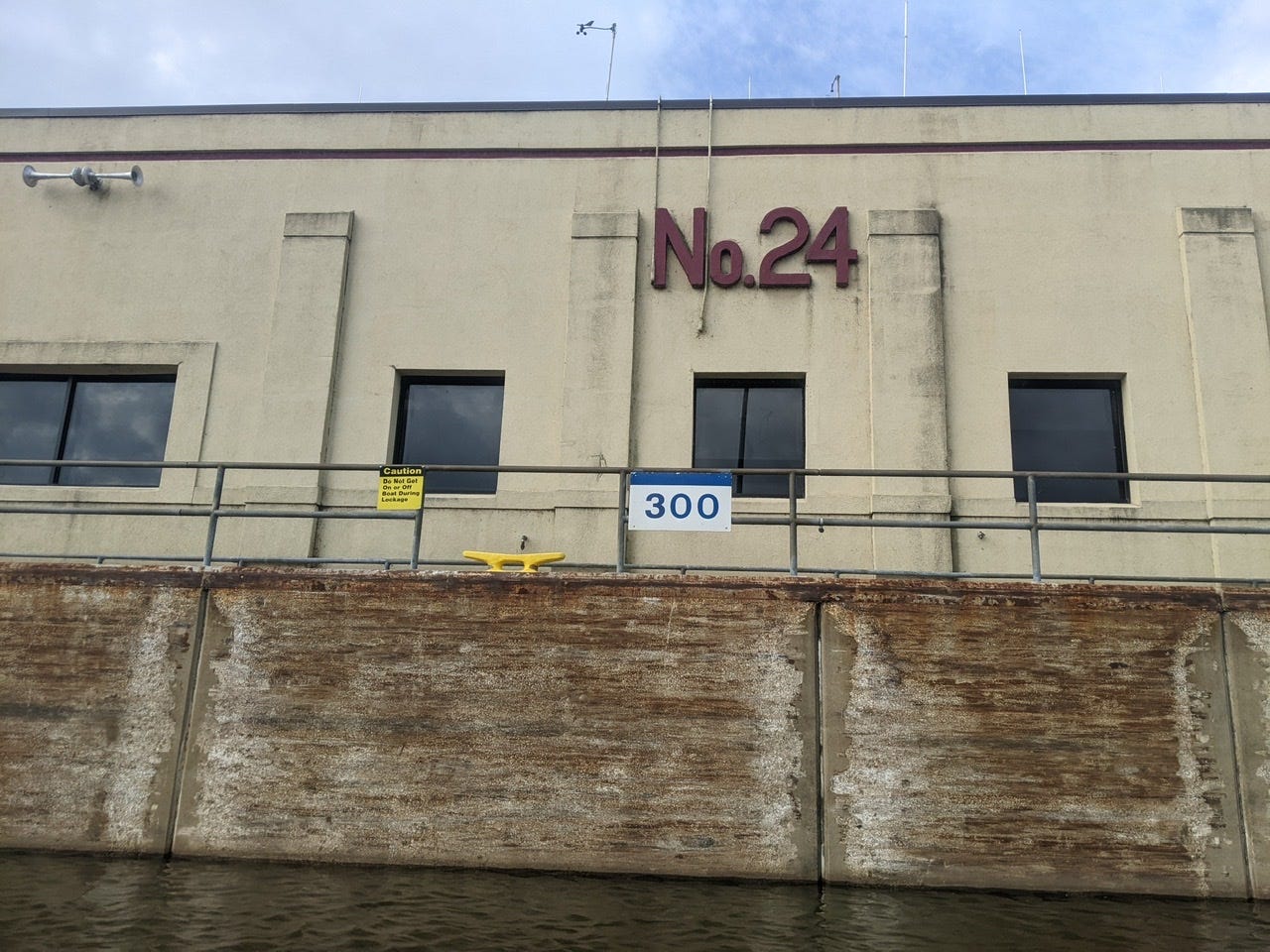
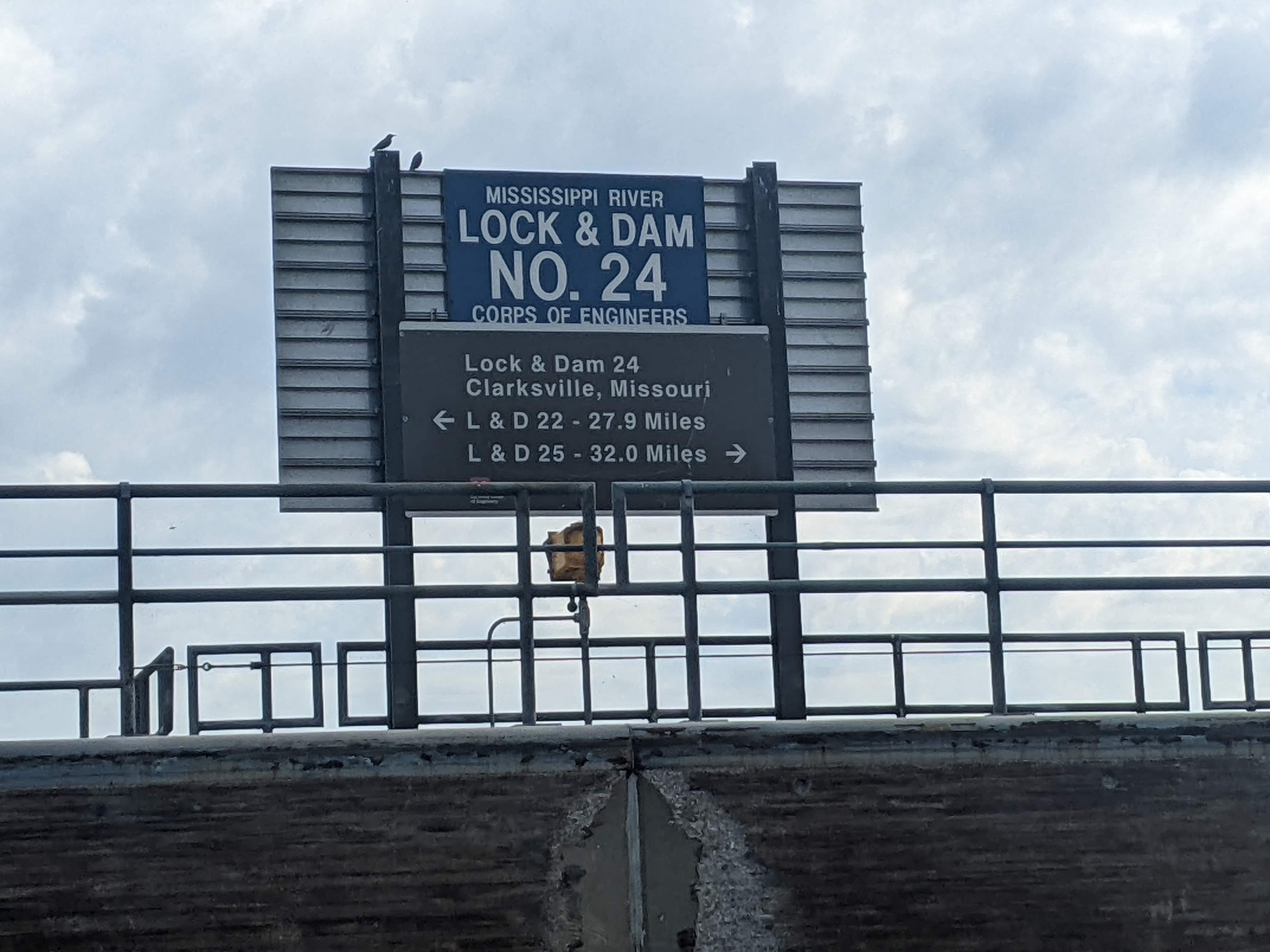
I slowly (under 2 mph!) made my way to Lock #24. A silver lining to the day is that there were no delays due to tow boats! I locked through without issue and found myself staring at Clarksville, Missouri. I had a very nice chat with some locals on the dock there, and they gave me some great ideas for camping just downriver. By then it was around 10 a.m. and I was ready to call it a day soon!
However, after the dam, the River turned ever so slightly such that I was now protected if I hugged the right bank. This was a welcome respite from the gales, and I figured as long as I was going forward without too much resistance I should carry on. The River had an 11-mile straightaway in which I was protected the entire way. This was so fortuitous! I even forgot that it was a super windy day at one point! But alas, as soon as I made the next turn, the wind welcomed me with gusto.
At that point I had done 18 miles, far more than I thought I’d get, so I called it a day and took the afternoon off. It ended up not really being a nero day, because of the surprise wind cover. At one point I really did think it would be a 7-mile day though.
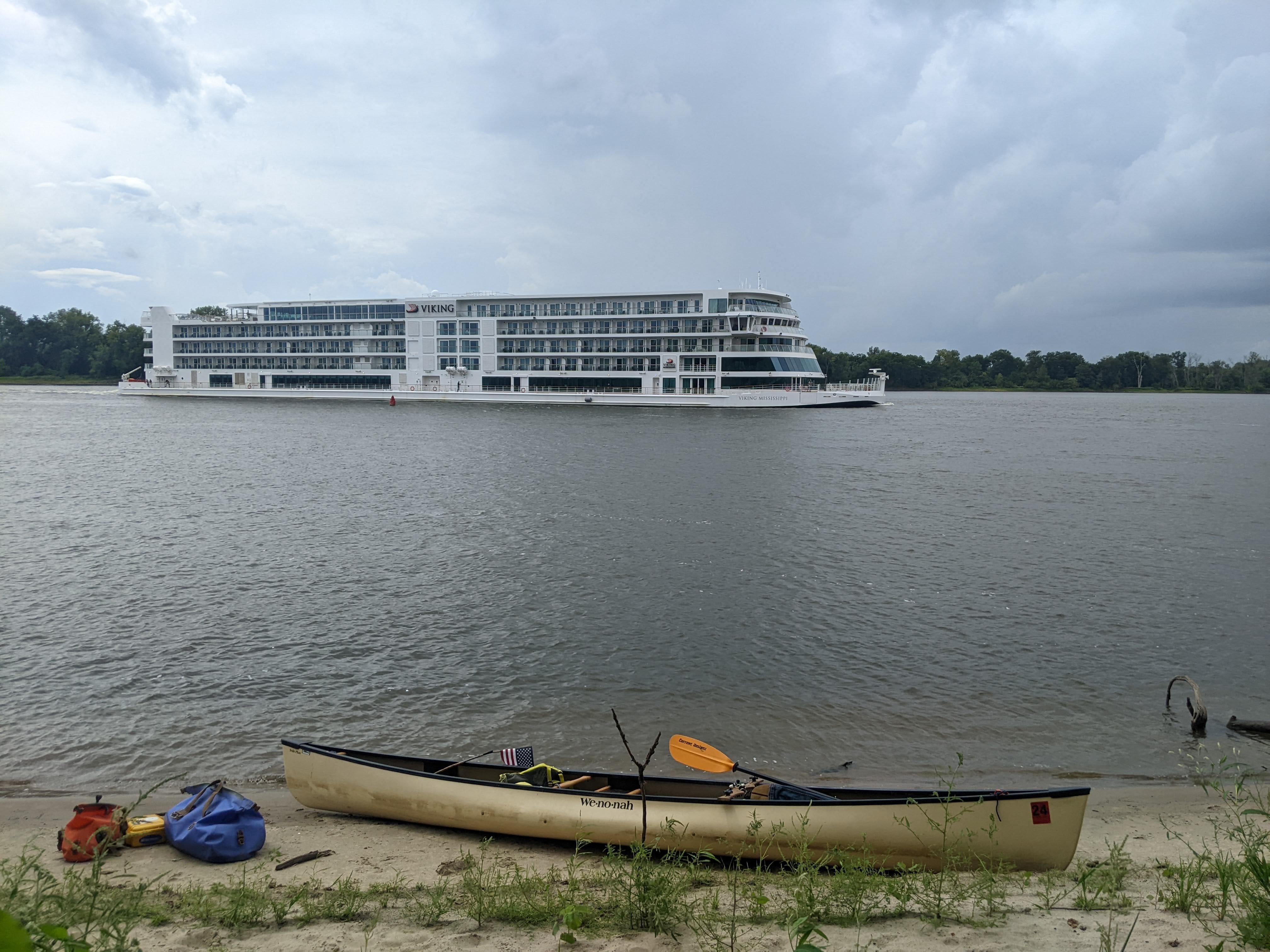
Thunderstorms were in the forecast, so I hunkered down in my tent and took a fat nap. From the campsite, a massive, modern cruise ship passed me by.
Tomorrow the winds are similar, but Tuesday they are projected to finally let up! I will hope to go a similar ~20 miles tomorrow, then hopefully a good push on Tuesday with the winds at my back. These headwinds day in and day out the last few days have worn on me, and have set me back a bit on my goal to be through St. Louis in August. It still may happen, but Sept. 1 is looking more likely at this point.
No Lock #23?
If you were paying close attention, you may have realized that the lock I went through last was Lock #22, and today I went through Lock #24. So where is Lock #23?
Well, Lock #23 was proposed to be placed somewhere between Saverton, Missouri, and Clarksville, Missouri, in the original 9-Foot Channel Project. However, upon further investigation it was determined not to be needed:
“The final survey report of the 9-Foot Channel Project, published in January 1932 as House Document 137, included a plan for the construction of Lock and Dam 23 at a cost estimate of $4,842,500.
However, during construction of the Project, it was determined that Lock and Dam 23 was not necessary to maintain the navigation channel and it was eliminated from the plan."1
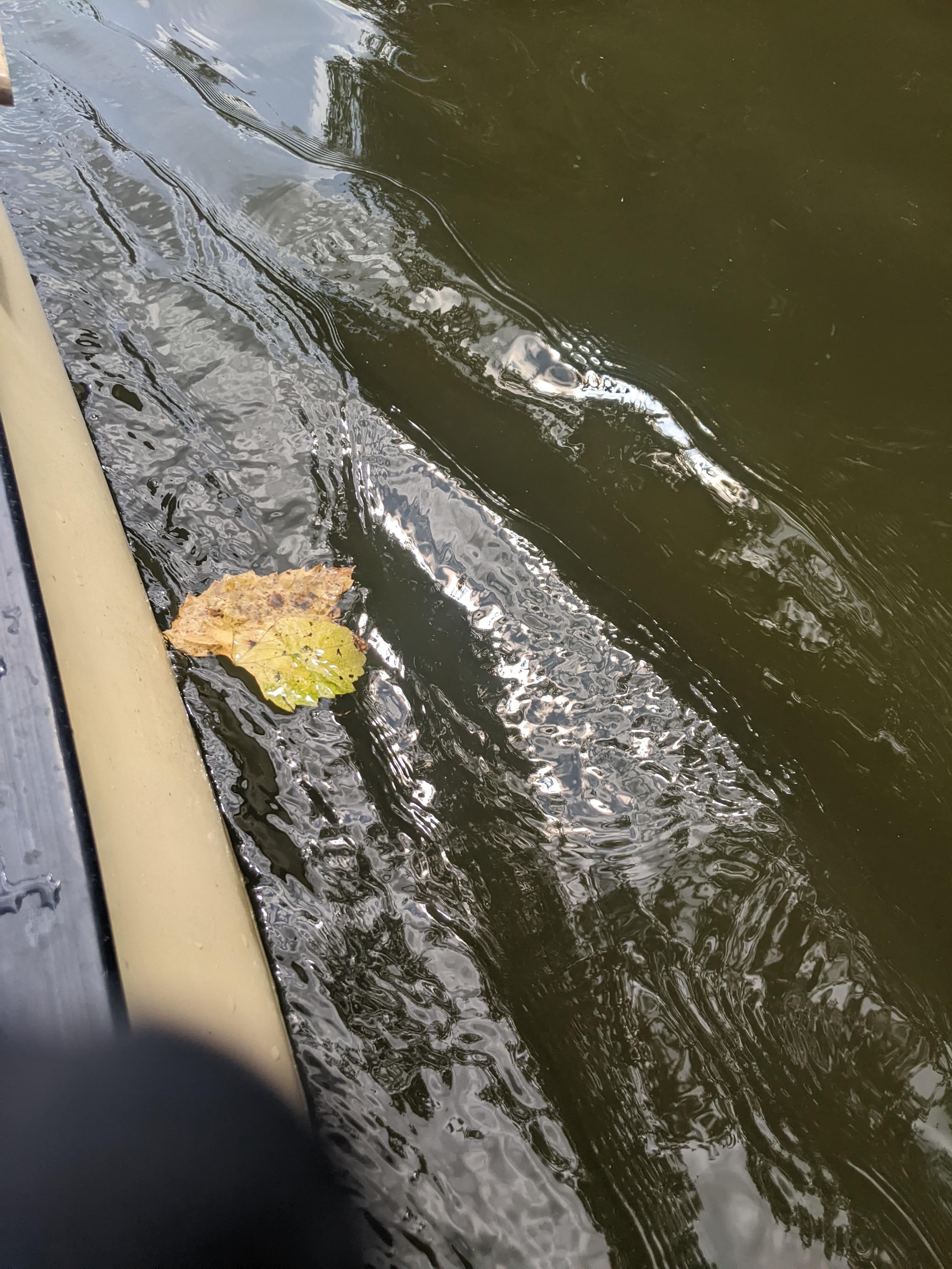
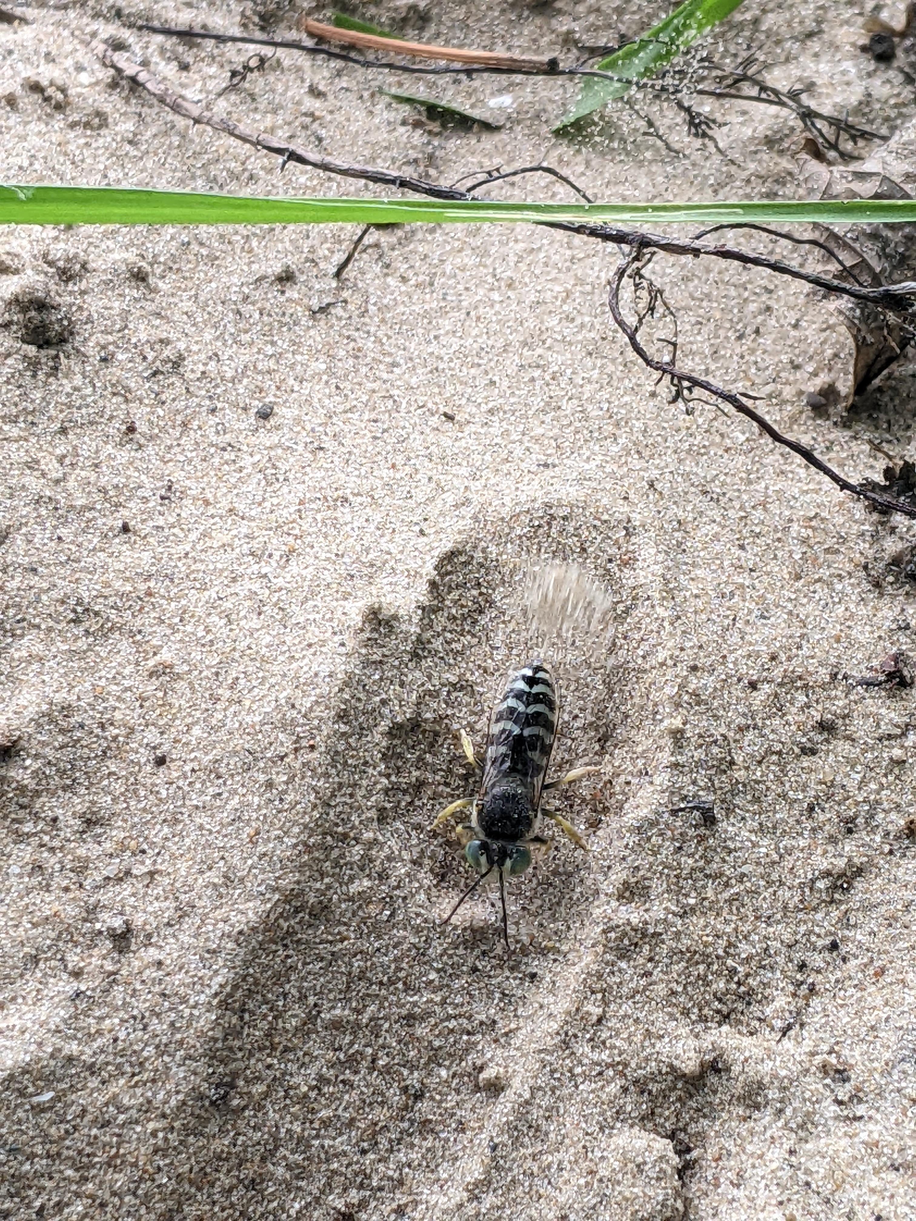
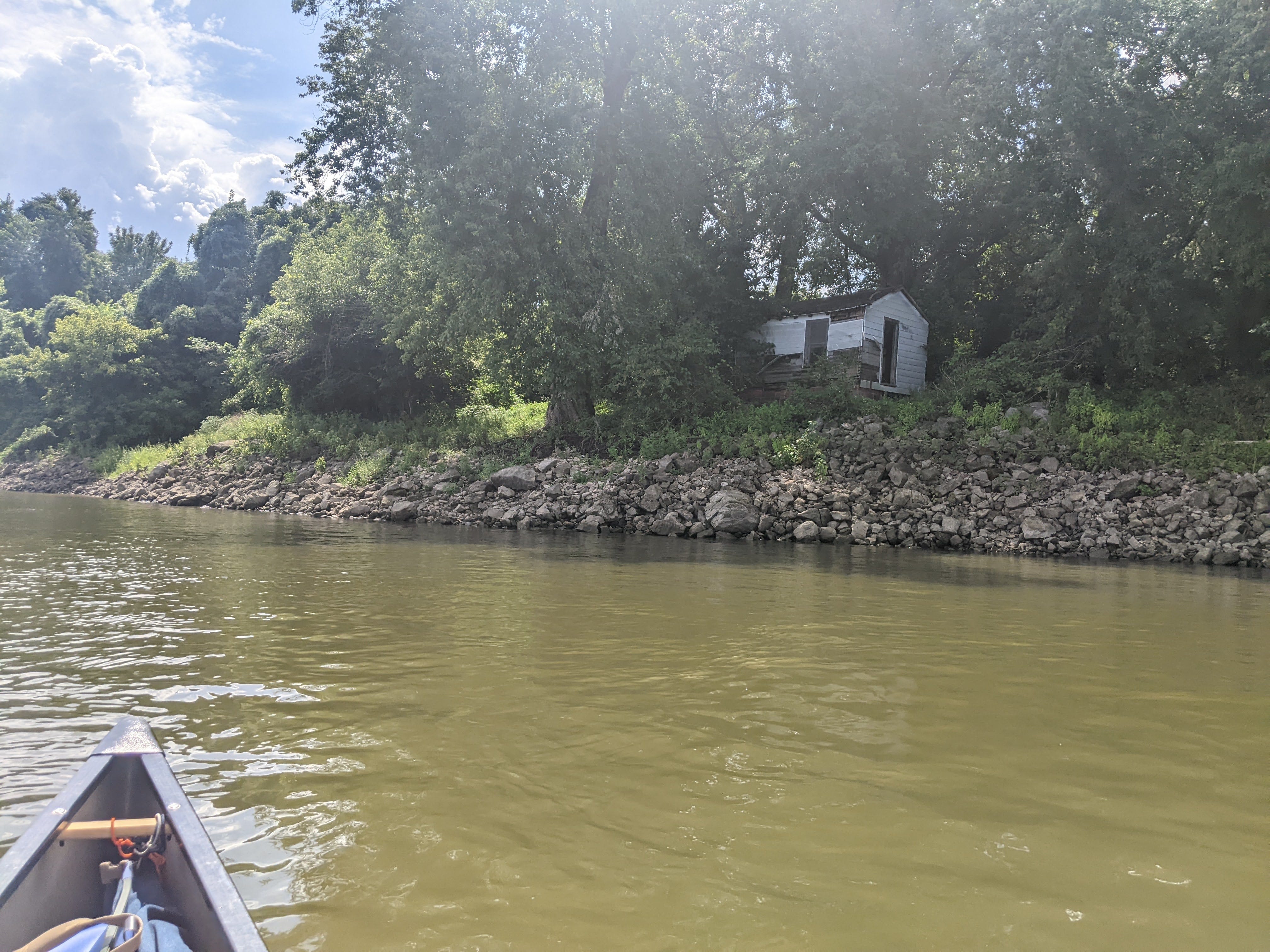
Photos from Today
Weekly Review
I almost forgot, but it’s Sunday. Here’s what I did this week:
I woke up last Monday, August 22nd, just south of Lock #17 near New Boston, Illinois. Now I find myself just past Lock #24 on Tinsel Towhead, near the town of Clarksville, Missouri.
Start Point: Edwards Island, 2 miles south of New Boston, IL
End Point: Tinsel Towhead, 10 miles past Lock #24
Starting River Mile: URM 431
Ending River Mile: URM 263
Total Mileage: 168
Highlights/Milestones:
Paddling into Missouri.
Locking through Locks #17 to #24. (Only 2 remain!)
A rest day in Hannibal, Missouri. The very Mark Twain themed town.
A very tough couple of days on Pools #19 and #20. The day coming into Canton, Missouri, was especially tough.
River Log Day 51
276 - Silo Park: RBD on mainland. Really nice free campsite with mowed lawn and lots of flat space.
269 - Carroll Islands: LBD, three islands with some so-so camping spots.
266 - Coon Island: LBD, very good sand and trees on the very tail of the island.
263 - Tinsel Towhead: LBD, small island, lots of sand with little shade.
Fact Sheet: Lock & Dam 23. Updated Aug. 2018. Locks and Dams - Upper Mississippi River; U.S. Army Corps of Engineers, Rock Island District.
THAT’S a sand flea?!?!
Hard to believe nearly two months have passed!!! Bravo!!!
I have another book for you - perhaps you’ve trad it: A Voyage Long and Strange, by Tony Horowitz. It’s about all the Europeans who came to this continent, starting with the Vikings. I’m thinking of you on every page! And here’s some Carib vocabulary from pre-Colombian “Hispaniola”: canoa = dugout canoe; hamaca = netted-cotton swinging bed.
Bon courage - you’re doing great and continuing to inspire us all!