


Days 83 & 84 - Passing the Atchafalaya, and into Louisiana
Alligators Abound

These last two days have been nothing but wind. And although it has been overall in my favor, it basically flip-flops with each bend of the River. It also makes it especially difficult to share the River with tows, as it seems like the wind is always trying to push me into the navigation channel when tows are present!
These winds have been caused by Hurricane Ian, and I cannot wait for them to die down and for the River to be calm again. You never know what you’ve got until it’s gone, but man do I miss a River that’s not raging!
Day 83: Natchez, MS → Union Point
Date: September 29th, 2022
LRM 364 → LRM 326
Distance today: 38 miles
River Time: 8 hours
Countdown to Baton Rouge, LA: 97 miles
Local Gauge: 13.5 Natchez Gauge
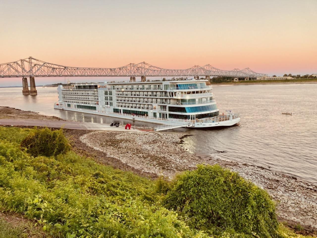
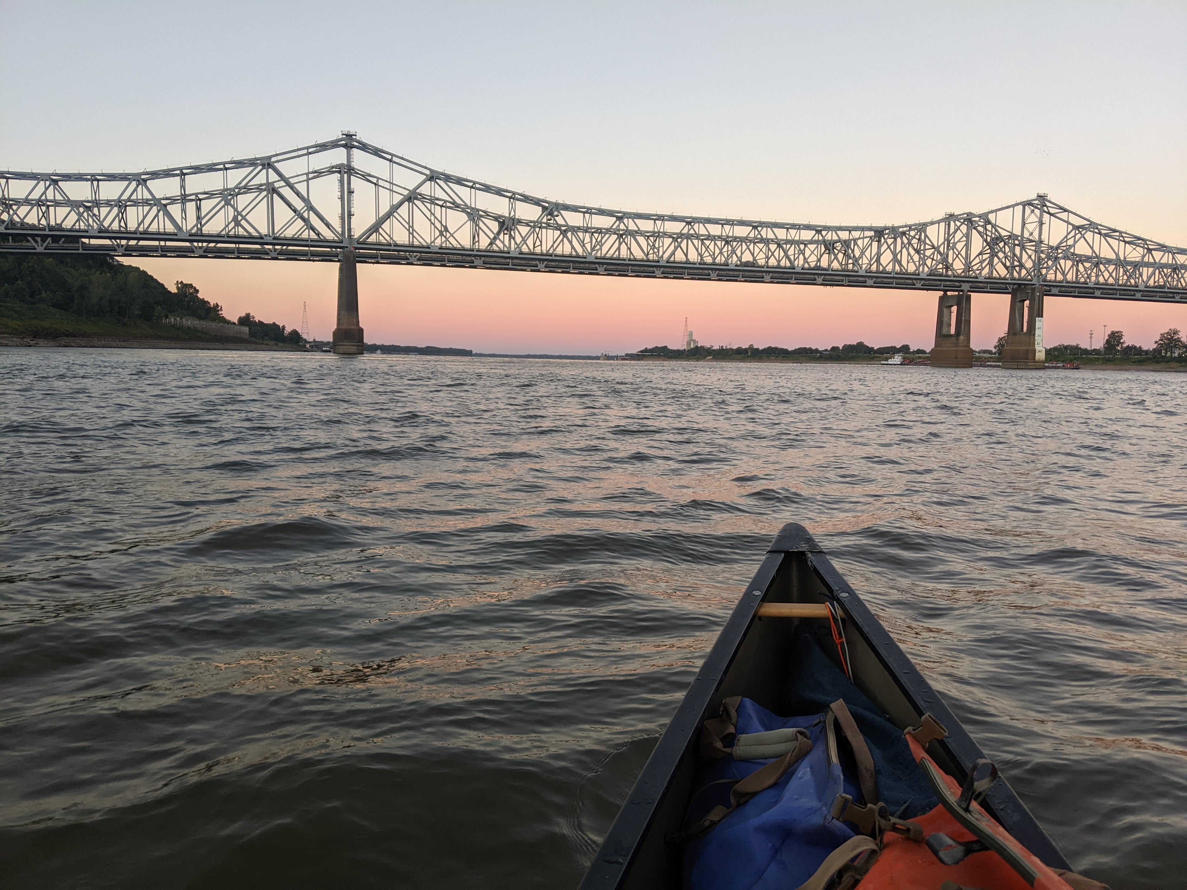
Today I woke before dawn in Natchez and packed my gear. When River Angel Peggy and I got to the boat ramp, the American Jazz was gone, but two different cruise ships had taken its place: The Viking Mississippi and the American Queen. The American Queen is one of the oldest cruise ships still in operation, and the Viking Mississippi is the very newest — on its maiden voyage right now.
I paddled out at dawn in the company of these behemoths, and set off for the Natchez bridges, and the Port of Natchez beyond.
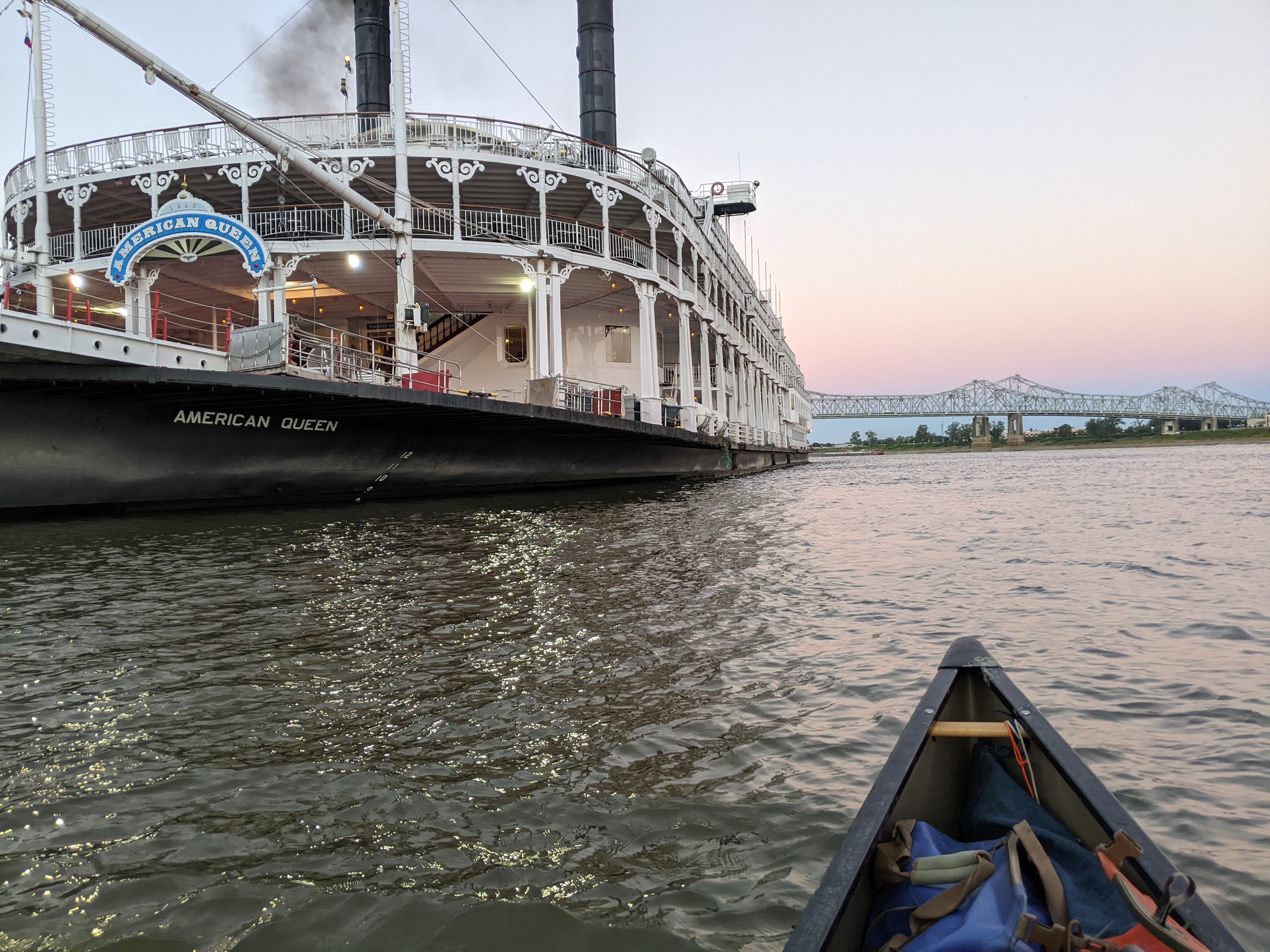
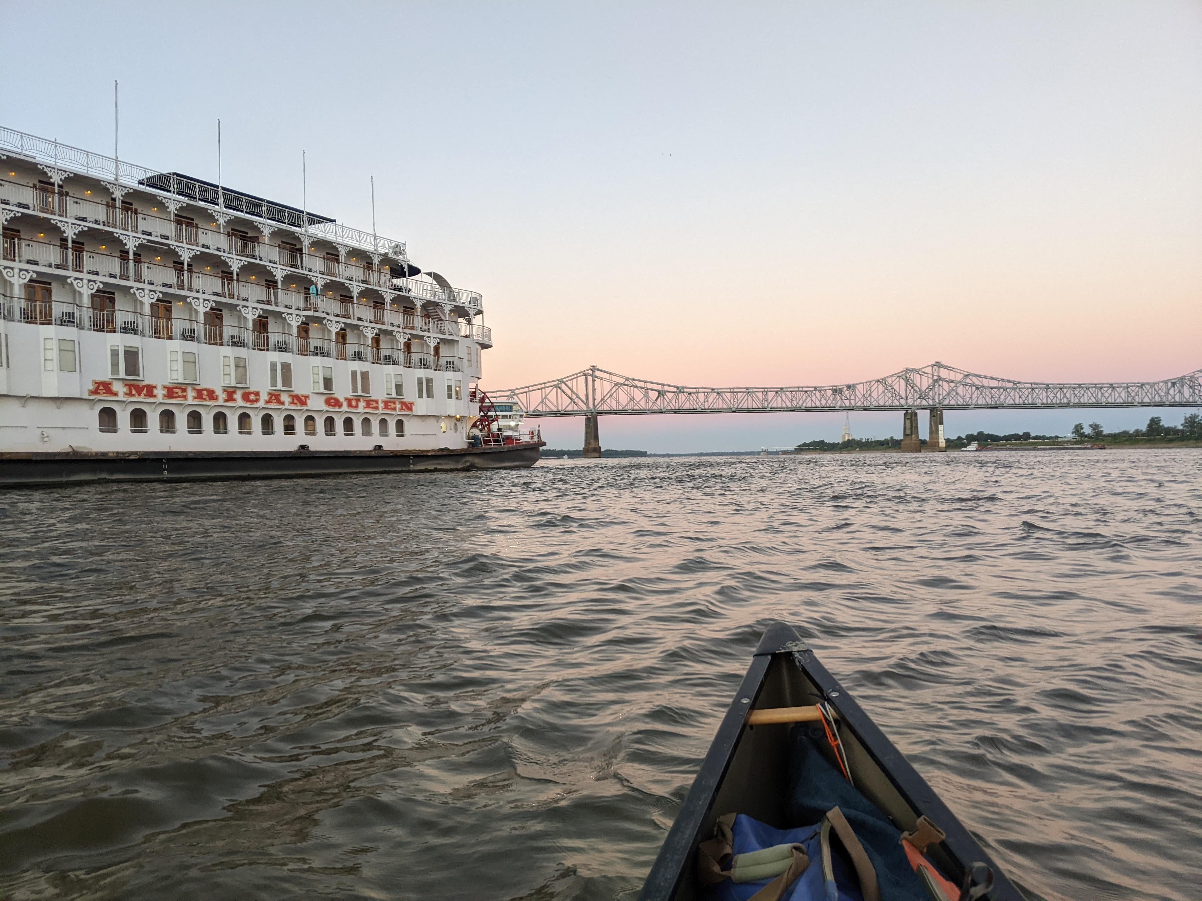
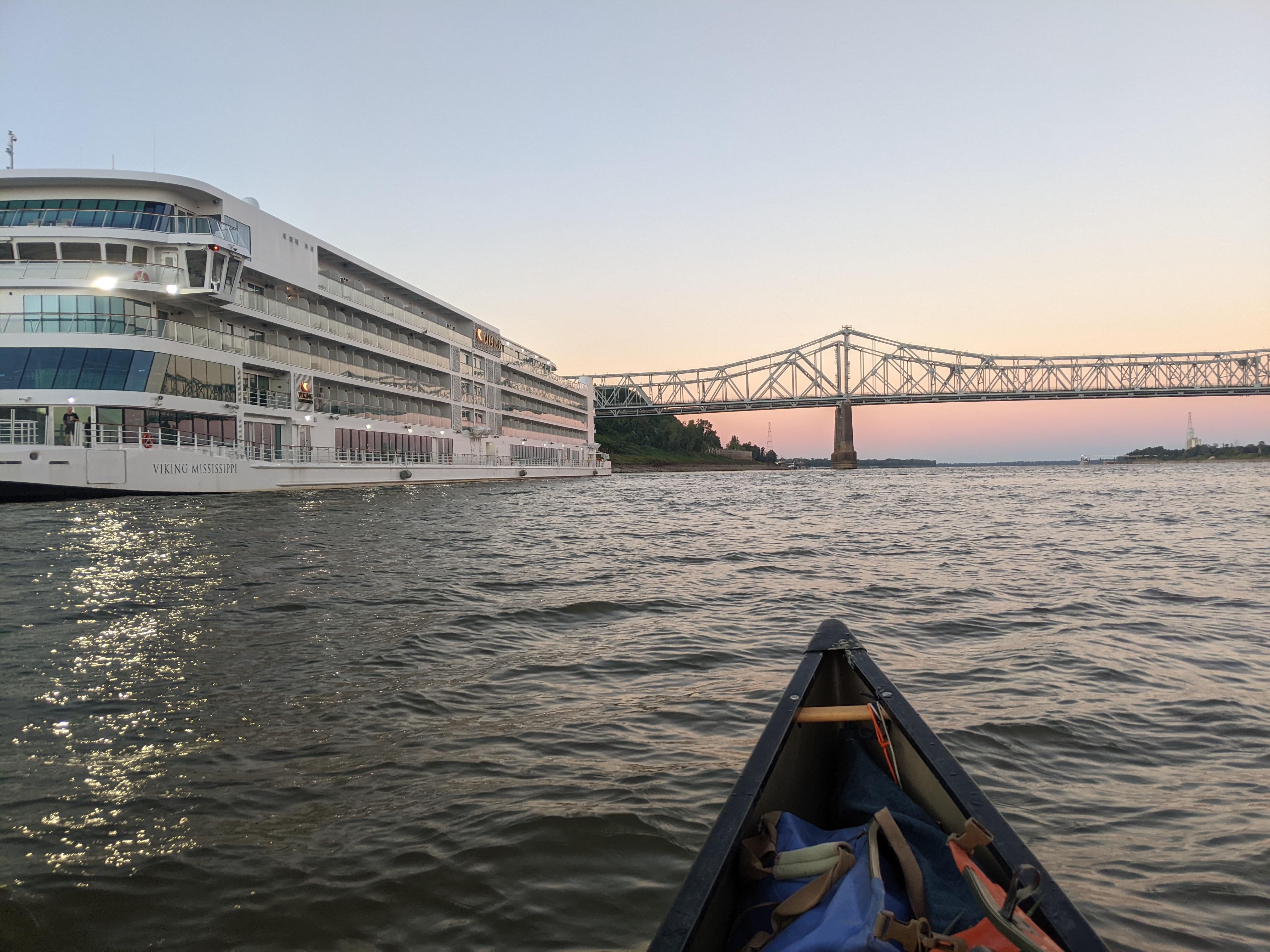
Passengers on both ships, holding their morning coffees, looked down from their balconies and shouted “Where’d you come from?!” or “Where ya headed?!” I respond that I started at the beginning, and I’m going all the way to the end.
After the port, conditions started to get choppy. Nothing too bad, though, and when I rounded a corner, I found myself in the shadow of the wind. Total calm once again, but I knew the day had woken up.
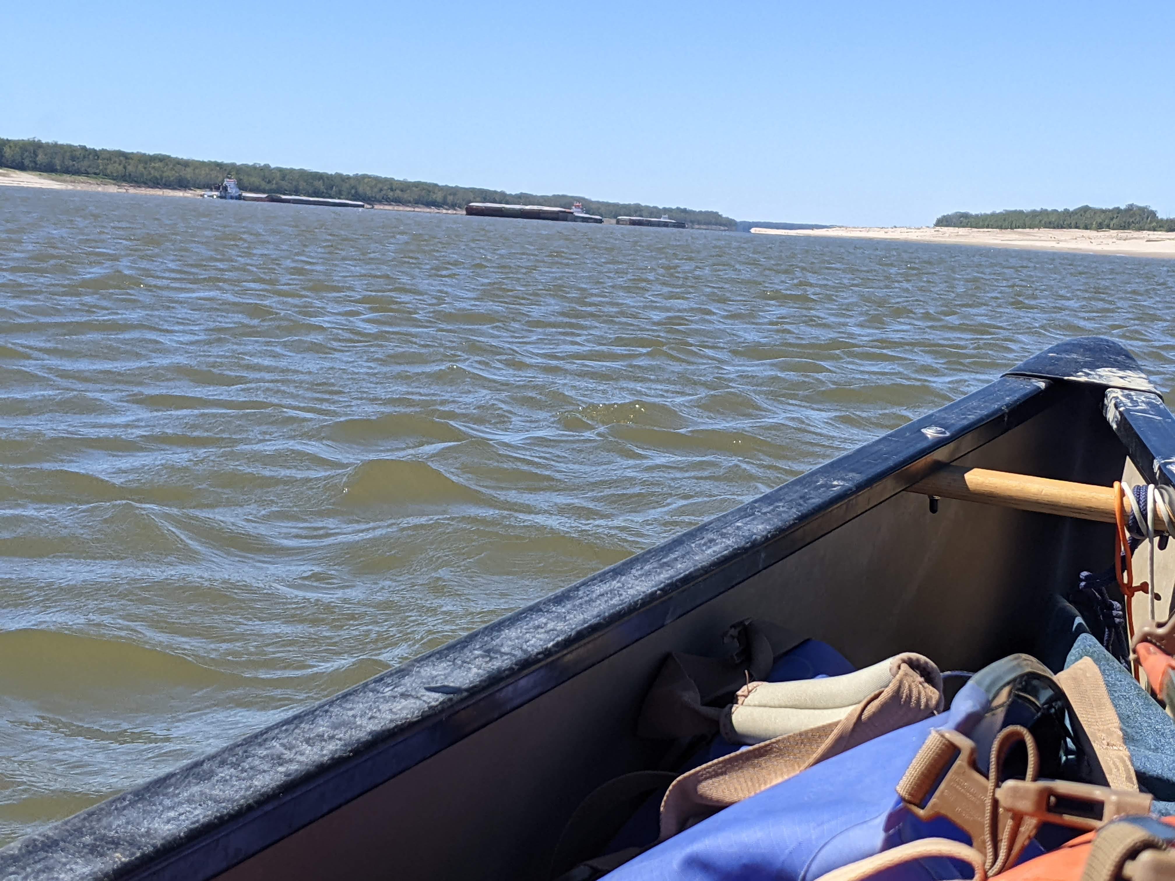
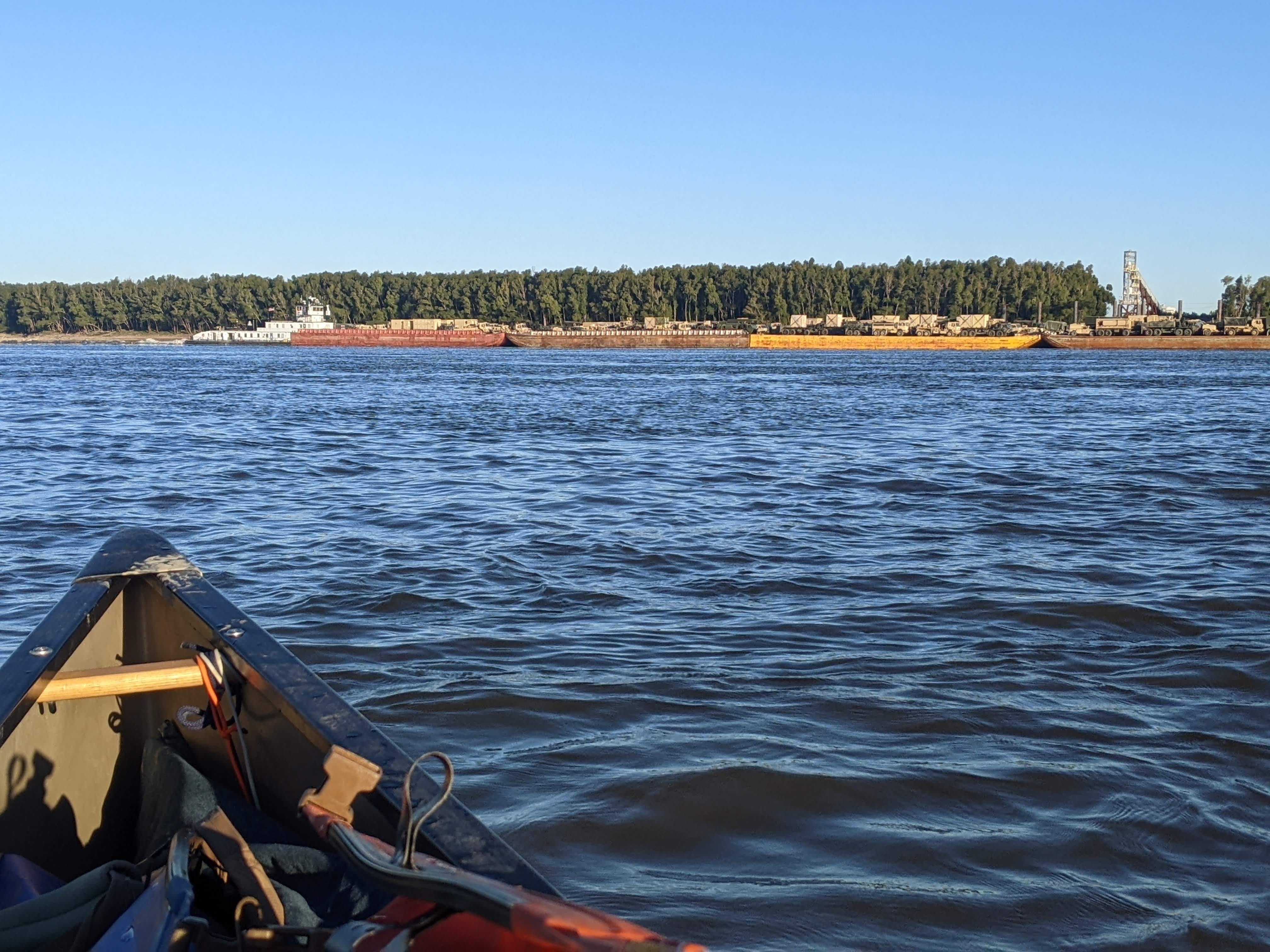
Sure enough, this was to be the theme of the day: very blustery conditions in open water, and every once in a while a line of trees on shore would block the wind for me. The conditions made it challenging to navigate barges, and boy were there a lot of them today.
On Dead Man’s Bend there was a traffic jam of 3 southbounders and 4 northbounders all clumped up right where I wanted to be! Thus began a two hour game of dodging barges via paddling and the marine radio.
By the end of fighting the wind to stay away from vessels a quarter mile long, I was spent. Finally, I rounded the next bend and there was nothing but open river ahead of me! This was an amazing relief and I took a few minutes just to float and shake out my arms.
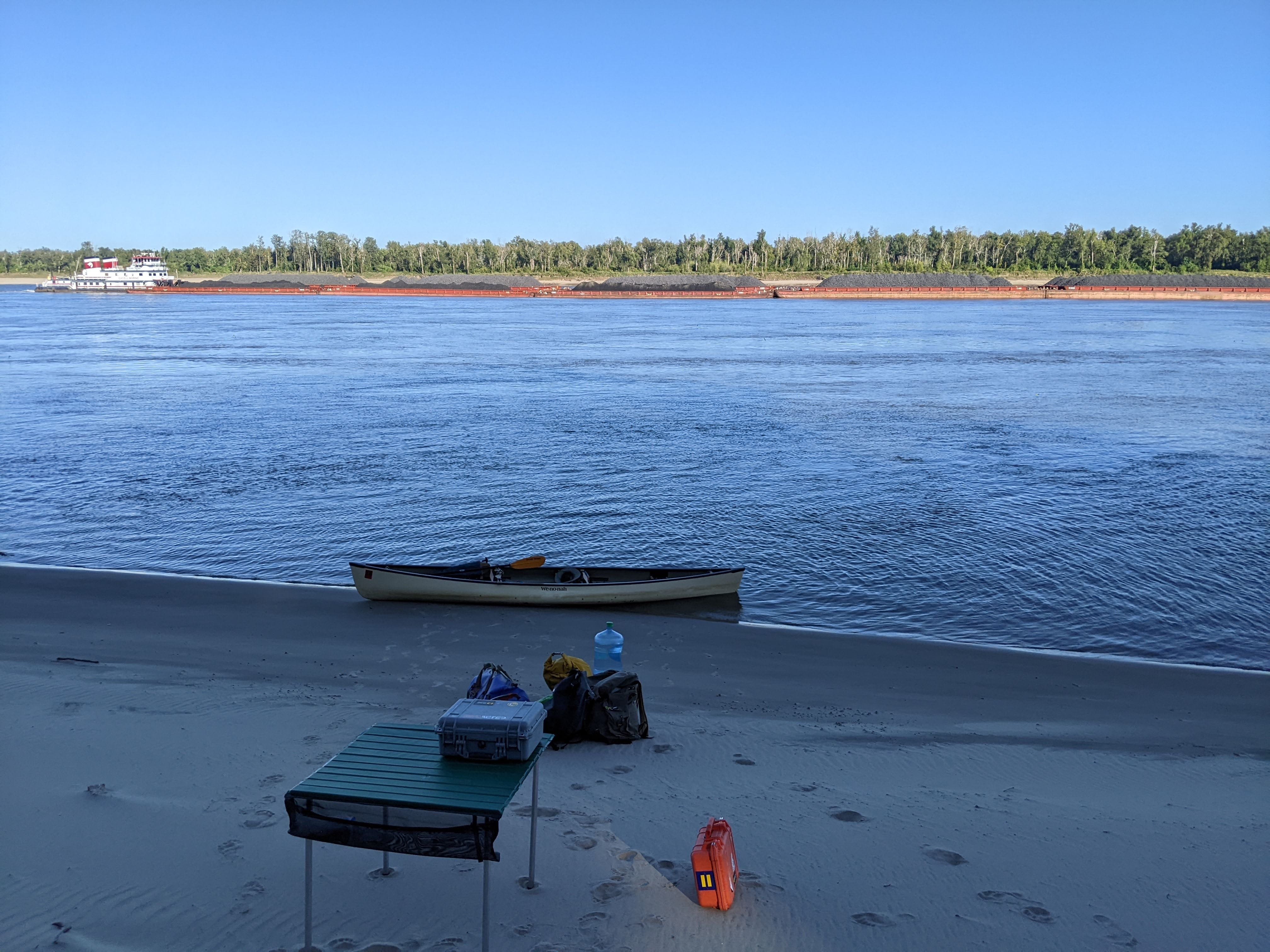
I decided to make camp shortly after, at Union Point. It’s a nice lump of sand directly following where the revetment ends. I’ve found many good camping spots in places just like this.
I’m camped in Louisiana tonight, and I’m looking across at Mississippi. This will be my last night I’m able to do so. Tomorrow I pass fully into Louisiana.
All in all, it was a good day on the River!
Day 84: Union Point → Brunette Point
Date: September 30th, 2022
LRM 326 → LRM 285
Distance today: 41 miles
River Time: 8 hours
Countdown to Baton Rouge, LA: 56 miles
Local Gauge: 13.4 Natchez Gauge
I awoke to a chill in the air — one of the handful of times this has happened on this trip. Fall is finally in the air, and I couldn’t be happier to be past the sweltering summer. I got an early start as the sun was rising, and was even a bit chilly on the water for the first hour. But eventually the sun caught up and the day was nice and toasty.
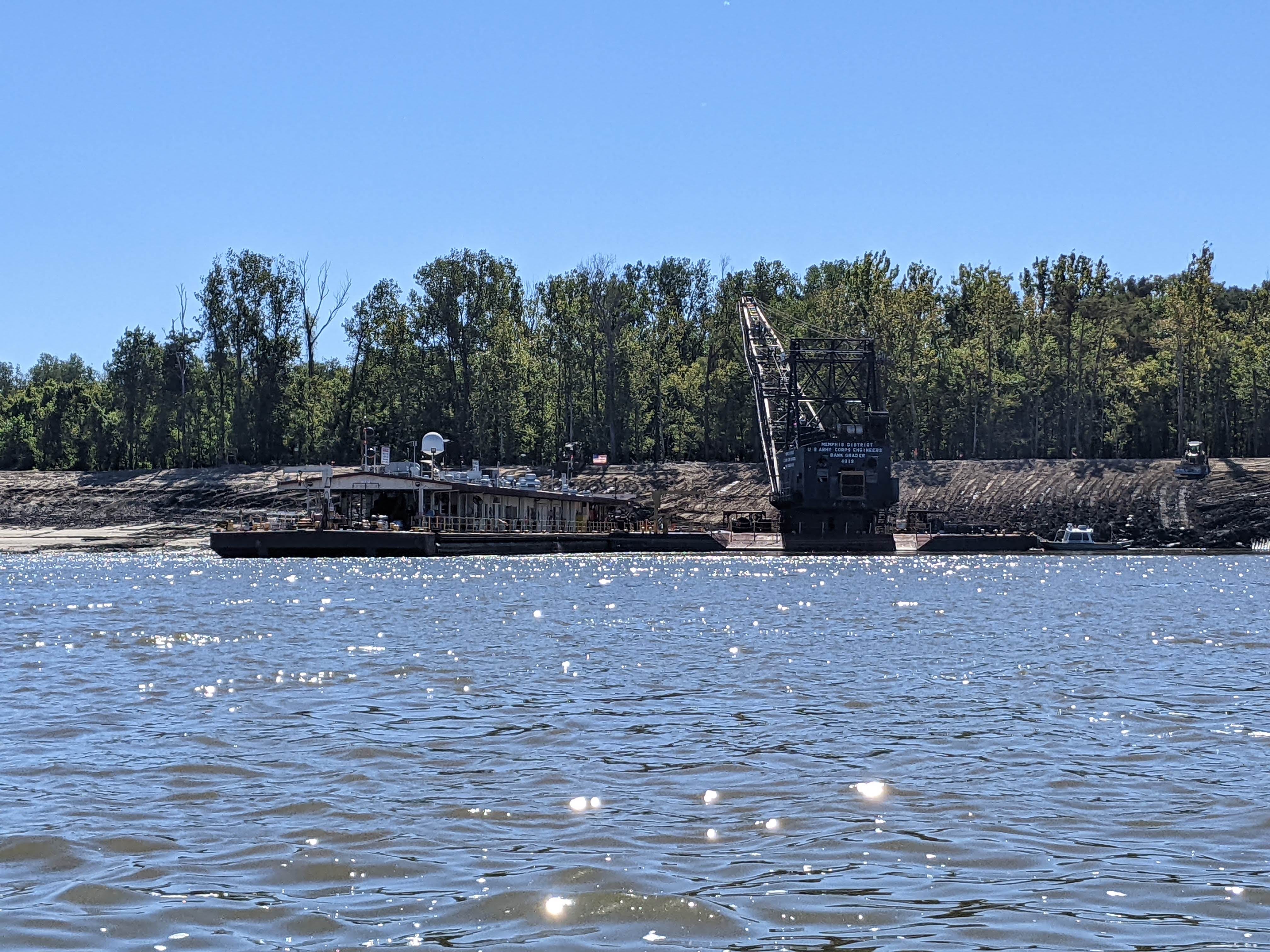
Today two things of note happened in the morning: I passed fully into Louisiana (bye, Mississippi!) and I passed the Old River Control Structure, which separates the Mississippi and Atchafalaya Rivers.
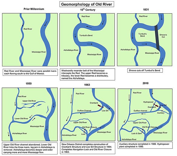
The Atchafalaya
Many do not know it, but not all of the Mississippi River stays in the Mississippi River all the way into the Gulf of Mexico. Around 315 miles from the Gulf, approximately 1/3 of the volume of water flows into a distributary of the Mississippi River: The Atchafalaya River.
Now, the all of the Mississippi River really wants to go down the Atchafalaya, and without human intervention it certainly would be doing so today. However the Old River Control Structure, which separates the two rivers keeps 2/3 of the water dutifully flowing down the Mississippi.
In the 1940s, before the control structure, the Atchafalaya was taking more and more water to the Gulf every year. This is a natural process for most rivers — that is, to find the quickest path to the sea. The Atchafalaya is about 150 miles more direct. In the process, the channel became wider and deeper, and more attractive for water to flow down. By the early 1950s, the Atchafalaya was siphoning off nearly 30% of the volume, and alarm bells were being sounded that soon the Mississippi River at New Orleans would be nothing but a trickle.
The U.S. Congress, which charged the U.S. Army Corps to preserve the main channel, decreed that the flow of 1950 should remain forever unchanged. That is, 30% of water volume down the Atchafalaya, 70% down the Mississippi. The U.S. Army Corps completed the Old River Control Structure in 1963 and has been faithfully serving that order ever since, except in extreme circumstances like flood, when the Atchafalaya may take more than its fair share in order to save New Orleans. (McPhee, 1989)1
In the intervening 60 years, the Atchafalaya has only become more attractive to the River. What began as a small 2 or 3 foot drop in the 1960s, today can be as large as a 40 or 50 foot drop. That means the water really wants to go down the Atchafalaya. Most river rats know that eventually it will.
As I approached this control structure, I began to see warning signs on the banks, warning me that there is a suction effect from the intake of water. After all, approximately 30% of the River is being drawn away. My maps had a strong warning as well, advising me to stay as far to the left as possible.
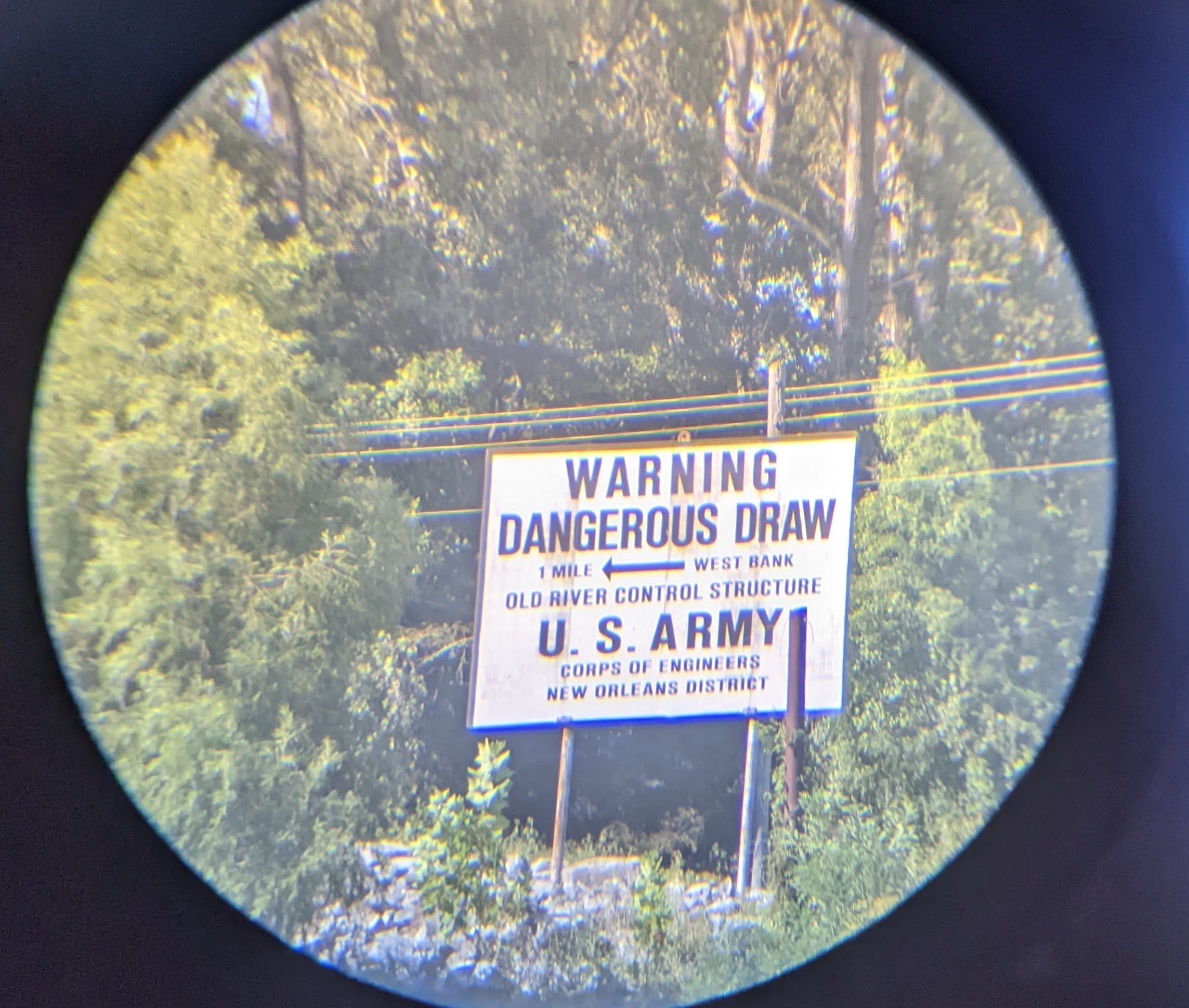
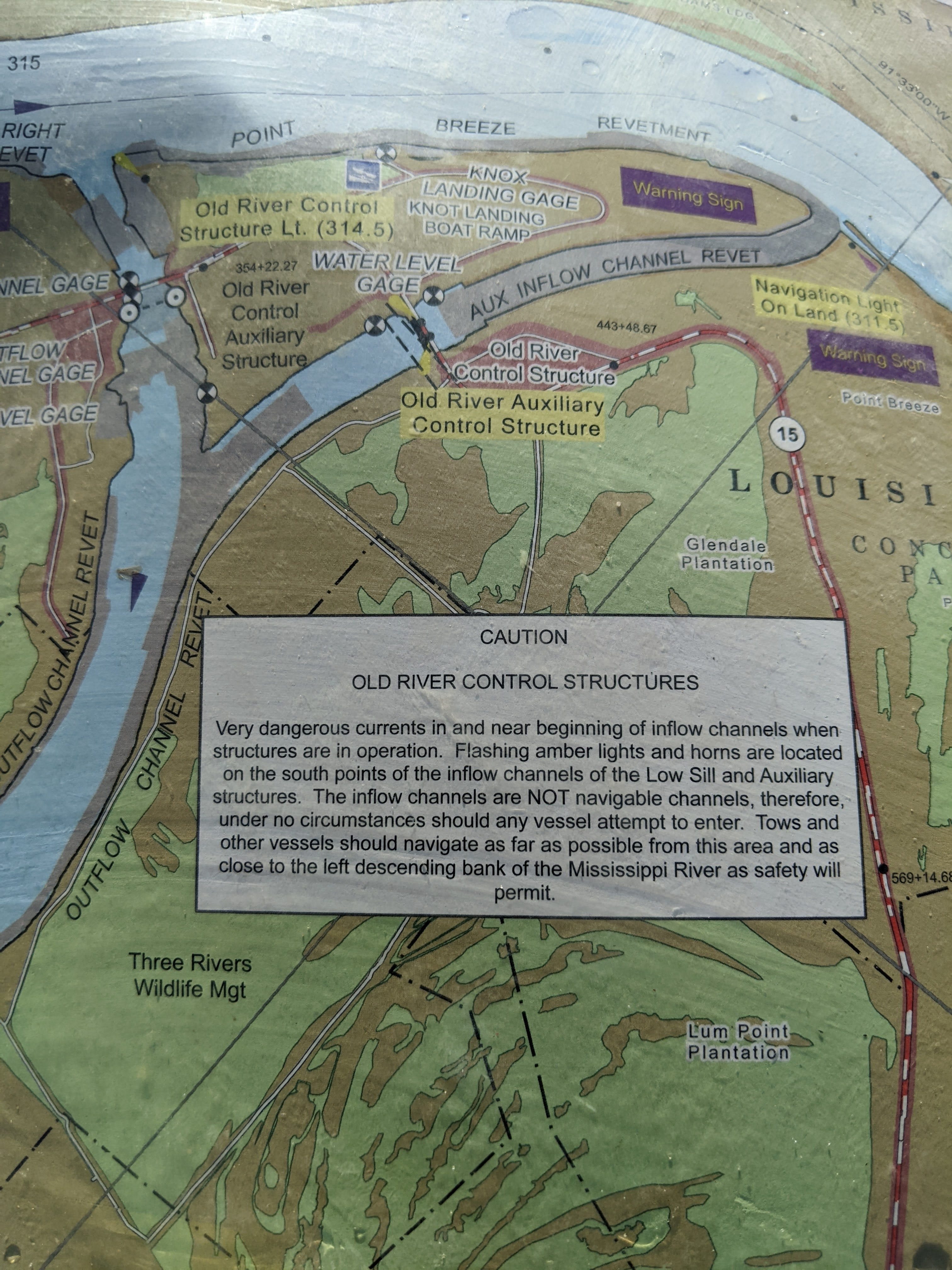
As I passed by the Old River Control Structure, I did feel a slight suction effect, but nothing major. In low water such as this, it was very easy to paddle out of harm’s way. However in in high water, this area can be a raging whirlpool, capable of sucking barges down. It has done so before.
Soon after that, I was on my way to the Old River Lock, which is how tows and other vessels get from one river to the next. I wanted to take the lock just to get a glimpse of the Atchafalaya and camp a night there, however the lock is closed for repairs until November, so I just paddled on past.
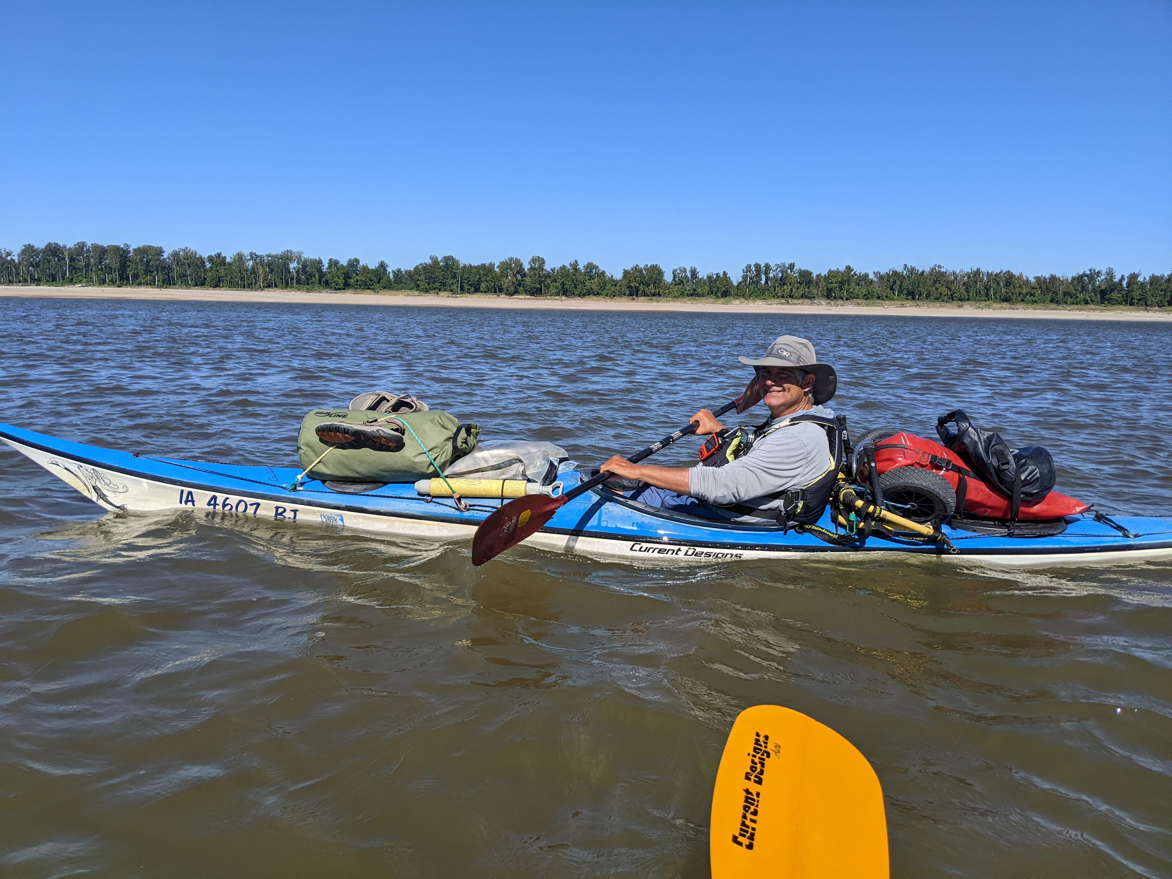
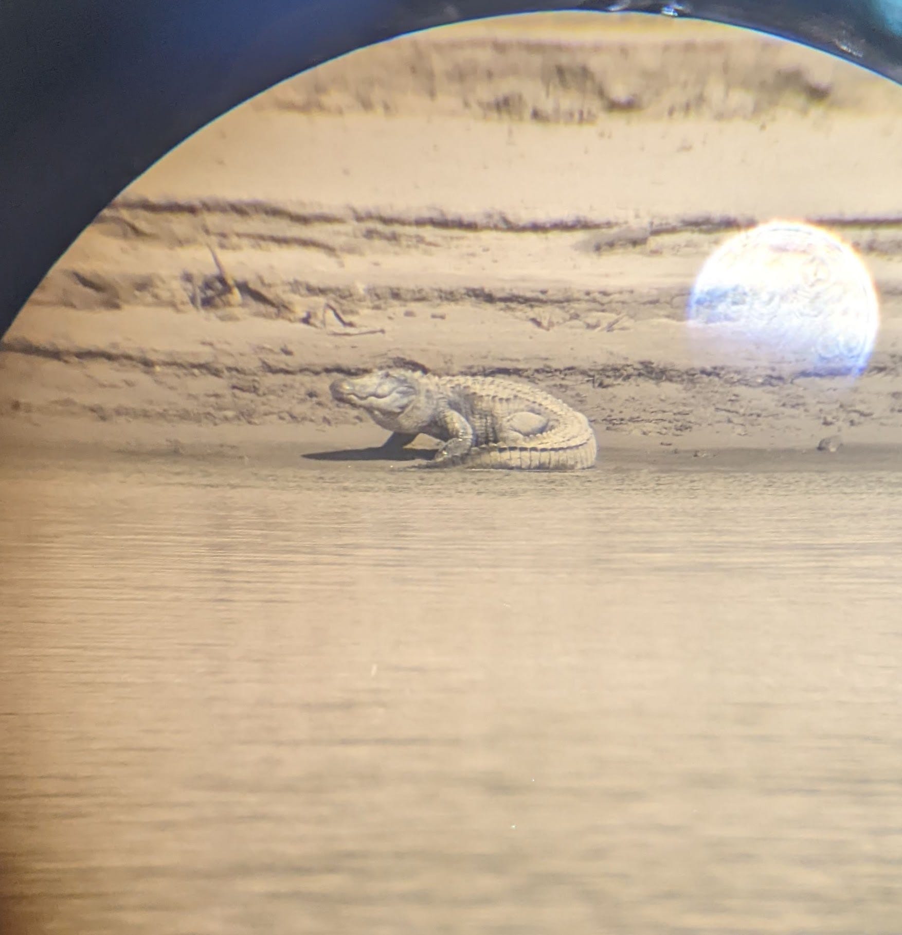
I saw my first alligator on the River here as well, right above the lock. I’m not sure if it lives on the Mississippi River, or just made its way over from the Atchafalaya, but in any case, they are only going to become more common! This guy was big — I’m guessing between 11 and 14 feet long.
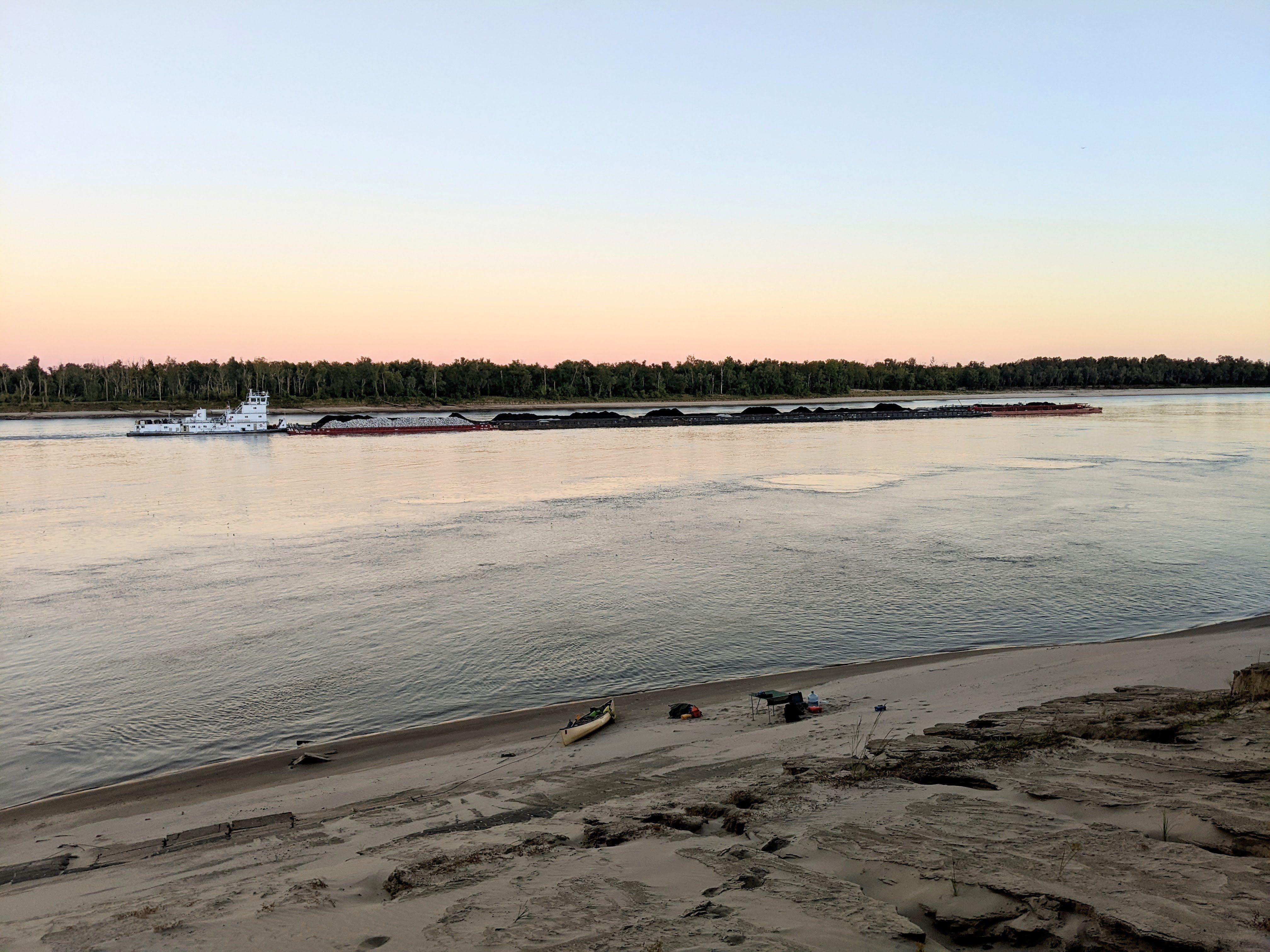
My goal was Mile 190, but the campsite that I was hoping for was a huge expanse of sand, so I opted to keep going. Five miles later at 285, I found a really great hidey-hole campsite at Brunette Point. This site has some elevation to it, and would be good all the way to high water. My tent is a good 50 vertical feet above water level with a sweet overlook!
McPhee, J. The Control of Nature. New York, NY: Farrar, Straus, and Giroux; 1989.
Nice Gator! That’s a big boy