


The Wild Free-Flowing Miles of the Lower Arkansas River
From the Wilbur D. Mills Dam to the Confluence of the Mississippi River

A canoe trip on the free-flowing portion of the Lower Arkansas River had been on my bucket list for some time, since I worked this summer at the Arkansas Post Canal.
The modern Arkansas River is a series of 16 locks & dams stretching from near Tulsa Oklahoma, to the Arkansas Post Canal. These are in place to allow for navigation of barges even in low water, and the effect it a series of lakes over the course of some 435 miles1. Interestingly enough, for the last 10 navigable miles, the channel cuts over to the White River before finally emptying into the Mississippi River. The last dam on the Arkansas is Dam 2, The Wilbur D. Mills dam. This means downstream of this point the water flows freely, unhindered by human constraints.
Thus, from my first day on the job observing the mighty current of the Lower Arkansas, I had it ingrained in my mind to explore the last ~40 miles to the confluence with the Mississippi.
The route began at the Wilbur D. Mills dam, and from there down the Arkansas until it joins the Mississippi. From there would turn and paddle upriver about 5 miles before making our crossing into the Rosedale Harbor, where our jounrey ended. This is the story of that adventure!
Here is a brief overview of the area with some of the landmarks mentioned above:

Day 1 - Dec 13th
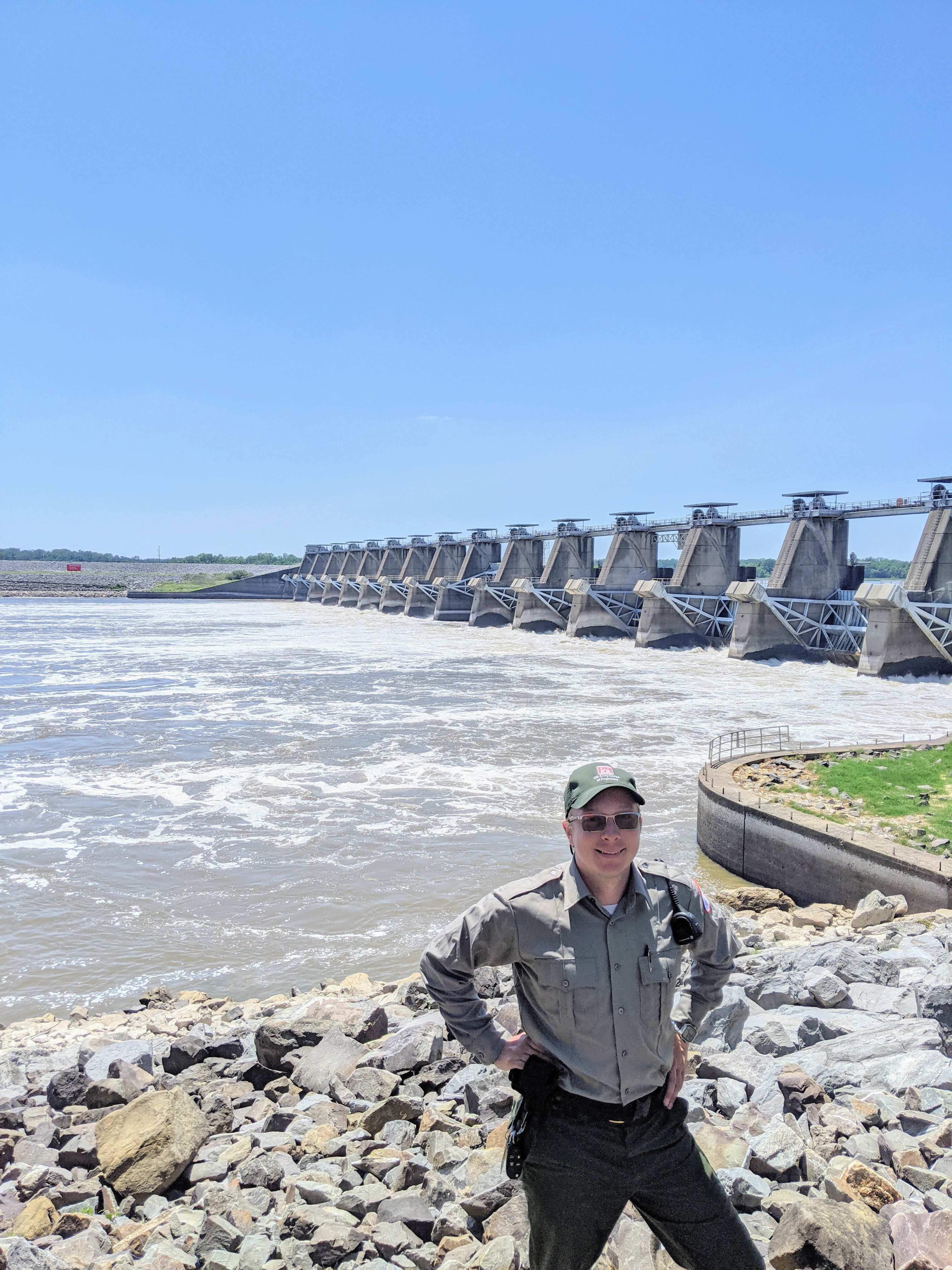
When we arrived at Wilbur D. Mills dam for our put-in, on a sunny day in December it became clear that the Arkansas River would be much different than how it was flowing in June. A quick glance at the flow report would tell us that a measly 200 CFS was flowing through, and had been for the past week or so, leading to an extremely low Arkansas River. In fact, the levels were at historic lows, not seen in the prior decade or more.


This extremely low water meant that, while we wouldn’t have much current pushing us downstream, we would see things that had been submerged for 10+ years, and only now seeing the light of day. The tailwater of the dam is read in ft-msl, or “feet above median sea level”. The gauge at the dam is inaccurate, in that it won’t read below ~119 ft-msl, no matter how low the water level actually is. Judging by the boat ramp, which ends around 119 ft-msl, I would estimate the river was at 116 or 117 ft-msl on our departure day.
The water was so low that even Monarch Canoe bottomed out within the first 30 minutes!
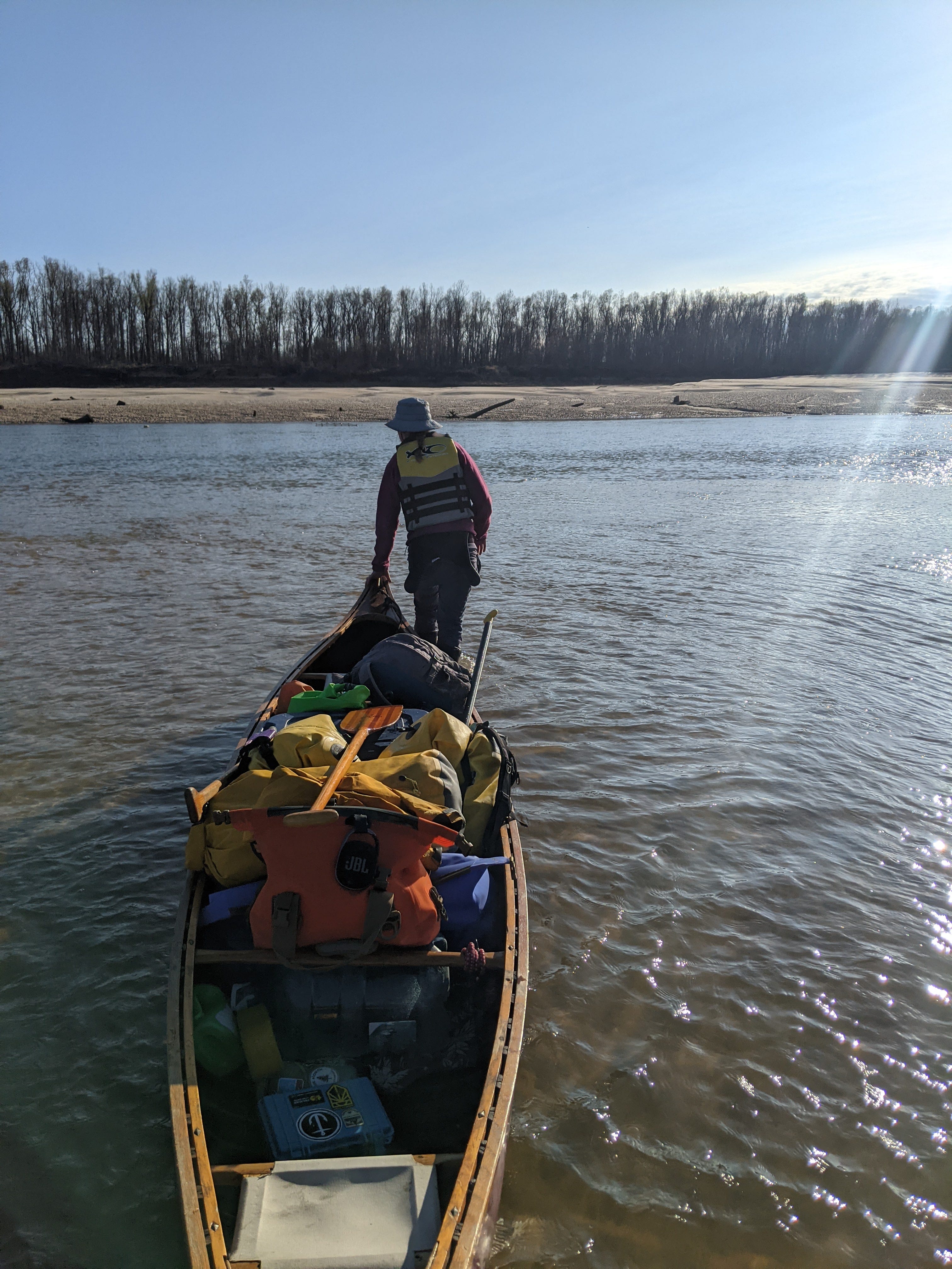
With water this low, you can imagine our surprise, when gradually we started to notice forceful flow. We wrote it off, as the park rangers had assured us that the dam would not be letting any water through in these dry conditions. However, slowly but surely, unmistakably, the river was flowing faster. We conducted a scientific test:


Sure enough, we checked with the flow charts, and within 30 minutes of our departure, the dam had begun a big release! That trickle on 200 CFS was now a gushing 23,000 CFS!

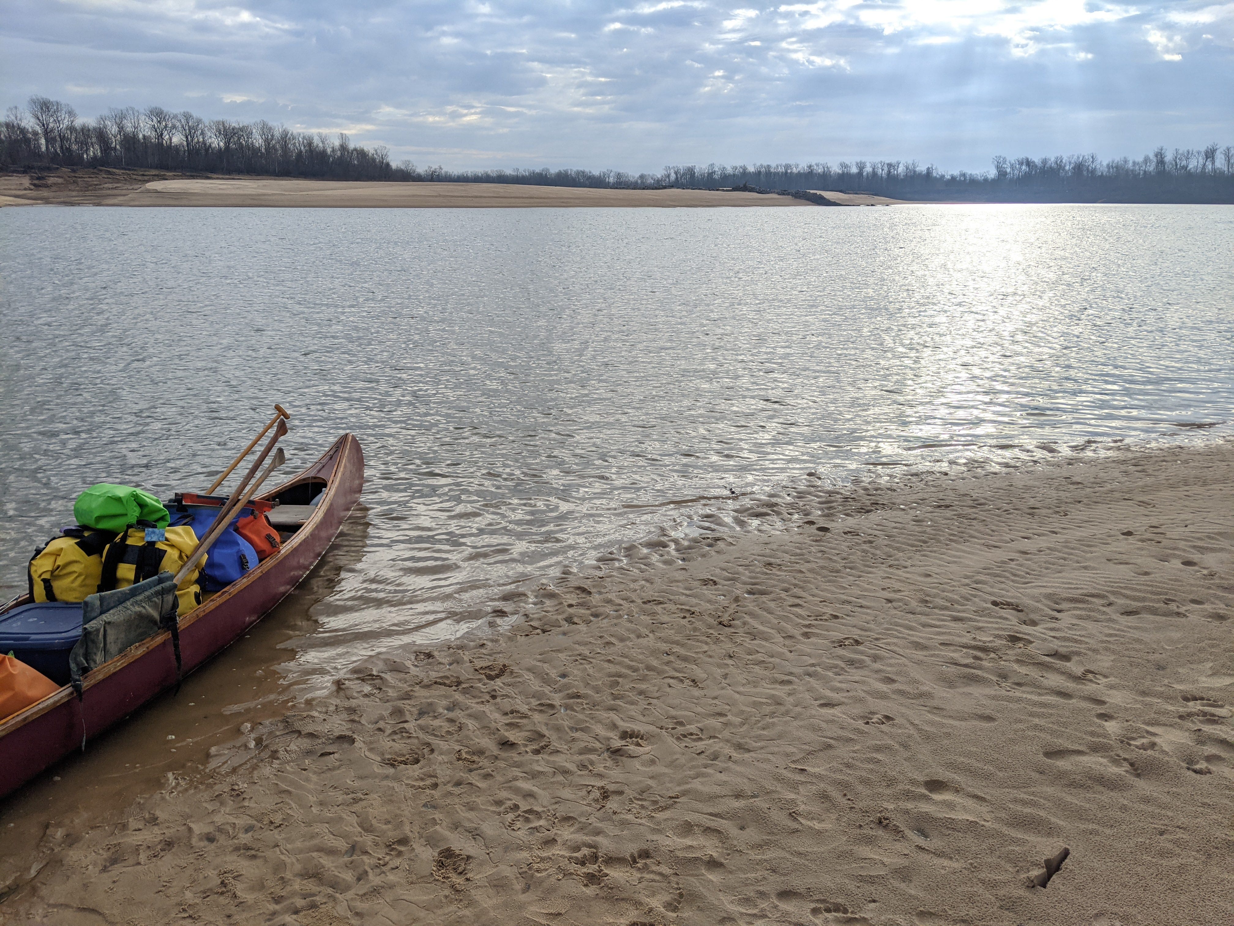
The water level went up very quickly at first, ~5ft in the first couple hours after it began releasing. By the time we had settled down at our campsite, and made dinner, the river was creeping up gradually but consistently every hour, creeping ever closer to where the canoe was moored.
It’s the thing that can give a paddler nightmares, constantly worrying about your boat while you’re trying to get some sleep in your tent. We decided to avoid this anxiety completely and thoroughly, by hauling the canoe up 30 vertical feet.

In the morning, this turned out to be overkill, as the river had contracted and gone back to almost its original. We had to carry it down 40 vertical feet, but we slept like babies.
Day 2 - Dec 14th
Since we had no flow propelling us forward, our itinerary was looking more daunting. We had to paddle long and hard days to stay on track. So we got up early, saw a few deer drinking from the river at dawn, and set off shortly after!
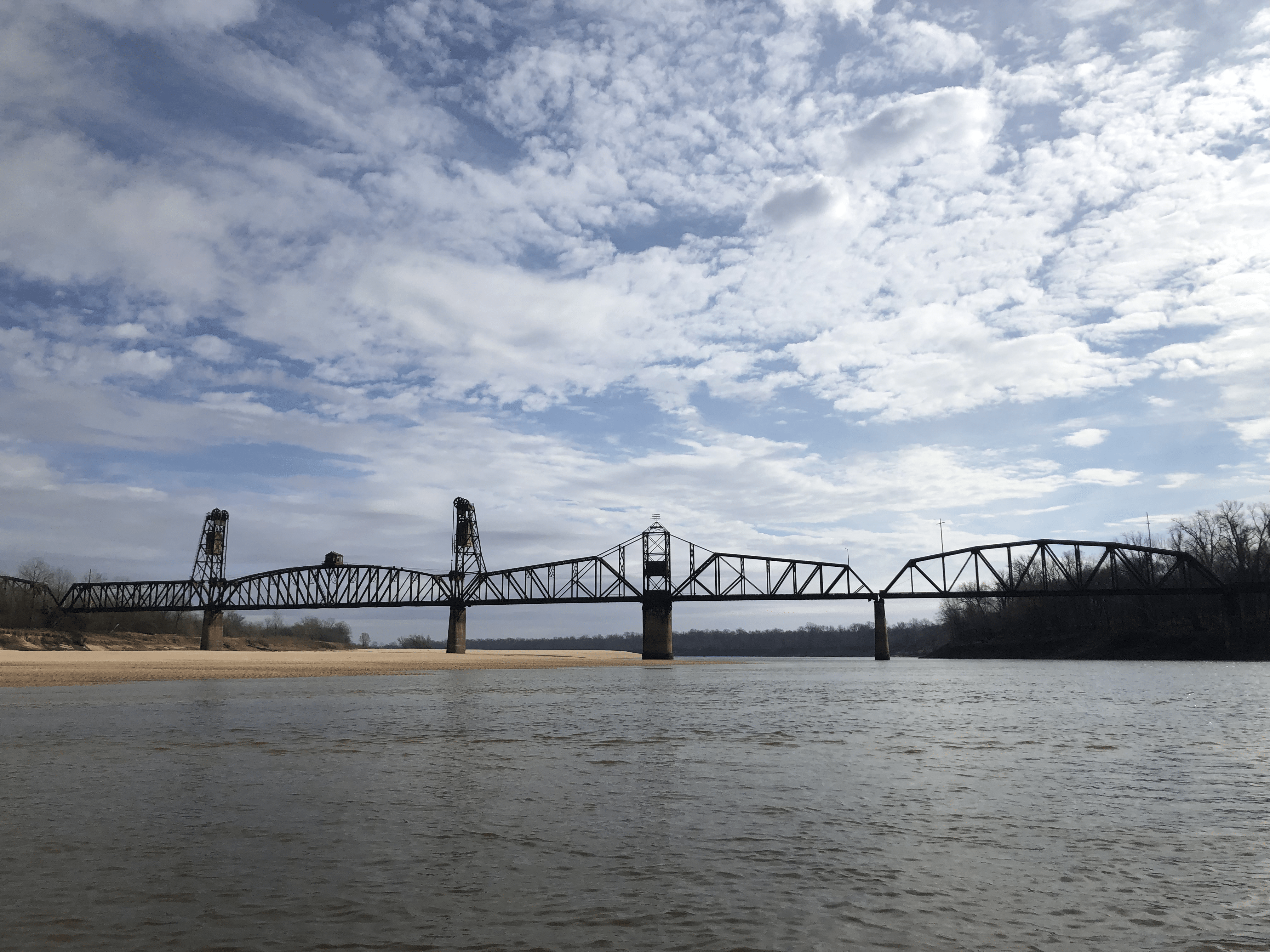
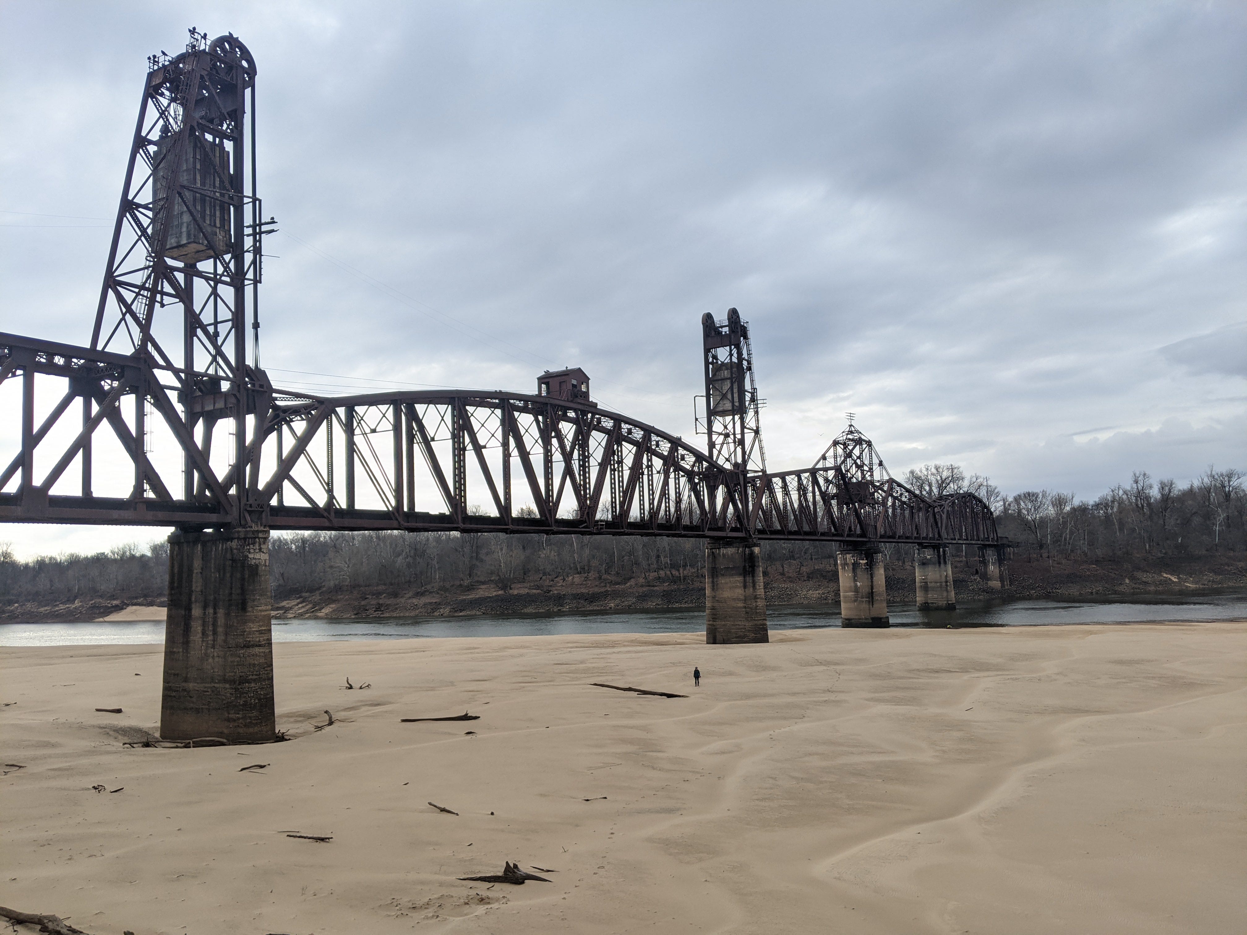
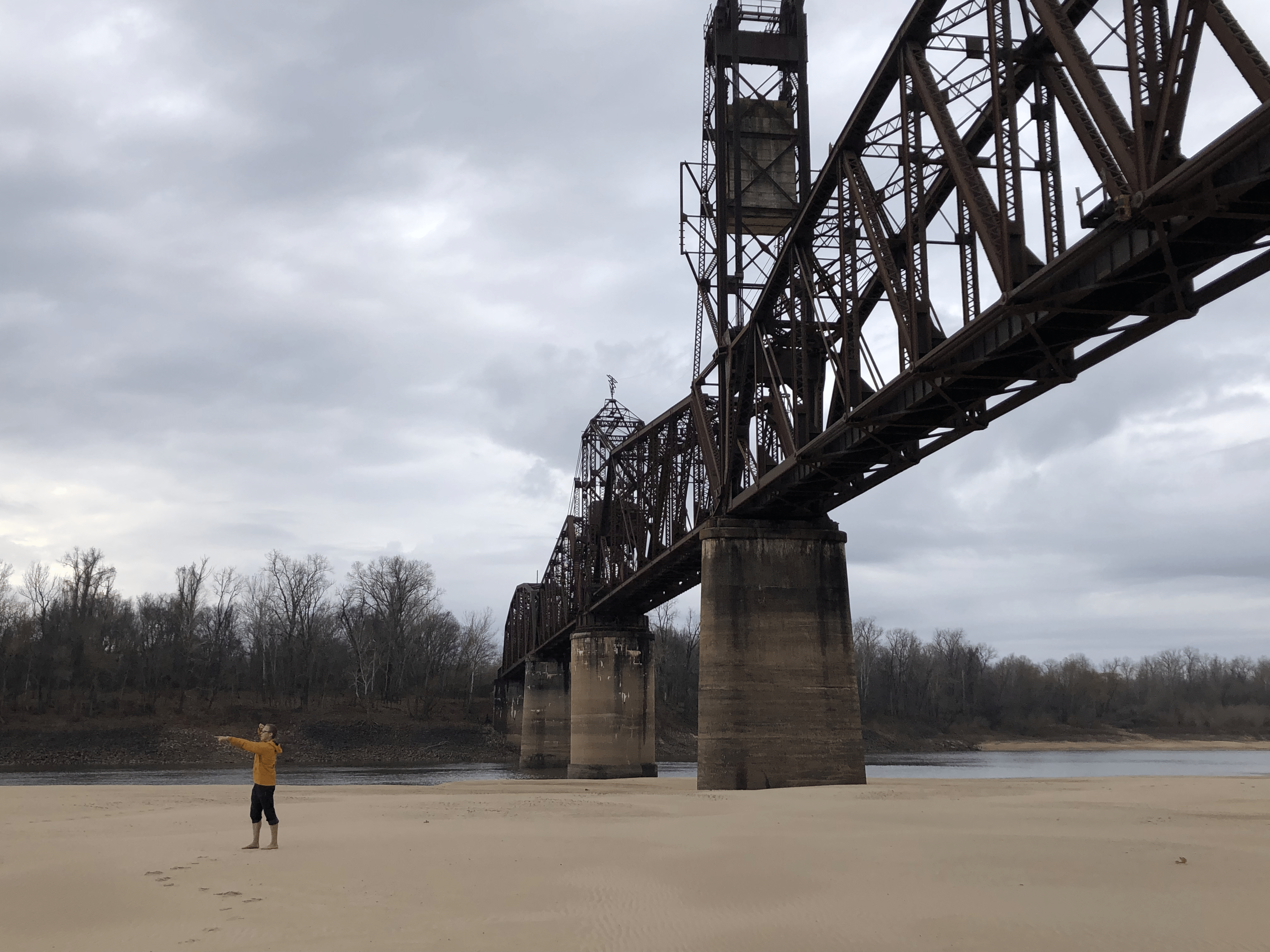
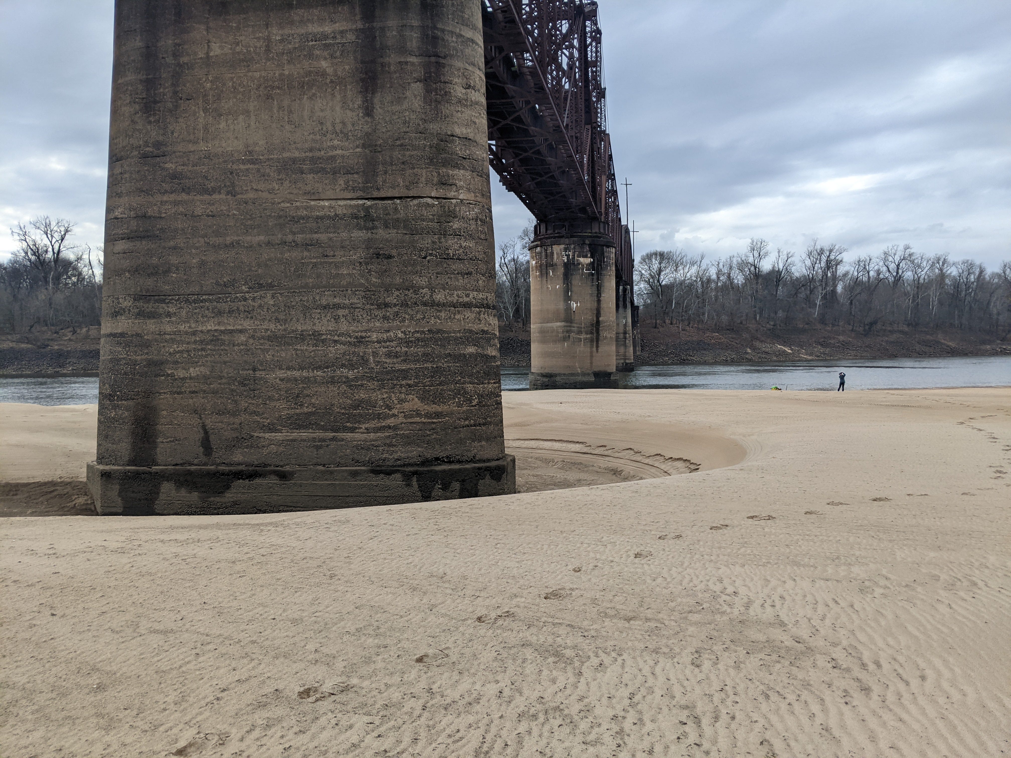
The highlight of this day was passing under the Yancopin bridge, the final bridge along the Arkansas River. It once carried trains, but now is abandoned and derelict. The main proprietors we about 100 ravens perched on top of the dark structure. We stopped to check out the slightly ominous abode.
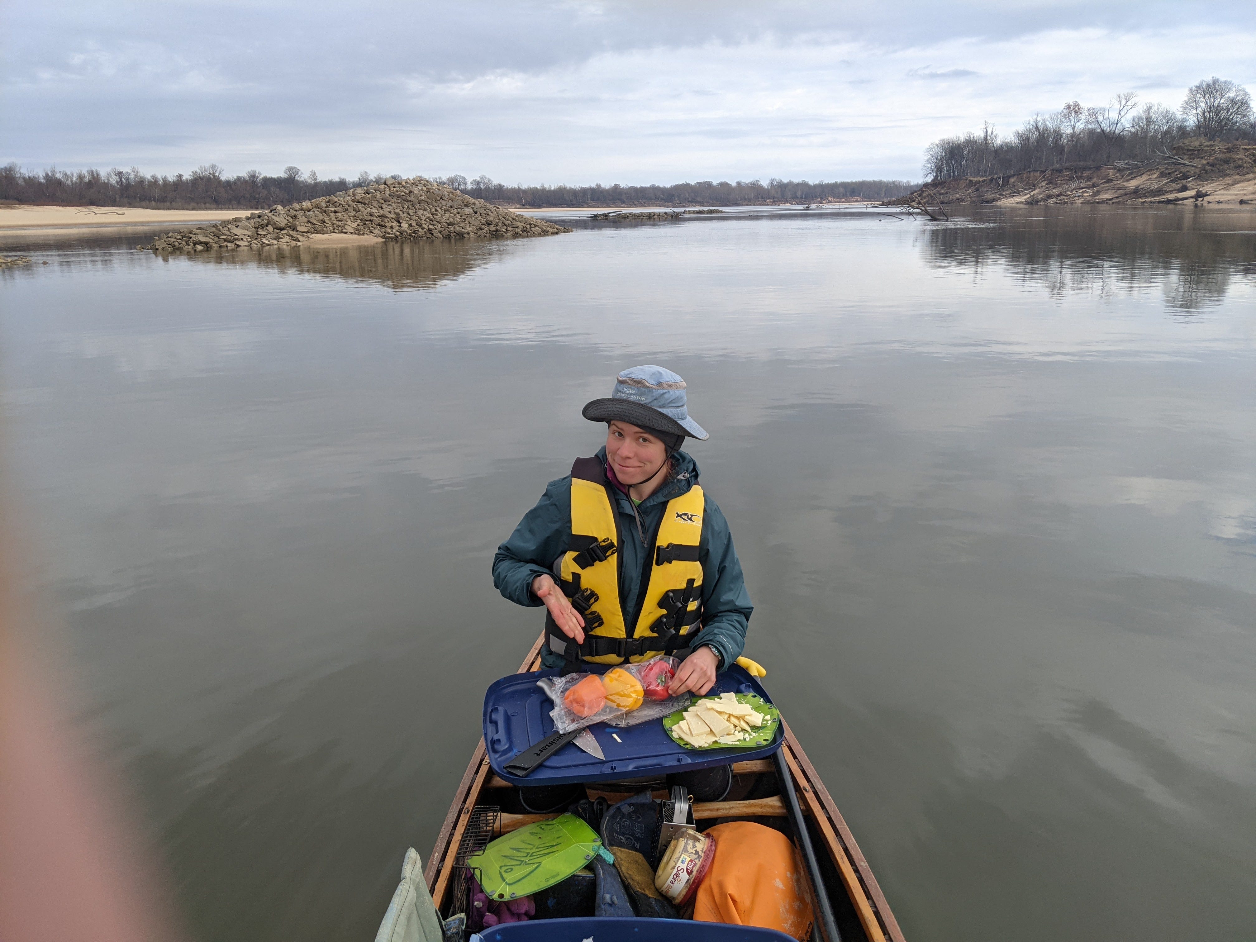
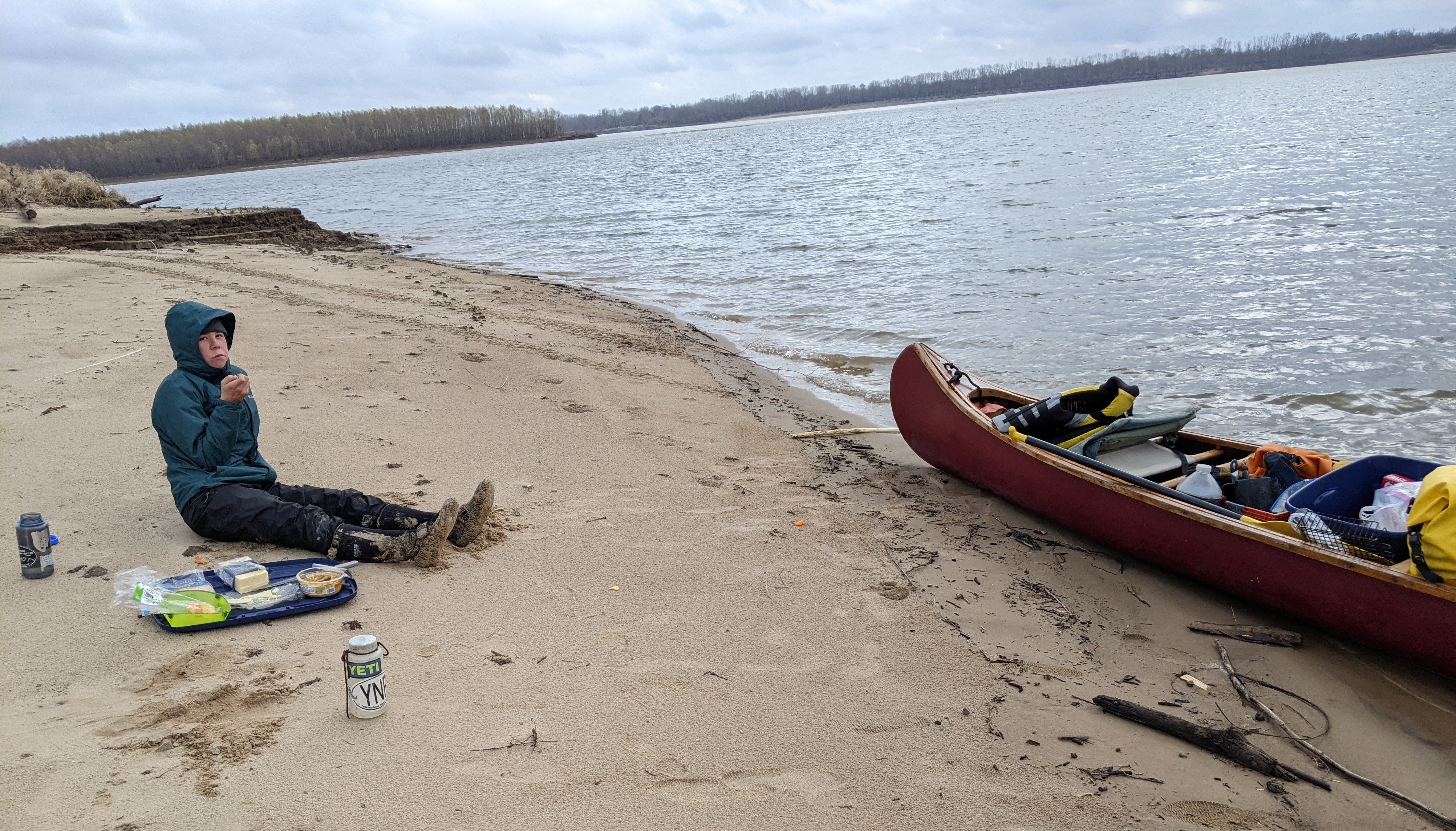
After this visit, with quite a few miles to go, we opted for a floating lunch to stay on schedule.
That night, we made camp in the middle of a river bend on a sea of sand. We named this bend of the river “Long Echo Bend” due to the curiously delayed echo at this spot.


Day 3 - Dec 15th
This was the day we had to make it to the confluence of the Mississippi River. We had our sights set on the Arkansas Bar, a place we have camped before. It was still another ~10 miles downstream in the Arkansas River, and 2.5 miles of an upstream paddle on the Mighty Miss.
A heavy fog had set up from the night before. Typically, this would mean delaying our departure, but since there is no barge traffic on this part of the Arkansas, we decided to venture into it.

Visibility came and went, and only really cleared up around noontime. At that point, we had arrived at Cat Island, the last island on the Arkansas River. From this vantage point one can see the confluence, and the Mississippi flowing by. It was striking how flat the Arkansas River was in contrast to the roiling nature of the Mississippi. The barges were zooming by!
We entered the Mississippi River, and began to work our way upstream. It probably took us a good hour and a half of exertion to reach the Arkansas bar. There were no eddies to hide behind either in this stretch, just us against the Big River. Funny how you always feel the flow more when going upstream.
By the time we did reach the bar, it had been a full day of paddling. Because the trip was so close to the winter solstice, twilight began to hit between 4 and 5pm every night. We were soaked from the weather and drenched from our own sweat, so Solange set up an ingenious clothes drying system without the use of any trees, in the dying hours of the afternoon:

We fell asleep, for the first night of this trip, accompanied by the gentle lullabies of 3000 Horsepower engines churning by at all hours of the night.
Day 4 - Dec 16th
The last day of a wilderness trip is always bittersweet, and this was no exception. The Mississippi didn’t give it to us easily though! Our crossing was one of the harder ones I have ever done.
Upstream and against a hearty wind, we paddled upriver to the head of the Arkansas bar, and poked our nose into the navigation channel. At the last minute a tow came screaming downstream around a blind spot, so we decided to dart back near shore. Unfortunately this maneuver pushed us another half mile downstream. We idled until the tow was almost adjacent to our position, and went to start our crossing, timing it so we would pass right behind. We saw another, slower tow coming downstream and had to make a real quick decision: cross right then and there, and paddle hard to safely cross ahead of it, or back off, regroup, and try the crossing in thirty minutes after the tow had passed, assuming there wasn’t more barge traffic at that point. The thought of perpetually waiting for barge traffic was unappealing. We had an opening now and we weren’t going to miss it. I radioed the tow that was passing by at that moment:
Me: "Hey captain, we're that little red canoe on your starboard side. We are starting our crossing to Rosedale Harbor, and should be passing right behind you shortly."

Tow Captain: "Roger that, be safe out there in this wind."

Me: "Will do. Do me a favor and call the Coast Guard if you see us go down!"
We managed to keep Monarch Canoe upright, but the waves were definitely testing us at times. Our other consideration is that the mouth of the harbor was slipping away from us quickly! We lost a lot of ground on that crossing, but in the end did make it just below the mouth of the hardbor, close enough to claw our way back into the safehaven flatwater. It was a suspensful, exhausting 15 minutes of a crossing, but we had made it!

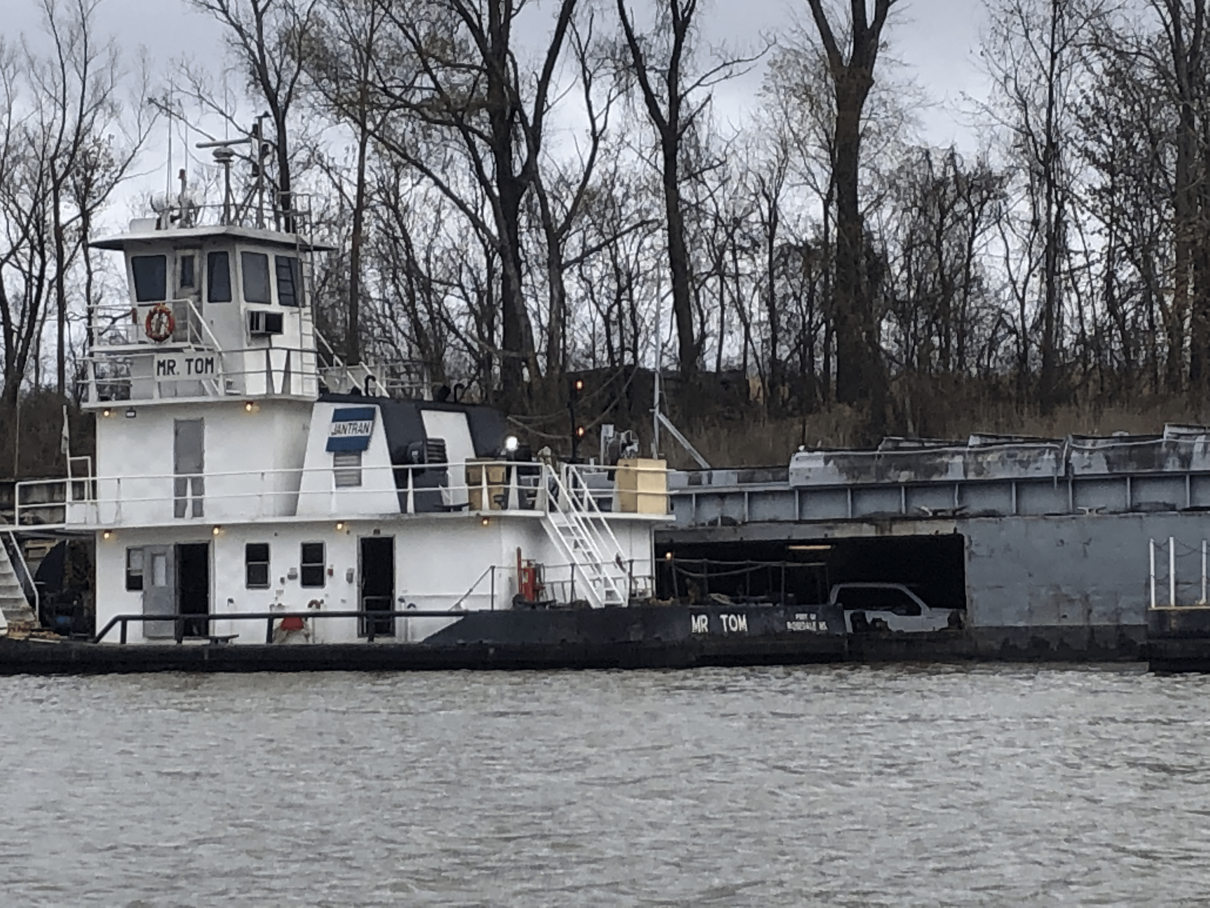
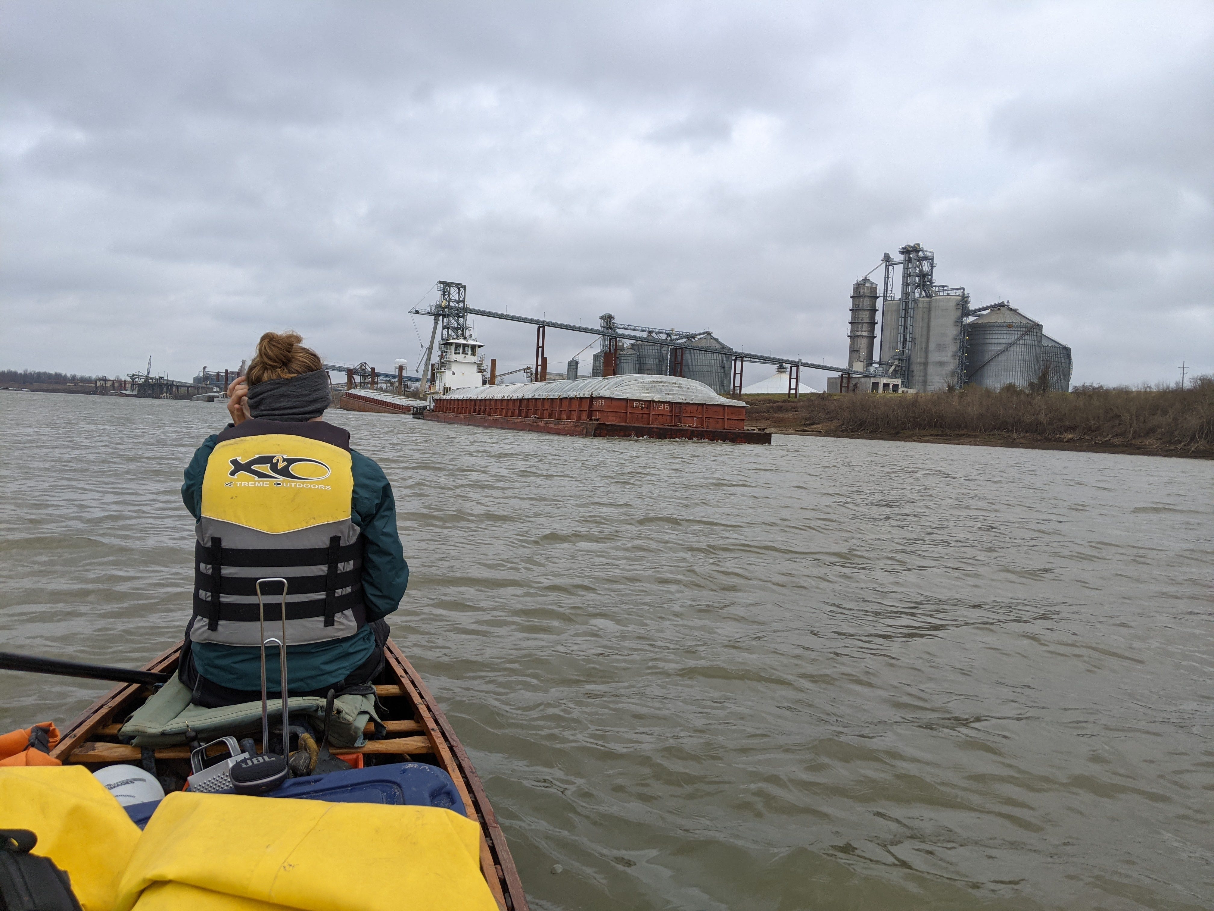
The rest of our paddle up the harbor was, comparatively, a breeze! We had to navigate a lor of industry and tow traffic, but at least we knew we were safe from the turmoils of the open water. We saw a couple of familiar faces in the Rosedale Harbor, including a boat that ‘constructs’ the barges: Mr. Tom. There’s always a lot of activity and a lot to see in a harbor, but I particulately love seeing land motor vehicles on floating barges. I don’t think that will ever get old for me!
I set out with the idea to '“connect the dots” from where I worked all summer, to familiar territory on the Mississippi River, via a waterway. Feeling exhausted but accomplished, we finished our trip in happy spirits. We had seen a sight that few have seen by canoe: the wild, free-flowing miles of the Lower Arkansas River.
https://www.swl.usace.army.mil/Missions/Recreation/Arkansas-River/Arkansas-River/