Wrap-Up #2: Stats, Trip Overview, Evergreen Posts, and More!

Hello everyone,
In this final wrap-up post I will detail various stats that I’ve collected and tabulated from the trip.
This will be my last post for a while, but you can get a sneak peek at what’s next at the bottom.
Contents of this post:
Trip Statistics
The Basics:
Total Days: 97
Paddling Days: 83
Rest Days: 14
Camping Days: 72
Sleeping Indoors Days: 25
Nights Spent in Each State:
Minnesota: 30 nights
Wisconsin: 3 nights
Iowa: 7 nights
Illinois: 13 nights
Missouri: 8 nights
Kentucky: 1 night
Arkansas: 4 nights
Tennessee: 4 nights
Mississippi: 11 nights
Louisiana: 16 nights
Mileages:
Total Miles: 2,308
Paddling Days: 83
Average miles per day: 27.80
Shortest day: 1 mile
Longest day: 54 miles
Miles Per Hour
Total hours spent on River: 687
Average speed: 3.36 mph
This one was interesting, because my speed varied wildly in different sections of the River, so I will break it down a bit. Keep in mind, when I tracked my time on the water it was from the moment I left camp, to when I arrived at my destination. So this time includes delays at locks, portaging, eating lunch, and all stops along the way.
Lake Itasca → Minneapolis, MN:
495 miles in 179 hours = 2.77 mph
Minneapolis, MN → St. Louis, MO:
645 miles in 217.5 hours = 2.97 mph
St. Louis, MO → Baton Rouge, LA
926 miles in 208 hours = 4.45 mph
Baton Rouge, LA → Gulf of Mexico
242 miles in 82.5 hours = 2.93 mph
What made these speeds fluctuate so much? Why did I slow down again after Baton Rouge? Read onward to the trip overview to see what defined each section of river, which had a huge impact on my speeds.
A Trip Overview
Many have asked me about a trip overview, specifically where I thought the Mississippi River changed dramatically, from a paddler’s perspective. It is, of course, subjective, but here is my take on the issue:
Section #1: The Headwaters
Lake Itasca, MN → Grand Rapids, MN
URM 1342 → URM 1179 (163 miles)
Days 1 through 9 (for me)

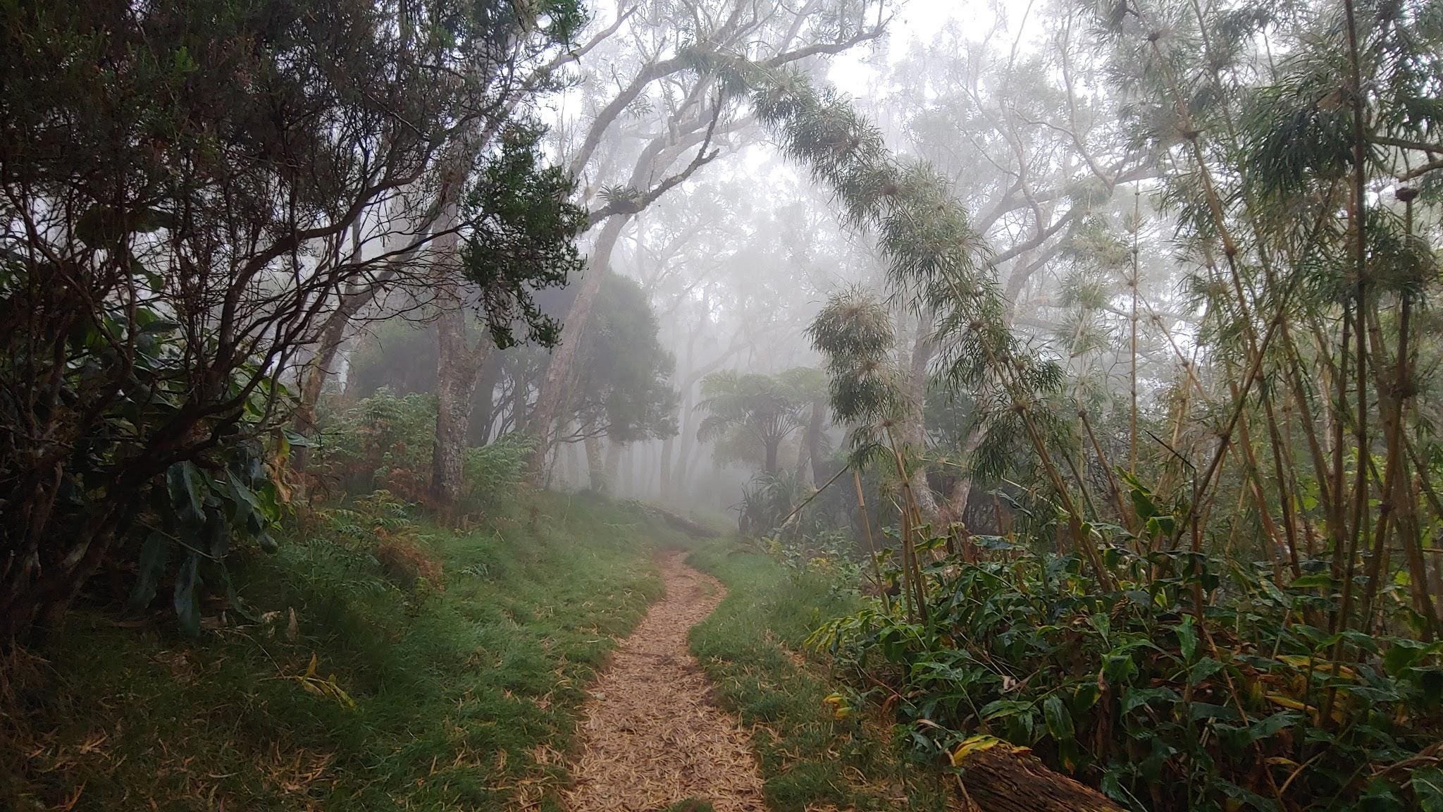
This section is defined by bog and marshland. Solid ground is sparse, and many obstructions lay in the path of the River, including beaver dams and bog chunks. There are ample opportunities to get lost as the River swells through these large swampy lakes. There are 6 portages in this section, or more during times of low water. Wear shoes and pants you don’t mind getting wet, and plan on getting them wet.
Section #2: The Uppermost Mississippi
Grand Rapids, MN → Minneapolis, MN
URM 1179 → URM 853 (326 miles)
Days 10 through 23 (for me)

The great change from the headwaters section to this one is that the River’s channel is much more defined. The River is now substantial enough that you’re not going to touch bottom anymore. In short, the Mississippi feels like a river now, and not like a stream. There are 6 substantial portages in this section, and the Sauk Rapids, which may need to be portaged in times of low water (under ~4,000 CFS). The last portage, in Minneapolis, is 1.5 miles long.
Section #3: The Locks & Dams (The Upper Mississippi)
Minneapolis, MN → St. Louis, MO
URM 853 → URM 180 (673 miles)
Days 26 through 54 (for me)
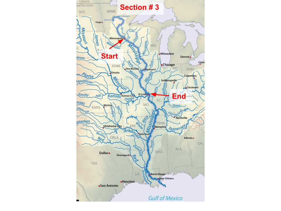
Of course the big change here is that you’ve now graduated from portages to locks & dams. After all those portages it’s very welcome to arrive in Minneapolis and be done with them. Some people leave their portage wheels and continue on without them. Navigation from here on out gets a tad more technical. Towboats pushing barges now share the River with you, thus a bit more vigilance is required.
There are 27 Locks & Dams available to paddlers beginning with lock #1 in Minneapolis. Lock #27 in St. Louis is optional, and many paddler choose to take the Chain of Rocks instead. It’s highly recommended to have a marine radio to communicate both with the towboats and the locks & dams.
Section #4: The Middle Mississippi
St. Louis, MO → Confluence of the Ohio River
URM 180 → URM 0 (180 miles)
Days 55 through 59 (for me)
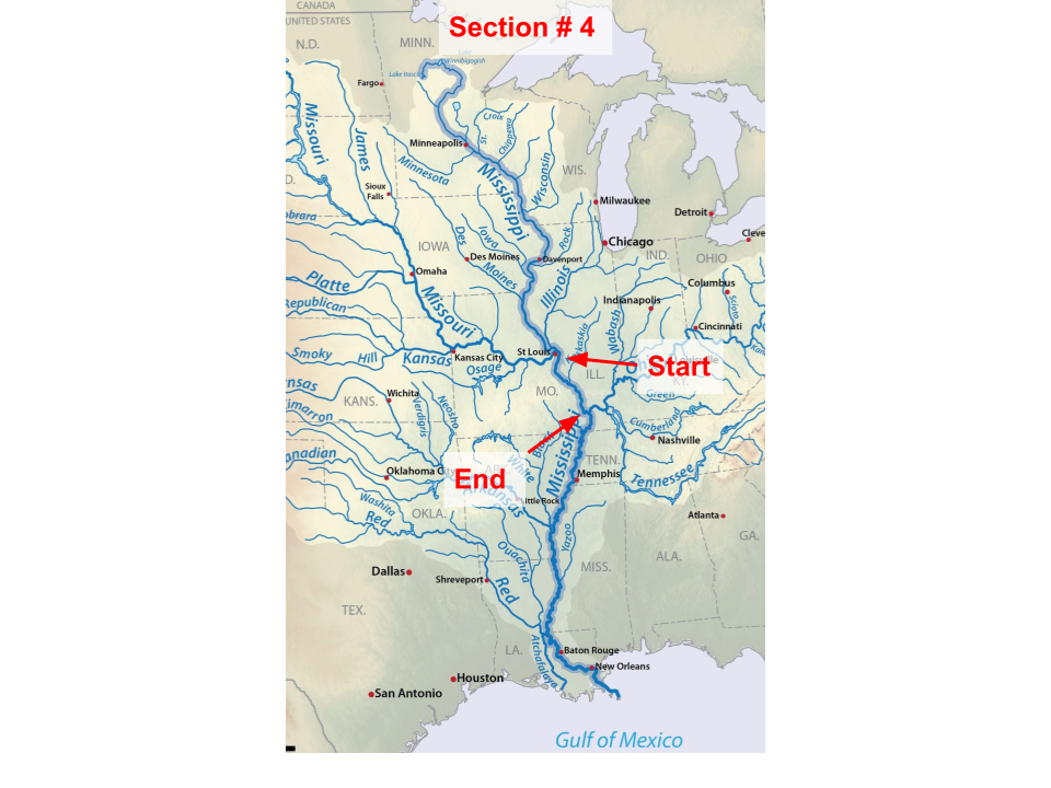
This is a relatively short section of the River, but one of abundant change. Especially in low water, the change from the flatwater pools to the free-flowing Mississippi is stark.
Section #5: The Lower Mississippi
Confluence of the Ohio River → Baton Rouge, LA
LRM 953 → LRM 229 (724 miles)
Days 60 through 86 (for me)
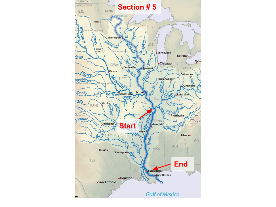
The big change here is in scope. The Mississippi River triples in volume when the Ohio River joins it, and becomes a behemoth. You thought you were on a big River before, and you were, but now it’s massive. One million gallons of water can easily flow by every second on the Lower Mississippi, and more like 7 million in times of flooding.
Section #6: The Chemical Corridor
Baton Rouge, LA → New Orleans, LA
LRM 229 → LRM 96 (133 miles)
Days 87 through 92 (for me)
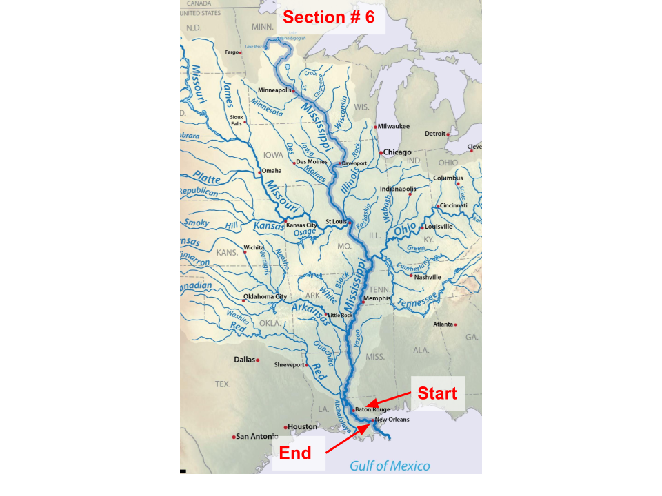
The River changes in two noticeable ways here, in flow and in scenery. The reduction in flow is most felt in low water, when the channel becomes at least 45-feet deep from here on down. This is to accommodate ocean vessels.
The change in scenery is more stark and affects most everything you see. You will share the water with new and curious vessels, massive tanker ships, and tug boats to accompany them. On shore, the scenery becomes less wild and far more industrial. There will be fewer spots to pull off for the entire 133 miles, as there will simply be wharves, pipelines, moored barges, and rocky shores for miles without break.
Section #7: New Orleans to the Gulf
New Orleans, LA → The Head of the Passes
LRM 96 → LRM 0 (96 miles)
Days 86 through 92 (for me)
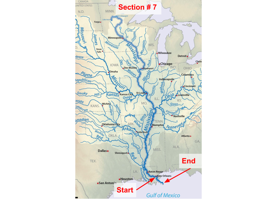
After New Orleans, the scenery on the banks shifts back to forested, but they’ve changed a bit. The whole country begins to flatten out, so it becomes a challenge at times to find high ground. In addition, the earth is becoming more muddy and less sandy.
Another thing you will contend with here is tidal effects. You won’t necessarily feel the tide pulling or pushing you (except in cases of extreme low water, like 2022!), but you will notice the water level in a different spot when you wake up in the mornings. It’s critical to secure your boat well in this last stretch and keep up with a tide chart.
Lessons Learned
Some things are not meant to be planned to far in advance. Stay flexible.
Shade is good.
Ocean liners can sneak up behind you.
A marine radio is worth its weight in gold.
Secure your boat well every night. Even if you think you don’t need to.
Do a last check before departing camp. Going back upstream is less fun.
If you don’t ask for permission, you won’t be denied.
Waking up at 5:30 is tough, but makes the whole rest of the day go better.
Accept help when it’s offered, even if you don’t strictly need it. People are ecstatic to help and be a small part of your trip, and it’s a conversation starter.
Solo trips are tough.
All the research in the world can’t beat local knowledge.
Everything is gigantic in scale on the Mississippi. Binoculars are good.
Start your crossing early.
Most towboat pilots see you, but some don’t.
What’s Next for The Canoe Rambler?
I am not positive where the Canoe Rambler blog will go next, but I do know I want to keep writing.
Some potential ideas that I have going forward:
A bicycle trip around Lake Superior documented in much the same way
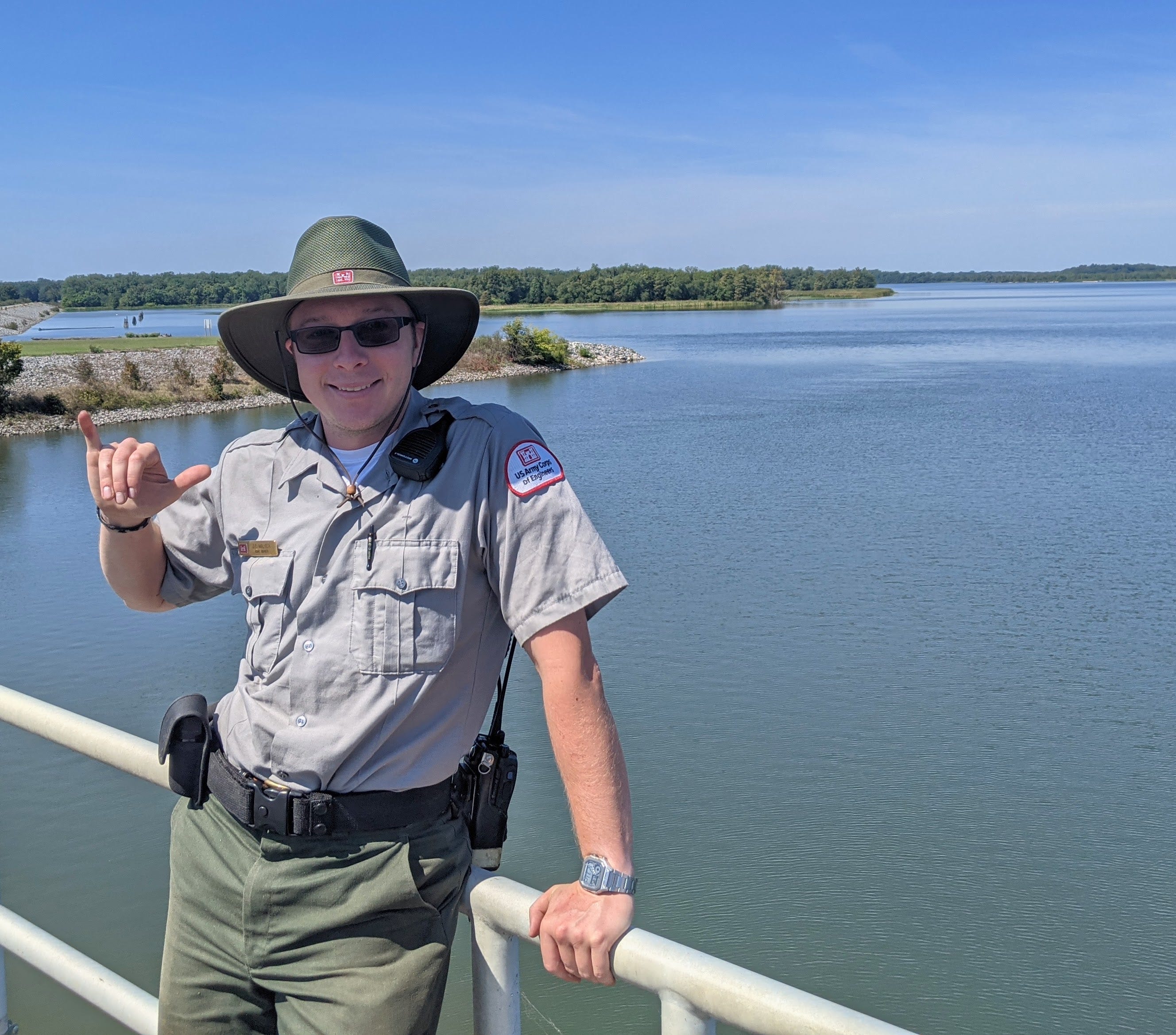
Writing about a summer job with the National Parks
Writing a “Paddler’s Guide to the Upper Mississippi River” type book. An accompanying guide to the Lower Mississippi’s RiverGator.
If any of that sounds interesting to you, stay subscribed and I’ll begin posting again when those become relevant.
Additionally, if anyone has ideas or suggestions for what you’d like to see in this space, I am always open to suggestions and will consider them all.
In the meantime, feel free to enjoy some evergreen posts I’ve written from before this trip, before most of you subscribed.
Some Popular Posts from Before The Mississippi River
For those of you who joined during the Mississippi River trip, I do post more than trip reports (though that is by far the main thing I post). If you missed them, check out some of these posts which are now far back in the archive.